

- Usage in publication:
-
- Hiko Tuff
- Modifications:
-
- First used
- Dominant lithology:
-
- Tuff
- AAPG geologic province:
-
- Great Basin province
Summary:
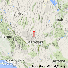
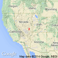
First published use of name, (to be proposed by Cook) for an ignimbrite of rhyodacitic to dacitic composition in the Pahranagat area, Lincoln Co., NV in the Great Basin Range. Known to extend over a large part of eastern NV and western UT. Crops out on east front Pahranagat Range, Hiko Range, along east wall of Badger Valley, parts of Alamo Range. Geologic map shows extent in Pahranagat valley. Overlies Hells Bells Canyon Formation (Named). Underlies Alamo Range Formation (new). Divisible into a basal ash member of semiconsolidated crystal-vitric brown, gray, white dacitic tuff and ash, and the overlying welded tuff member, gray to brown bouldery, pseudo-granitic welded crystal-vitric dacitic tuff. Cross sections. Is the most widespread, uniform, and easily recognized of the volcanic units. Was erupted without significant pause over a wide area. Weathers into huge, joint-controlled rectangular and (or) prismatic brown-gray blocks and boulders of welded tuff. Some blocks exceed 25 ft. Measured sections. Thought to be a simple cooling unit. Assigned to the Miocene.
Source: GNU records (USGS DDS-6; Denver GNULEX).
- Usage in publication:
-
- Hiko Tuff [Member]
- Modifications:
-
- Named
- Dominant lithology:
-
- Tuff
- AAPG geologic province:
-
- Great Basin province
Summary:
Named Hiko Tuff [Member], upper member of Page Ranch Formation. Occupies stratigraphic position as the Kane Point Tuff. Makes up a large part of Hiko Range. Type section is on east side of Hiko Range about 6 mi south of U. S. Hwy 93 sec. 3, T5S, R62E, Lincoln Co., NV, Great Basin province. Originally covered more than 5,000 sq mi area and had a volume of 500 cubic miles. Distribution map shows member extending from west of the Hiko Range east into southwestern UT almost as far as Cedar City, Iron Co., all in the Great Basin province. Ranges between 213 and 1,135 ft thick. Rests on bedded volcanic sandstone and pumice sillar of Ironton Member [?] of Page Ranch Formation. Overlain by Kane Wash Formation (Named) disconformably. Consists of 1.) basal nonwelded pink pumice-rich lithic-crystal tuff with many fragments of dark flow rock 200 ft thick, 2.) lightly welded gray-pink crystal-pumice tuff, 3.) highly welded red purple tuff or lenticulite 50-60 percent crystals and fragments of flow rock as large as 4 inches in diameter, and 4.) red purple, crumbly, highly welded crystal tuff with 40-50 percent crystals. K-Ar date of 24 +/-2 m.y. obtained on biotite. Miocene age. Cross sections. Correlation chart.
Source: GNU records (USGS DDS-6; Denver GNULEX).
- Usage in publication:
-
- Hiko Tuff*
- Modifications:
-
- Adopted
- Geochronologic dating
- AAPG geologic province:
-
- Great Basin province
Summary:
Hiko Tuff (Dolgoff, 1963) adopted as unit of formational rank. Composed of relatively crystal-rich rhyodacite containing phenocrysts of plagioclase, quartz, alkali feldspar, biotite, hornblende, zircon, apatite and sphene. "Caliente Depression" contains extremely thick section of Hiko Tuff; it is thought to be collapse caldera or cauldron subsidence block marking vent area of Hiko Tuff. Radiometric ages of 17.9 +/-0.4 to 17.6 +/-0.6 Ma from Armstrong (1970) and of 19.6 +/-0.5 Ma (this report) are interpreted to be middle Miocene. [Note these are now all early Miocene according to time scale of Berggren and others (1985)]
Source: Modified from GNU records (USGS DDS-6; Menlo GNULEX).
- Usage in publication:
-
- Hiko Tuff*
- Modifications:
-
- Areal extent
- AAPG geologic province:
-
- Great Basin province
Summary:
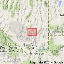
(advance copy). Unit geographically extended into report area (East Pahranagat Range, Pahranagat Range, near Sheep Range). Age is [early] Miocene.
Source: GNU records (USGS DDS-6; Menlo GNULEX).
- Usage in publication:
-
- Hiko Tuff*
- Modifications:
-
- Areal extent
- Geochronologic dating
- AAPG geologic province:
-
- Great Basin province
Summary:
Hiko Tuff geographically extended into Seaman Range and Fox Mountain, Lincoln and Nye Cos, NV. Radiometric age is about 18.5 Ma (Miocene).
Source: GNU records (USGS DDS-6; Menlo GNULEX).
- Usage in publication:
-
- Hiko? Tuff*
- Modifications:
-
- Overview
- AAPG geologic province:
-
- Great Basin province
Summary:
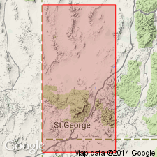
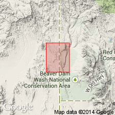
Mapped in southwesternmost part of quad, Lincoln Co, NV, Great Basin province. Occurs as a few small exposures; best exposures in sec 30, T9S, R71E, in an extensional graben on east flank of Tule Springs Hill. Identification of unit is queried as according to P.D. Rowley (personal commun., Feb., 1993) unit may be Racer Canyon Tuff which is similar in age and appearance. Consists of light gray to pinkish gray weakly to densely welded, crystal-poor rhyolitic ash-flow tuff; contains about 20% small phenocrysts. Conformably overlies Harmony Hills Tuff; unconformably underlies Muddy Creek Formation. Cites age of 18.6 Ma (Miocene) after Taylor and others (1989, Jour. Geophy. Res., v. 94, no. B6, p.7757-7774).
Source: GNU records (USGS DDS-6; Denver GNULEX).
For more information, please contact Nancy Stamm, Geologic Names Committee Secretary.
Asterisk (*) indicates published by U.S. Geological Survey authors.
"No current usage" (†) implies that a name has been abandoned or has fallen into disuse. Former usage and, if known, replacement name given in parentheses ( ).
Slash (/) indicates name conflicts with nomenclatural guidelines (CSN, 1933; ACSN, 1961, 1970; NACSN, 1983, 2005, 2021). May be explained within brackets ([ ]).