


- Usage in publication:
-
- Higham grit*
- Modifications:
-
- Areal extent
- AAPG geologic province:
-
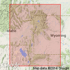
- Snake River basin
Summary:
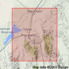
Pg. 492. Higham grit. Basal member of Nugget sandstone in Fort Hall Indian Reservation. Thickness 500 feet. Underlies Deadman limestone member of Nugget. [Age is Triassic(?).]
Source: US geologic names lexicon (USGS Bull. 896, p. 951).
- Usage in publication:
-
- Higham grit member*
- Modifications:
-
- Principal reference
- Dominant lithology:
-
- Sandstone
- AAPG geologic province:
-
- Snake River basin
Summary:
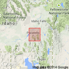
Pg. 32, 41. Higham grit member of Nugget sandstone. Coarse white to pinkish gritty or conglomeratic sandstone, the component particles of which are coarse and subangular. Locally is almost quartzite. Thickness 500+/- feet. Basal member of Nugget sandstone in Fort Hall Indian Reservation, southeastern Idaho. Underlies Deadman limestone member of Nugget and conformably overlies Ankareh sandstone [later named Timothy sandstone]. [Age is Triassic(?).]
Named from Higham Peak, in sec. 23, T. 3 S., R. 37 E., [Lat. 43 deg. 08 min. 28 sec. N., Long. 112 deg. 05 min. 00 sec. W., Higham Peak 7.5-min quadrangle, Bingham Co., southeastern ID], the highest summit in northeastern part of the Fort Hall Indian Reservation, which is composed of this rock.
[Additional locality information from USGS GNIS database, USGS historical topographic map collection TopoView; accessed March 22, 2016.]
Source: US geologic names lexicon (USGS Bull. 896, p. 951).
- Usage in publication:
-
- Higham grit*
- Modifications:
-
- Revised
- AAPG geologic province:
-
- Snake River basin
Summary:
Pg. 29, 50. (1) treated Higham grit as a distinct formation; (2) restricted Nugget sandstone to upper part ("main sandstone member") of Nugget sandstone as recognized by him in previous reports; (3) introduced Timothy sandstone to replace Ankareh sandstone as used by him in previous reports on southeastern Idaho; and (4) reported the Higham as resting unconfomably on Timothy sandstone.
This report is present (ca. 1936) generally accepted definition of Higham grit.
Source: US geologic names lexicon (USGS Bull. 896, p. 951).
- Usage in publication:
-
- Higham grit*
- Modifications:
-
- Areal extent
- AAPG geologic province:
-
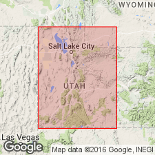
- Wasatch uplift
Summary:
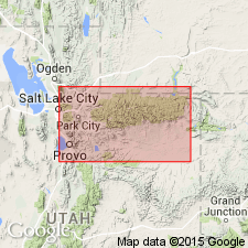
Pg. 473, 475-476, fig. 2. Higham grit. Use extended southward to Park City area and as far east as upper Weber River section, Utah, to replace part of Ankareh shale which is stratigraphically restricted. [Age is Triassic(?).]
Source: US geologic names lexicon (USGS Bull. 1200, p. 1755).
- Usage in publication:
-
- Higham grit*
- Modifications:
-
- Principal reference
- AAPG geologic province:
-
- Snake River basin
Summary:
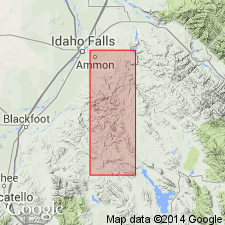
Pg. 17, 34, pl. 1. Higham grit. Mapped in Ammon and Paradise Valley 15-min quadrangles, southeastern Idaho. Underlies Deadman limestone; overlies Timothy sandstone. [Age is Triassic(?).] Type locality designated.
Type locality: Higham Peak, the highest summit in northeastern part of the Fort Hall Indian Reservation, in sec. 23, T. 3 S., R. 37 E., [Lat. 43 deg. 08 min. 28 sec. N., Long. 112 deg. 05 min. 00 sec. W., Higham Peak 7.5-min quadrangle, Bingham Co., southeastern ID].
[Additional locality information from USGS GNIS database, USGS historical topographic map collection TopoView; accessed March 22, 2016.]
Source: US geologic names lexicon (USGS Bull. 1200, p. 1755).
- Usage in publication:
-
- Higham grit*
- Modifications:
-
- Areal extent
- AAPG geologic province:
-
- Green River basin
- Wasatch uplift
- Snake River basin
Summary:
Pg. 179-181, fig. 18. Timothy sandstone, Higham grit, Deadman limestone, and Wood shale are each distinct lithologically and are equivalent to Ankareh formation of Wasatch and Uinta Mountains and of western Wyoming. In present report, the Timothy is considered uppermost member of Thaynes formation. The Higham unconformably overlies Timothy sandstone member. Higham grit and Deadman limestone are recognized as independent formations, but Wood shale is considered westward extending tongue of Ankareh. Thickness of 105 feet at Cokeville, Sublette Range, Wyoming. Age shown on table as Upper Triassic.
Source: US geologic names lexicon (USGS Bull. 1200, p. 1755).
- Usage in publication:
-
- Higham grit*
- Modifications:
-
- Not used
Summary:
p. 104. Higham grit. Discussion of stratigraphy of Triassic sequence in Wasatch and western Uinta Mountains, [Utah]. The thin conglomeratic sandstone unit above Ankareh formation in this area is litho-stratigraphic equivalent of Higham grit of southeastern Idaho and Shinarump(?) conglomerate of eastern Uinta Mountains. Use of names Higham and Gartra to refer to this unit in this region ignores rule of priority. Older name Shinarump conglomerate is recommended.
Source: US geologic names lexicon (USGS Bull. 1200, p. 1755).
- Usage in publication:
-
- Higham Grit*
- Modifications:
-
- Overview
- AAPG geologic province:
-
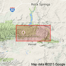
- Central Western Overthrust
- Wasatch uplift
Summary:
Chart 29 (Monte Cristo Range). Higham Grit recognized locally along Willard thrust, notably in Daisy Ridge and Horse Ridge 7.5-min quadrangles, Cache, Rich, and Weber Counties, northern Utah.
See J.C. Coogan, 2006a, Utah Geol. Survey Open-File Rpt., no. 479, scale 1:24,000; J.C. Coogan, 2006b, Utah Geol. Survey Open-File Rpt., no. 480, scale 1:24,000; J.C. Coogan and J.K. King, 2001, Utah Geol. Survey Open-File Rpt., no. 380, scale 1:100,000.
Source: Publication.
For more information, please contact Nancy Stamm, Geologic Names Committee Secretary.
Asterisk (*) indicates published by U.S. Geological Survey authors.
"No current usage" (†) implies that a name has been abandoned or has fallen into disuse. Former usage and, if known, replacement name given in parentheses ( ).
Slash (/) indicates name conflicts with nomenclatural guidelines (CSN, 1933; ACSN, 1961, 1970; NACSN, 1983, 2005, 2021). May be explained within brackets ([ ]).