

- Usage in publication:
-
- Harvard Conglomerate*
- Modifications:
-
- Revised
- Age modified
- AAPG geologic province:
-
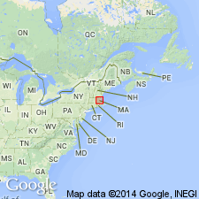
- New England province
Summary:
Worcester Formation geographically and stratigraphically restricted to exclude Harvard Conglomerate (rank raised) and Vaughn Hills Quartzite (rank raised). Harvard Conglomerate is located in same northeast-trending belt as Coal Mine Brook Formation and is involved in same fault system. Age has been considered Pennsylvanian. Rests unconformably on Ayer Granite at Pin Hill, near Harvard, MA, providing a lower age limit for the Harvard, although there is some uncertainty about the age of the Ayer at this locality. Ayer could be Silurian or Late Ordovician (R.E. Zartman and R.S. Naylor, written commun., 1978). Age now considered to be probably Pennsylvanian.
Source: GNU records (USGS DDS-6; Reston GNULEX).

- Usage in publication:
-
- Harvard Conglomerate*
- Modifications:
-
- Overview
- AAPG geologic province:
-
- New England province
Summary:
Used as Harvard Conglomerate of Pennsylvanian age.
Source: GNU records (USGS DDS-6; Reston GNULEX).
For more information, please contact Nancy Stamm, Geologic Names Committee Secretary.
Asterisk (*) indicates published by U.S. Geological Survey authors.
"No current usage" (†) implies that a name has been abandoned or has fallen into disuse. Former usage and, if known, replacement name given in parentheses ( ).
Slash (/) indicates name conflicts with nomenclatural guidelines (CSN, 1933; ACSN, 1961, 1970; NACSN, 1983, 2005, 2021). May be explained within brackets ([ ]).