

- Usage in publication:
-
- Greenfield stone
- Modifications:
-
- First used
- Dominant lithology:
-
- Limestone
- AAPG geologic province:
-
- Cincinnati arch
Summary:
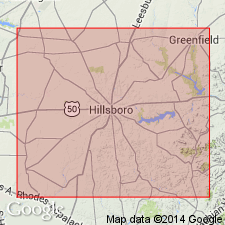
Name Greenfield stone introduced for Helderberg limestone of Highland Co., southwestern OH. Thickness ranges from 15 to 100 ft. Overlies Hillsboro sandstone; underlies Devonian black slate. Top formation of Niagara group.
Source: GNU records (USGS DDS-6; Reston GNULEX).
- Usage in publication:
-
- Greenfield stone
- Modifications:
-
- Named
- Areal extent
- AAPG geologic province:
-
- Cincinnati arch
Summary:
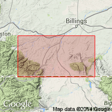
In all of southwestern OH, the Helderberg limestone or Waterlime group can be perfectly distinguished by the local name Greenfield stone, derived from its most extensive and valuable exposures, which occur at Greenfield, Highland Co. Consists chiefly of even, thin-bedded light-brown magnesian limestone very similar in chemical composition to the heavy beds of Niagara limestone beneath, but it has peculiarities of color and bedding that distinguish it from all other limestones associated with it. It disappears at Latham, Pike Co, and is not seen again until a few mi below Buffalo, NY.
Source: GNU records (USGS DDS-6; Reston GNULEX).

- Usage in publication:
-
- Greenfield formation
- Modifications:
-
- Overview
- AAPG geologic province:
-
- Cincinnati arch
Summary:
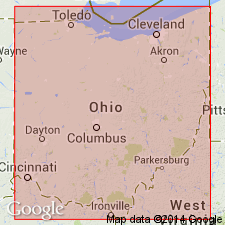
Bulletin 896 lists thirteen references for the Greenfield, ten of which are summarized here. In 1898, A.W. Grabau (Science, n.s., v. 8, p. 800) extended the name Greenfield limestone to Buffalo, NY, when he proposed to use it for the so-called "bullhead" limestone. C.S. Prosser (1903: Journal of Geology, v. 11) agreed that the name Greenfield limestone of Grabau was appropriate for the "Lower Helderberg or Waterlime formation" in central and southern OH if further study showed that the name Monroe formation was not suitable. Grabau, in 1906 (NY State Museum Bulletin 92), used the name Cobleskill limestone for western NY instead of Greenfield limestone. According to A.C. Lane, C.S. Prosser, W.H. Sherzer, and A.W. Grabau (1908: Science, n.s., v. 27, p. 409), the Greenfield formation extends into western NY and is represented by Cobleskill limestone of eastern NY. In 1909 (GSA Bull., v. 19) they also treat it as the basal formation of "Lower Monroe or Bass Islands series" of MI and northern OH, but Sherzer and Grabau in the same publication (p. 540-553) state that the Greenfield is so far known only from OH, where it is exposed at Greenfield, Highland Co., and Ballville, Sandusky Co. In the same year, Grabau (Michigan Geological and Biological Survey, Pub. 2, p. 215-223) admits that though he formerly identified the Greenfield fauna with the Bullhead or Akron fauna of western NY, critical comparison shows agreement in only a few points. J.E. Carman (1927: Journal of Geology, v. 35, p. 481-506) describes the Greenfield dolomite as 75 to 100 ft thick and occurring near Carey, Findley, and Tiffin, OH, and also in western Allen, southwestern Putnam, and Van Wert Cos. He designates the Greenfield as the basal member of the Bass Island formation. A.F. Foerste (1931: Kentucky Geol. Survey, ser. 6, v. 36, p. 192) extends the Greenfield southward but states that the only exposure known in KY is along the banks of the Ohio River at Vanceburg, Lewis Co. R.J.B. Newcombe, 1933 (Mich. Geol. Survey, Pub. 38) included the dolomite in the Bass Islands group.
Source: GNU records (USGS DDS-6; Reston GNULEX).
- Usage in publication:
-
- Greenfield formation
- Modifications:
-
- Overview
- Areal extent
- AAPG geologic province:
-
- Cincinnati arch
Summary:
Greenfield assigned as basal formation of Bass Island[s] group in OH. Consists of dolomite, thin- to massive-bedded, gray to brown. Thickness commonly 175 to 225 ft. Underlies Tymochtee formation. Upper limit very indefinite and fixed more on faunal than stratigraphic evidence. From Greenfield, Highland Co., OH, the formation extends northwestward and crops out in belt across parts of Fayette, Logan, Shelby, Auglaize, Allen, Van Wert, and Paulding Cos. Age is Late Silurian.
Source: GNU records (USGS DDS-6; Reston GNULEX).
- Usage in publication:
-
- Greenfield Dolomite
- Modifications:
-
- Overview
- AAPG geologic province:
-
- Cincinnati arch
Summary:
Greenfield has been assigned as basal unit to Bass Islands Group by Lane and others (1907) and to Salina Group by Ehlers and others (1951). Problem of overlapping group categories has not yet been resolved. Greenfield Dolomite is not assigned to a group in present report. Unit consists of tan to light-gray consistently fine- to medium-grained evenly bedded dolomite of rather uniform character. Disconformably overlies Peebles Dolomite. Gradationally underlies Tymochtee Shale. Southward, truncated by Ohio Shale. About 35 ft thick in Adams Co., OH. Age is Late Silurian.
Source: GNU records (USGS DDS-6; Reston GNULEX).
- Usage in publication:
-
- Greenfield Dolomite
- Modifications:
-
- Overview
- AAPG geologic province:
-
- Michigan basin
Summary:
Rock units forming the bedrock in the Maumee, Lucas Co., OH, and that crop out in the walls of a quarry are the Lockport Dolomite and the Greenfield Dolomite. The two form a thick reef complex roughly 600 m in diameter and about 68 m thick. The Lockport contains multistory stromatolite, thrombolite, and coral-microbialite reefs that were probably formed in a subtidal setting within a hypersaline lagoon. Lockport may be Wenlockian or Llandoverian to Ludlovian. In contrast to the mostly massive Lockport, the Greenfield at Maumee quarry is well bedded. It is Wenlockian, according to Shaver (1991), but fig. 16 of this report (after Howell, 1993) depicts the Greenfield as Llandoverian with a significant hiatus between deposition of the two units.
Source: GNU records (USGS DDS-6; Reston GNULEX).
For more information, please contact Nancy Stamm, Geologic Names Committee Secretary.
Asterisk (*) indicates published by U.S. Geological Survey authors.
"No current usage" (†) implies that a name has been abandoned or has fallen into disuse. Former usage and, if known, replacement name given in parentheses ( ).
Slash (/) indicates name conflicts with nomenclatural guidelines (CSN, 1933; ACSN, 1961, 1970; NACSN, 1983, 2005, 2021). May be explained within brackets ([ ]).