

- Usage in publication:
-
- Goddard shale
- Modifications:
-
- Original reference
Summary:
Pg. 140 (chart 2), 143. Goddard shale. Proposed to replace term "Pennsylvanian Caney." Consists of uniform dark shales with some thin concretionary layers between top of Mississippian rocks (commonly the Caney shale of Meramec age according to Ulrich, 1927, Oklahoma Geol. Survey Bull., no. 45) and base of Rod Club sandstone. Thickness at least 2,000 feet in type area. Age is Pennsylvanian (Springer). Name credited to J.M. Weistheimer.
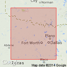
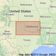
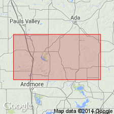
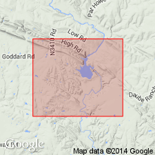
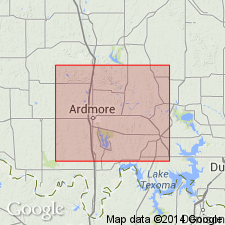
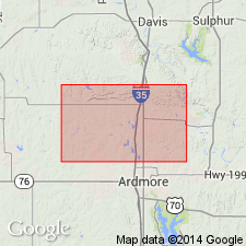
Type locality: along Oil Creek, in secs. 19 and 20, T. 3 S., R. 4 E., on Goddard Ranch about 7 mi east of Gene Autry (Berwin on older maps), Johnston Co., OK. Section starts on west side of Oil Creek in SE/4 sec. 18 where contact between Caney and Goddard shales is well exposed, and extends in southwesterly direction to base of Rod Club sandstone.
Source: US geologic names lexicon (USGS Bull. 1200, p. 1533-1534).
- Usage in publication:
-
- Goddard shale member*
- Modifications:
-
- Revised
- Mapped 1:500k
Summary:
Mapped as a member at base of Springer formation. Age is Pennsylvanian.
Source: US geologic names lexicon (USGS Bull. 1200, p. 1533-1534).
- Usage in publication:
-
- Goddard shale
- Modifications:
-
- Revised
- AAPG geologic province:
-
- South Oklahoma folded belt
Summary:
Pg. 70 (table 2), 74-89. Goddard shale. In southern Arbuckle Mountains, includes Redoak Hollow sandstone member (new) in middle part [footnote, p. 70 (table), indicates Redoak is in lower part]. In measured type section, lower part, 1,189 feet thick gray to black shale with limonitic concretions; upper part, 1,671 ft thick (mostly covered) gray shale with ferruginous concretions. Underlies Pennsylvanian Rod Club sandstone. Conformably overlies Caney shale; the Goddard is a fine silty clay and disintegrates quickly in water, whereas the Caney is a very hard "siliceous" shale. Fossiliferous (crinoids, pelecypods, cephalopods, crustaceans). Age is Mississippian (Chester). Report includes stratigraphic table, fossil lists, geologic map.
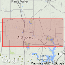
Type locality (also called type section) stated to be on Goddard Ranch, in secs. 17, 18, 19, and 20, T. 3 S., R. 4 E., Johnston Co., OK.
Source: US geologic names lexicon (USGS Bull. 1200, p. 1533-1534); supplemental information from GNU records (USGS DDS-6; Denver GNULEX).
- Usage in publication:
-
- Goddard shale
- Modifications:
-
- Revised
Summary:
Pg. 392-396. Goddard shale. Name was proposed for pre-Springer "Pennsylvanian" sediments. Because Goddard shales are indistinguishable from shales above Rod Club sandstone, it had been proposed that base of Springer group be extended downward to top of the Caney. In view of new faunal evidence, the Goddard should not be included in the Springer and Mississippian-Pennsylvanian boundary should be drawn at base of Rod Club.
Source: US geologic names lexicon (USGS Bull. 1200, p. 1533-1534).
- Usage in publication:
-
- Goddard formation
- Modifications:
-
- Revised
Summary:
Pg. 323. Goddard formation [of Springer group]. Includes Grindstone Creek member (new) in upper part. Age is Mississippian (precise systemic boundary open to question).
Source: US geologic names lexicon (USGS Bull. 1200, p. 1533-1534).
- Usage in publication:
-
- Goddard formation
- Modifications:
-
- Revised
Summary:
Pg. 6 (fig. 2), 8-10. Goddard formation of Springer group. Formation comprises lower half (Chesterian part) of Springer group as defined here.
Source: US geologic names lexicon (USGS Bull. 1200, p. 1533-1534).
- Usage in publication:
-
- Goddard formation
- Modifications:
-
- Revised
Summary:
Pg. 123-124. Goddard formation of Springer group. Tiff member proposed to replace preoccupied name Grindstone Creek member of Tomlinson (1959).
Source: US geologic names lexicon (USGS Bull. 1200, p. 1533-1534).
- Usage in publication:
-
- Goddard Formation
- Modifications:
-
- Revised
- AAPG geologic province:
-
- South Oklahoma folded belt
Summary:
Goddard Formation of Noble Ranch Group (new). Present in Carter County, south-central Oklahoma. Age is Late Mississippian.
Source: US geologic names lexicon (USGS Bull. 1520, Noble Ranch entry p. 222).
- Usage in publication:
-
- Goddard Shale*
- Modifications:
-
- Revised
- Adopted
Summary:
Pg. A14-A15, A54, A56-A57 (fig. 5). Goddard Shale Member of Springer Formation raised in rank to Goddard Shale and assigned to Springer Group as one of five named formations. Divided into (ascending): unnamed lower shale member, Redoak Hollow Member, and unnamed upper shale member. Overlies Caney Shale and its Delaware Creek Member; underlies Overbrook Sandstone. Present in southern Arbuckle Mountains, south-central Oklahoma. Age is Late Mississippian (Chesterian; Namurian A of Europe); foram zones 17 and 18, and ammonoid zones TUMULITES VARIANS and CRAVENOCERAS RICHARDSONIANUM. [See also Mackenzie Gordon, Jr., and G.C. Stone, 1976, Arkansas Geol. Commission Symposium on the geology of the Ouachita Mountains, v. 1.]
Source: Publication.
For more information, please contact Nancy Stamm, Geologic Names Committee Secretary.
Asterisk (*) indicates published by U.S. Geological Survey authors.
"No current usage" (†) implies that a name has been abandoned or has fallen into disuse. Former usage and, if known, replacement name given in parentheses ( ).
Slash (/) indicates name conflicts with nomenclatural guidelines (CSN, 1933; ACSN, 1961, 1970; NACSN, 1983, 2005, 2021). May be explained within brackets ([ ]).