

- Usage in publication:
-
- Gatuna formation*
- Modifications:
-
- Original reference
- AAPG geologic province:
-
- Permian basin
Summary:
Pg. 84-85. Gatuna formation. Name given to an assemblage of rocks of various kinds that were laid down in Pecos Valley in post-High Plains time and apparently after completion of maximum cycle of erosion. Terrestrial; fine red sand dominant; conglomerates, stream gravels, gypsum, limestone also present; gray, purplish, and red. Mantles many places to depth of only a few feet; more than 100 feet in Pierce Canyon; may exceed 300 feet at head of Cedar Canyon. Overlies Rustler formation. Age is Pleistocene.
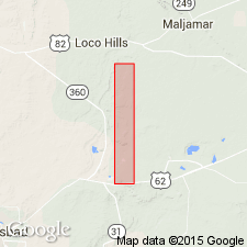
Named from Gatuna Canyon, [along Nimenim Ridge, Tower Hill North 7.5-min quadrangle], northeastern Eddy Co., southeastern NM.
Source: US geologic names lexicon (USGS Bull. 1200, p. 1483).
- Usage in publication:
-
- Gatuna formation*
- Modifications:
-
- Areal extent
- AAPG geologic province:
-
- Permian basin
Summary:
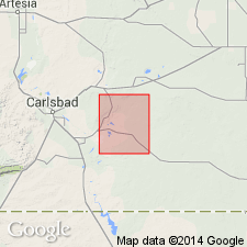
Unconformably overlies Permian and Triassic rocks. Difficult to distinguish from Pierce Canyon redbeds and from Santa Rosa sandstone. In general, bedding more obscure in Gatuna than in the older rocks. Mapped (geologic map) in several exposures at southwest corner and central part of quad., Eddy Co., NM in the Permian basin. Is about 3 to 5 ft thick in most of area. Locally can be as much as 100 ft. Is overlain by caliche that is more resistant than Gatuna. Caliche and Gatuna mapped together, except where Gatuna thick enough to map separately. Three measured sections described. One drillhole described. Stratigraphic chart. Consists of reddish-orange friable sandstone. siltstone, and conglomerate. Deposition of Gatuna thought to have started just after, or accompanied solution of the older Rustler and Salado formations. Considered Pleistocene? in age, deposited on an erosional surface that is younger than Pliocene Ogallala to east. However, it may be of Ogallala rather then post-Ogallala in age.
Source: GNU records (USGS DDS-6; Denver GNULEX).
- Usage in publication:
-
- Gatuna Formation*
- Modifications:
-
- Reference
- Dominant lithology:
-
- Sandstone
- Conglomerate
- AAPG geologic province:
-
- Permian basin
Summary:
Pg. 138 (table 1), 140-141. Gatuna Formation. Consists of (descending): pale-reddish-brown, medium-grained, slightly calcareous sandstone, 11.4 feet (3.5 m) thick; poorly sorted conglomerate (includes abundant clasts derived from Pliocene age pisolitic caprock caliche of the Ogallala), 40 feet (12.3 m) thick; moderate-reddish-orange to pale-reddish-brown, fine- to medium-grained friable sandstone, 3.3 feet (1 m) thick. Total thickness 54.7 feet (16.8 m). Rests on Permian age red beds and is overlain by Mescalero caliche. Age is considered early or middle Pleistocene. Reference section designated where formation is less disturbed by slumping.
Reference section: north side of Gatuna Canyon, in SW/4 SW/4 sec. 36, T. 19 S., R. 30 E., [Tower Hill North 7.5-min quadrangle], northeastern Eddy Co., southeastern NM.
Source: Publication.
- Usage in publication:
-
- Gatuna Formation
- Modifications:
-
- Mapped 1:250k
- Dominant lithology:
-
- Sand
- Conglomerate
- Gypsum
- Limestone
- Siltstone
- AAPG geologic province:
-
- Permian basin
Summary:
Pamphlet [p. 2]. Gatuna Formation. Mostly sand, fine, friable, yellowish to reddish orange, red; some conglomerate, gypsum, limestone, and siltstone, gray, purplish, red, and shale, greenish; upper few feet calichified; may exceed 300 feet in thickness at head of Cedar Canyon, in many places only a few feet thick. (Probably underlies part of the Querecho Plains, Mescalero Sands, San Simon Swale, and Monument Draw); confined to New Mexico [eastern Eddy County]. Age is Pleistocene.
Source: Publication.
- Usage in publication:
-
- Gatuna Formation*
- Modifications:
-
- Geochronologic dating
- AAPG geologic province:
-
- Permian basin
Summary:
Isotopic dating based on sample of Lava Creek B ash that occurs as 1-m-thick bed in the Gatuna Formation on east side of Nash Draw at about 3,300 ft altitude. Locality is SE1/4 NW1/4 sec 36, T21S, R30E, Eddy Co, NM, Nash Draw 7 1/2 minute quadrangle in Permian basin. Zircon fission-track age of 0.53 +/-0.33 m.y. (C.W. Naeser, written communication, 1978) on sample number 78W73. Age is Pleistocene.
Source: GNU records (USGS DDS-6; Denver GNULEX).
For more information, please contact Nancy Stamm, Geologic Names Committee Secretary.
Asterisk (*) indicates published by U.S. Geological Survey authors.
"No current usage" (†) implies that a name has been abandoned or has fallen into disuse. Former usage and, if known, replacement name given in parentheses ( ).
Slash (/) indicates name conflicts with nomenclatural guidelines (CSN, 1933; ACSN, 1961, 1970; NACSN, 1983, 2005, 2021). May be explained within brackets ([ ]).