

- Usage in publication:
-
- Francis formation*
- Modifications:
-
- Original reference
- Dominant lithology:
-
- Limestone
- Shale
- Sandstone
- Conglomerate
- AAPG geologic province:
-
- Arkoma basin
- Chautauqua platform
Summary:
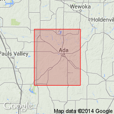
Pg. 113-119, pls. 3, 27, and map. [Name was also used by Morgan, but not defined, in Oklahoma Geol. Survey Circ., no. 12, pl. and p. 15, 1923.] Francis formation. Consists of (ascending): (1) DeNay limestone member; (2) dark-blue and black shales, 30+/- feet; (3) nearly 20 feet of sandstones; (4) 250+/- feet of dark and sometimes calcareous shales; (5) 100+/- feet of coarse brown sandstones and chert conglomerates; and (6) 100+/- feet of shale with few thin sandstones and one rather persistent conglomeratic limestone, often very fossiliferous. Underlies Belle City limestone. Overlies Seminole formation. Large fauna. Fossils include anthozoans, crinoids, echinoids, bryozoans, brachiopods, trilobites, mollusks, and fish. Age is Pennsylvanian. Report includes geologic map.
Named from town of Francis, Pontotoc Co., OK, which is situated on eastern edge of outcrop.
Source: US geologic names lexicon (USGS Bull. 896, p. 768-769); GNC OK Corr. Chart, sheet 2, Jan. 1931; supplemental information from GNU records (USGS DDS-6; Denver GNULEX).
- Usage in publication:
-
- Francis formation*
- Modifications:
-
- Mapped 1:500k
- AAPG geologic province:
-
- Arkoma basin
- Chautauqua platform
Summary:
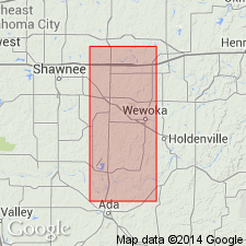
Mapped as extending northward from Pontotoc County across Seminole County; north of Seminole County, name Francis is dropped and other terminology (Coffeyville, Nellie Bly) is used. Age is Late Pennsylvanian (Missourian).
Source: US geologic names lexicon (USGS Bull. 1200, p. 1413).
- Usage in publication:
-
- Francis formation
- Modifications:
-
- Principal reference
- AAPG geologic province:
-
- Arkoma basin
- Chautauqua platform
Summary:
Pg. 62, pl. 1. In this report [Seminole County, Oklahoma], northern names are carried south to Canadian River; interval designated by Morgan as "Francis" is herein described under headings "Coffeyville" and "Nellie Bly."
Type locality stated: Town of Francis, northeastern Pontotoc Co., [OK], and "all that portion of the outcrop which extends for distance of 3 mi north, and for a similar distance south of Canadian River" (Morgan, 1924).
Source: US geologic names lexicon (USGS Bull. 1200, p. 1413).
For more information, please contact Nancy Stamm, Geologic Names Committee Secretary.
Asterisk (*) indicates published by U.S. Geological Survey authors.
"No current usage" (†) implies that a name has been abandoned or has fallen into disuse. Former usage and, if known, replacement name given in parentheses ( ).
Slash (/) indicates name conflicts with nomenclatural guidelines (CSN, 1933; ACSN, 1961, 1970; NACSN, 1983, 2005, 2021). May be explained within brackets ([ ]).