

- Usage in publication:
-
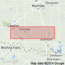
- Fort Sill formation
- Modifications:
-
- Original reference
- AAPG geologic province:
-
- South Oklahoma folded belt
Summary:
Pg. 742-747. Fort Sill formation. Basal unit of Arbuckle limestone in both Arbuckle and Wichita Mountains, Oklahoma. Rests unconformably (locally overlaps) on Honey Creek formation, and in Wichita Mountains is everywhere overlain by Signal Mountain formation. In Arbuckle Mountains, however, the Royer marble, 100 to 600 feet thick, wedges in between Fort Sill and Signal Mountains formations. The Fort Sill is named for exposures in a small quarry on Fort Sill Military Reservation on east side of the highway between Fort Sill and Lawton, in SE/4 sec. 8 [projected], T. 2 N., R. 11 W., [Comanche County, southern Oklahoma], where only 40 feet of formation is exposed. A complete section of formation is found about 6 miles west of Fort Sill and 1 mile south of Signal Mountain, in sec. 7, T. 2 N., R. 12 W., [Comanche County, southern Oklahoma], where 150 feet of beds assigned to this formation are exposed, as follows (descending): (1) 70 feet of rather massive fine-grained gray to dove-colored limestone; sponge spicules abundant in zone near top; gastropod and trilobite zone in upper 50 feet; (2) 34 feet of thin-bedded, laminated fine-grained gray to dove-colored fossiliferous limestone in beds 2 to 6 inches thick, separated by thin shale partings, with trilobite fragments throughout entire thickness; (3) 6 feet of limestone similar to No. 12 with large trilobite fragments at base; (4) 40 feet of limestone similar to above but with dove-colored varieties predominating; base irregular, marked by a thin green seam of weathered and redeposited material; fossils (chiefly trilobites) throughout. A much thicker bed (368 feet) is exposed on north side of Wichita Mountains, in sec. 17, T. 4 N., R. 12 W. It is here divided into several faunal zones [described and named]. Age is Late Cambrian.
Source: US geologic names lexicon (USGS Bull. 896, p. 760).
- Usage in publication:
-
- Fort Sill formation
- Modifications:
-
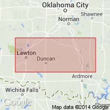
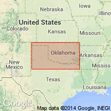
- Areal extent
- AAPG geologic province:
-
- South Oklahoma folded belt
Summary:
Pg. 16 (table 1), 20-21, measured sections. Fort Sill formation. Basal formation of Arbuckle group. Consists chiefly of thin beds of limestone; thick beds occur at intervals. Thicknesses: 120 to 283 feet in Arbuckle Mountains; 224 to 369 feet in Wichita Mountains. At type section, underlain by 44 feet of Honey Creek limestone and overlain by conglomerates of Signal Mountain formation. In Wichita Mountains, Fort Sill and Signal Mountain formations are separated by about 200 feet of Royer dolomite; in Arbuckle Mountains, separated by 675 to 771 feet of Royer. Age is Late Cambrian.
Source: US geologic names lexicon (USGS Bull. 1200, p. 1402).
- Usage in publication:
-
- Fort Sill limestone*
- Modifications:
-
- Mapped 1:500k
Summary:
Mapped as Fort Sill limestone.
Source: US geologic names lexicon (USGS Bull. 1200, p. 1402).
For more information, please contact Nancy Stamm, Geologic Names Committee Secretary.
Asterisk (*) indicates published by U.S. Geological Survey authors.
"No current usage" (†) implies that a name has been abandoned or has fallen into disuse. Former usage and, if known, replacement name given in parentheses ( ).
Slash (/) indicates name conflicts with nomenclatural guidelines (CSN, 1933; ACSN, 1961, 1970; NACSN, 1983, 2005, 2021). May be explained within brackets ([ ]).