

- Usage in publication:
-
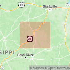
- Fearn Springs formation
- Modifications:
-
- Named
- Dominant lithology:
-
- Clay
- Silt
- Sand
- Lignite
- AAPG geologic province:
-
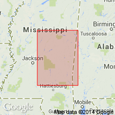
- Black Warrior basin
Summary:
Pg. 33-37. In this report [Winston County, Mississippi] four divisions of Wilcox series are recognized: Fearn Springs (new), Ackerman, Holly Springs, and Hatchetigbee. In complete section, Fearn Springs formation lies disconformably on lignite of Betheden formation (new) and is disconformably overlain by grit-bearing arkosic(?) sand of Ackerman formation. Contains ball-type clays, stoneware clays, silty clays, silt, sand, lignite, and siderite. Thickness 0 to more than 50 feet. Fearn Springs is possibly equivalent to Ackerman formation as limited in Alabama by Cooke (1933, AAPG Bull, v. 17, no. 2) or to Coal Bluff series of Langdon (1895). At time of Cooke's correlation, the Ackerman was defined as all the Wilcox below Holly Springs formation. [Age is early Eocene.]
Source: US geologic names lexicon (USGS Bull. 1200, p. 1332-1333).
- Usage in publication:
-
- Fearn Springs sand member
- Modifications:
-
- Revised
- Mapped
- AAPG geologic province:
-
- Black Warrior basin
Summary:
Fearn Springs sand member of Wilcox formation. Mapped as sand member of Wilcox formation. [Age is early Eocene.]
Source: US geologic names lexicon (USGS Bull. 1200, p. 1332-1333).
- Usage in publication:
-
- Fearn Springs member*
- Modifications:
-
- Revised
- Overview
- AAPG geologic province:
-
- Black Warrior basin
Summary:
Unit is redefined as member of Wilcox formation in MS and as member of Nanafalia formation in AL. Unit is more of a channel sand in AL than in MS. Thickens and thins greatly along strike. Maximum thickness in AL (western Butler Co.) is 80 ft. In type area, in addition to fine-grained sands and clay originally assigned to unit by Mellen, it also includes coarse sand (originally considered to be colluvium) exposed farther downhill from type locality but actually forming main part of member. In MS, member varies both in thickness and texture, but in general thickest sections carry coarsest material. Greatest thickness, about 199 ft and very coarse throughout, is in northern Lauderdale and southern Kemper Cos. Fine-grained sands and clays, which commonly mark top of member are lenticular; some lenses pinch out completely within single exposure. Member thins northward, becomes finer textured, and, in northern MS, is indistinguishable from overlying Wilcox.
Source: GNU records (USGS DDS-6; Reston GNULEX).
- Usage in publication:
-
- Fearn Springs formation
- Modifications:
-
- Overview
- Reference
- AAPG geologic province:
-
- Warrior basin
Summary:
Discussion of confusion existing in use of term Fearn Springs. Proposed that section of Fearn Springs clays at Flat Rock Church be regarded as alternate locality of formation. At this locality, basal Ackerman gritty sand, which caps ridge, overlies stoneware clays of Fearn Springs, at top of which is fossil leaf-bearing ironstone. About 300 yds to the west, Betheden kaolin is exposed in stream channel.
Source: GNU records (USGS DDS-6; Reston GNULEX).
- Usage in publication:
-
- Fearn Springs member*
- Modifications:
-
- Revised
- Overview
- AAPG geologic province:
-
- Black Warrior basin
Summary:
Report is reply to Mellens (1950) article. Evidence is presented to show that Mellen's interpretation of type locality was erroneous. From section compiled at Fearn Springs, based in part on auger hole, it is shown that upper part of Fearn Springs member (of Wilcox formation) consists of about 28 feet of laminated to slightly cross-bedded fine sandy or silty micaceous clay. Above this lies coarse red sand that Mellen called basal Ackerman sand. Below silty clay is concealed interval of 19 feet, and below this is exposed 27.5 feet of coarse cross-bedded sand, some fine gravel, and clay balls. Much of the disagreement between Mellen and writer hinges on this lower unit of coarse sand, found to have total thickness of 34.5 feet. This same sand in nearby exposures can be seen to be the sand Mellen included in his basal Ackerman sand, in most other sections. Probably this accounts for Mellen's failure to map the Fearn Springs and Ackerman separately in Winston County. This 34.5 feet thick unit of coarse sand is in turn underlain by 12.5 feet of tough silty clay, coarse sand, clay balls, and sand containing lignitized logs that probably represent Betheden formation, as defined by Mellen. There are, therefore, two coarse sands: one below the silty clay phase of the Fearn Springs and another above it. Mellen believes that only one sand exists. This erroneous interpretation led to the following misapplication of names: (1) sand in lower part of type exposure of Fearn Springs, which Mellen believed to be colluvium, is in reality in place; in other exposures, Mellen has termed unit basal Ackerman sand; (2) name Fearn Springs was applied to part of Naheola formation at surface in Lauderdale and Kemper Counties., Mississippi (Foster, 1940, Mississippi Geol. Survey Bull. 41) and to entire Naheola formation in subsurface in both Alabama and Mississippi (Mellen, 1950); and (3) Naheola, as used by Mellen (1950) in his subsurface diagrams, includes mainly Matthews Landing marl bed of Smith and Johnson (1887), a zone of fossiliferous greensand and clay that was once regarded as basal part of Naheola formation, but is now designated Matthews Landing marl member of Porters Creek clay. It is also suggested here that name Fearn Springs be made to include Betheden unit and that name Betheden be abandoned.
Source: Modified from GNU records (USGS DDS-6; Reston GNULEX).
- Usage in publication:
-
- Fearn Springs sand member*
- Modifications:
-
- Areal extent
- AAPG geologic province:
-
- Black Warrior basin
Summary:
Sand beds included in Gravel Creek member (new) of Nanafalia in AL have been called Fearn Springs sand member. However, name Fearn Springs is not used in this report for lower member of Nanafalia in AL because boundary positions at Fearn Springs type locality are in dispute and stratigraphic relationships with section in AL are uncertain.
Source: GNU records (USGS DDS-6; Reston GNULEX).
- Usage in publication:
-
- Fearn Springs Member*
- Modifications:
-
- Age modified
- AAPG geologic province:
-
- Black Warrior basin
Summary:
Age of the Fearn Springs Member of the Nanafalia Formation of the Wilcox Group changed from early Eocene to Paleocene.
Source: GNU records (USGS DDS-6; Reston GNULEX).
- Usage in publication:
-
- Fearn Springs Member
- Modifications:
-
- Revised
- AAPG geologic province:
-
- Black Warrior basin
Summary:
Fearn Springs is revised to member status in the Naheola Formation of the Midway Group. Interpreted to be updip facies of the Oak Hill Member in AL. Name remains a useful term because of the mineral deposits exclusive to that facies. This revision changes the position of the Midway-Wilcox boundary in MS.
Source: GNU records (USGS DDS-6; Reston GNULEX).
For more information, please contact Nancy Stamm, Geologic Names Committee Secretary.
Asterisk (*) indicates published by U.S. Geological Survey authors.
"No current usage" (†) implies that a name has been abandoned or has fallen into disuse. Former usage and, if known, replacement name given in parentheses ( ).
Slash (/) indicates name conflicts with nomenclatural guidelines (CSN, 1933; ACSN, 1961, 1970; NACSN, 1983, 2005, 2021). May be explained within brackets ([ ]).