

- Usage in publication:
-
- Edwards limestone*
- Modifications:
-
- Original reference
- Dominant lithology:
-
- Limestone
- AAPG geologic province:
-
- Ouachita folded belt
Summary:
Pg. 2; USGS 18th Ann. Rpt., pt. 2, p. 227-235. Edwards limestone. Generally whitish limestones, but on weathering show buff, cream-yellow, and dull-gray layers; of variable hardness, frequently massive, and contain flint nodules. Usually harder than Comanche Peak limestone and weathers into cliffs. Thickness 600 feet. Top formation of Fredericksburg division. Overlies Comanche Peak limestone and underlies Fort Worth limestone. Replaces "Caprina" limestone; also replaces "Barton Creek" limestone, as Barton Creek is not good type locality, name is binomial, and Barton was otherwise used many years before Barton Creek. [Age is Early Cretaceous (Comanche).]
[Named from Edwards Plateau, Nueces and Uvalde quadrangles, southern TX, of which it is chief component of scarps and mesas.]
Source: US geologic names lexicon (USGS Bull. 896, p. 663).
- Usage in publication:
-
- Edwards limestone*
- Modifications:
-
- Principal reference
- Dominant lithology:
-
- Limestone
- AAPG geologic province:
-
- Ouachita folded belt
Summary:
Pg. 338-348. Name Edwards replaced terms Caprina limestone (paleontological term) and Barton Creek limestone of Hill. From Fort Worth to south of Waco, Edwards gradually thickens, and is overlain, apparently unconformably by Kiamichi clay. South of Waco, Kiamichi is absent, and Edwards is overlain by Duck Creek limestone. [Age is Early Cretaceous (Comanche).]
Type locality: Barton Creek, near Austin, [Travis Co.], southern TX.
Source: US geologic names lexicon (USGS Bull. 1200, p. 1216-1217).

- Usage in publication:
-
- Edwards limestone*
- Modifications:
-
- Overview
Summary:
Edwards limestone of Fredericksburg group. Edwards limestone underlies Georgetown limestone in some areas, Fort Worth limestone in others areas, and Kiamichi clay in northeast Texas. (See also under Fredericksburg group.) Age is Early Cretaceous (Comanche).
Source: US geologic names lexicon (USGS Bull. 896, p. 663).
- Usage in publication:
-
- Edwards limestone
- Modifications:
-
- Areal extent
Summary:
Based on outcrop sections, a southern complex of Edwards, Comanche Peak, and Walnut formations is indicated to pass northward into a complex composed of Goodland, Walnut, and Paluxy formations.
Source: US geologic names lexicon (USGS Bull. 1200, p. 1216-1217).
- Usage in publication:
-
- Edwards limestone
- Modifications:
-
- Areal extent
- AAPG geologic province:
-
- Ouachita folded belt
Summary:
Pg. 78-85, 99-104. Edwards limestone. Described in Purgatory Creek, Texas, area where it is about 250 feet thick, overlies Walnut clay and underlies Georgetown limestone of Washita group Age is Early Cretaceous (Comanche).
Source: US geologic names lexicon (USGS Bull. 1200, p. 1216-1217).
- Usage in publication:
-
- Edwards Limestone*
- Modifications:
-
- Mapped 1:62.5k
- Dominant lithology:
-
- Limestone
- AAPG geologic province:
-
- Permian basin
Summary:
Edwards Limestone. Medium-gray to medium-dark-gray, very fine to fine crystalline, fossiliferous, thin- to thick-bedded limestone and dolomitic limestone, weathers to yellowish-gray especially in upper part. Contains sparse chert-replaced fossils and rare chert nodules in upper part. Thickness about 400 feet. Overlies Comanche Peak Limestone; underlies Kiamichi(?) Formation. Age is Early Cretaceous.
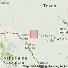
Exposed in steep cliffs in Rio Grande Canyon, eastern Brewster and southwest Terrell Cos., western TX.
Source: Modified from GNU records (USGS DDS-6; Denver GNULEX).

- Usage in publication:
-
- Edwards Limestone
- Modifications:
-
- Mapped 1:250k
- Dominant lithology:
-
- Limestone
- AAPG geologic province:
-
- Bend arch
Summary:
Pamphlet [p. 2]. Edwards Limestone. Upper part, argillaceous, nodular to evenly bedded, light gray, alternating hard and soft units weather recessive compared to lower part, EXOGYRA TEXANA and foraminifers locally abundant, thickness about 40 feet. Lower part, fine- to coarse-grained, mostly argillaceous, some recrystallized, locally dolomitic with chert in 2 to 5 inch beds, mostly nodular to massive, locally thin-bedded, weathers light gray to light brown, fossils include foraminifers, gastropods, and rudistids as molds and silicified remains locally, forms steep scarp, thickness about 100 feet. Total thickness of formation about 140 feet. Lies above Comanche Peak Limestone. Age is Early Cretaceous.
[Small isolated outcrops in eastern Callahan Co., central northern TX.]
Source: Publication.
- Usage in publication:
-
- Edwards Group
- Modifications:
-
- Revised
- AAPG geologic province:
-
- Permian basin
- Kerr basin
- Gulf Coast basin
Summary:
Edwards Group. [Raised to group rank in areas south of Texas Colorado River; north of the Colorado, formation rank retained.] Divided into Kainer and Person Formations (subsurface of San Marcos Platform, south-central Texas), and Fort Terrett and Segovia Formations (outcrop on eastern Edwards Plateau, central Texas); all new. Unconformably underlies Buda Limestone, Del Rio Clay, or Georgetown Formation. Overlies Glen Rose Formation, unconformably in places. Age is Early Cretaceous (Comanchean).
Source: Publication; GNC index card files (USGS-Reston).

- Usage in publication:
-
- Edwards Limestone
- Modifications:
-
- Mapped 1:250k
- Dominant lithology:
-
- Limestone
- Dolomite
- Chert
- AAPG geologic province:
-
- Ouachita folded belt
Summary:
Edwards Limestone. Limestone, dolomite, and chert; limestone, aphanitic to fine-grained, massive to thin-bedded, hard, brittle, in part rudistid biostromes, much miliolid biosparite; dolomite, fine- to very fine-grained, porous, medium gray to grayish brown; chert, nodules and plates common, varies in amount from bed to bed, white to light gray; in zone of weathering considerably recrystallized, "honeycombed" and cavernous; forms an important aquifer. Thickness 350 to 400 feet. Lies above Glen Rose Formation and below Georgetown Formation. Age is Early Cretaceous.
Mapped in Hays Co., southeastern TX.
Source: Publication.

- Usage in publication:
-
- Edwards Limestone
- Modifications:
-
- Revised
- Mapped 1:250k
- Dominant lithology:
-
- Limestone
- AAPG geologic province:
-
- Kerr basin
- Permian basin
Summary:
Edwards Limestone. Divided into (descending) Segovia and Fort Terrett Members. Age is Early Cretaceous.
[Members separately mapped in Geol. Atlas Texas Del Rio, Fort Stockton, Llano, San Antonio, and Sonora map sheets. See entries under Segovia and Fort Terrett.]
Source: Publication.

- Usage in publication:
-
- Edwards Limestone
- Modifications:
-
- Mapped 1:250k
- Dominant lithology:
-
- Limestone
- AAPG geologic province:
-
- Kerr basin
- Ouachita folded belt
Summary:
Edwards Limestone. Limestone, fine- to coarse-grained, abundant chert, medium gray to grayish brown. Contains fossil colonial (reefs) and solitary rudistids, miliolids, and shell fragments. Solution zones and collapse breccia common. Thickness 300 to 500 feet. Lies above Glen Rose Formation and below Del Rio Clay (Upper Cretaceous). Divided into (descending) Segovia and Fort Terrett Members (separately mapped on plateau in northwestern part of map sheet). Age is Early Cretaceous.
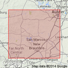
Mapped undivided, with overlying Georgetown [Limestone], in the Balcones fault zone (Medina, Bexar, Comal, and Hays Cos., southern TX), and to the northwest in Bandera and Kendall Cos., southern TX.
Source: Publication.
- Usage in publication:
-
- Edwards Limestone
- Modifications:
-
- Mapped 1:250k
- Dominant lithology:
-
- Limestone
- AAPG geologic province:
-
- Ouachita folded belt
- Strawn basin
Summary:
Edwards Limestone. In thicker sections consists of an upper scarp-forming rudistid facies, a middle aphanitic to biosparite fossiliferous limestone, and a lower bioclast-packed aphanitic to sparry limestone with individual corals, light gray to yellowish gray; weathers various shades of gray with moderate brown patches. Thickness up to 40 feet, gradually merges with Comanche Peak Limestone or Goodland Limestone in vicinity of the northern Hood County line. Lies above Comanche Peak Limestone and below Kiamichi Formation. Age is Early Cretaceous.
[Mapped in Bosque, Erath, Hill, Hood, Johnson, and Somervell Cos., eastern TX.]
Source: Publication.

- Usage in publication:
-
- Edwards Limestone
- Modifications:
-
- Mapped 1:250k
- Dominant lithology:
-
- Limestone
- AAPG geologic province:
-
- Permian basin
Summary:
Edwards Limestone. Limestone, fine- to coarse-grained, thick-bedded to massive, light gray to grayish yellow; abundant rudistids. Thickness 40+/- feet on east peak of Double Mountain. Overlies Comanche Peak Limestone; underlies Kiamichi Shale. Age is Early Cretaceous.
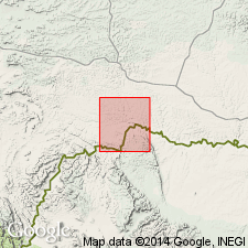
Mapped on floor of Lake Guthrie, Lynn Co., western northern TX. (Edwards Limestone, Comanche Peak Limestone, Walnut Formation, and Antler Sand [undifferentiated] mapped in Clairemont, Kent, and Stonewall Cos., western northern TX.)
Source: Publication
For more information, please contact Nancy Stamm, Geologic Names Committee Secretary.
Asterisk (*) indicates published by U.S. Geological Survey authors.
"No current usage" (†) implies that a name has been abandoned or has fallen into disuse. Former usage and, if known, replacement name given in parentheses ( ).
Slash (/) indicates name conflicts with nomenclatural guidelines (CSN, 1933; ACSN, 1961, 1970; NACSN, 1983, 2005, 2021). May be explained within brackets ([ ]).