

- Usage in publication:
-
- Drakes Formation*
- Modifications:
-
- Named
- Dominant lithology:
-
- Limestone
- Dolomite
- AAPG geologic province:
-
- Cincinnati arch
Summary:
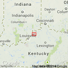
Named Drakes Formation. Composed of grayish green dolomite or limy silty mudstone and lesser amounts of argillaceous, fine-grained dolomite or dolomitic limestone. Megafossils absent or sparse in mudstone, some dolomite beds contain abundant poorly preserved bryozoans or brachiopods. Mudstone contains ripplemarks and mudcracks. 135 ft thick at type section. Divided into Rowland and overlying Preachersville Members. Conformably overlies Ashlock Formation; disconformably overlain by Brassfield Dolomite. Assigned to Late Ordovician. Approximately same rocks called the Waynesville limestone and overlying Liberty and Whitewater formations undivided by Palmquist and Hall (1960).
Source: GNU records (USGS DDS-6; Reston GNULEX).
- Usage in publication:
-
- Drakes Formation*
- Modifications:
-
- Areal extent
- AAPG geologic province:
-
- Cincinnati arch
Summary:
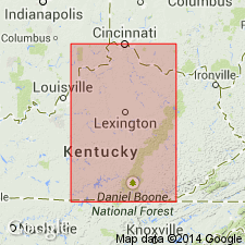
Drakes Formation geographically extended from southeast-central Kentucky to west-central Kentucky. Saluda Limestone reduced in rank to Saluda Dolomite Member and assigned to Drakes Formation. Drakes consists of Rowland (lowest), unnamed, and Saluda Dolomite Members.
Source: GNU records (USGS DDS-6; Reston GNULEX).
- Usage in publication:
-
- Drakes Formation*
- Modifications:
-
- Revised
- AAPG geologic province:
-
- Cincinnati arch
Summary:
Bardstown Member named as middle member of three of Drakes Formation on western side of Jessamine dome in KY.
Source: GNU records (USGS DDS-6; Reston GNULEX).
- Usage in publication:
-
- Drakes Formation*
- Modifications:
-
- Areal extent
- AAPG geologic province:
-
- Cincinnati arch
Summary:
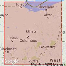
Drakes Formation (Preachersville Member) geographically extended from KY into southwestern OH.
Source: GNU records (USGS DDS-6; Reston GNULEX).
- Usage in publication:
-
- Drakes Formation*
- Modifications:
-
- Areal extent
- AAPG geologic province:
-
- Cincinnati arch
Summary:
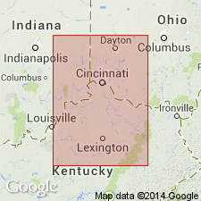
Rowland Member of Drakes Formation geographically extended from KY into southeast IN.
Source: GNU records (USGS DDS-6; Reston GNULEX).
- Usage in publication:
-
- Drakes Formation*
- Modifications:
-
- Overview
- AAPG geologic province:
-
- Cincinnati arch
Summary:
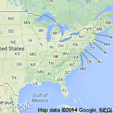
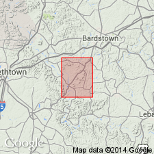
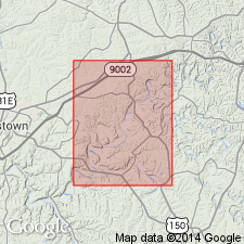
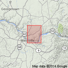
Comprehensive description of Drakes Formation in KY. Map shows area of exposure in KY. Discussions of members, stratigraphic relationships, and environments of deposition. Drakes consists of grayish green dolomite, limy mudstone, limy shale, and limestone. Commonly 30 to 100 ft thick. Crops out around Jessamine dome in KY, OH, and IN.
Source: GNU records (USGS DDS-6; Reston GNULEX).
- Usage in publication:
-
- Drakes Formation
- Modifications:
-
- Revised
- AAPG geologic province:
-
- Cincinnati arch
Summary:
The Geological Survey of Ohio recognizes the Cincinnati Group proposed by Meek and Worthen (1865), but at this time retains it as an informal term. The unit will be formally reinstated as a lithostratigraphic term after revision of its lower boundary and minor lithologic redescription of its units are completed. The ten formations included in the group are the (ascending) Clays Ferry Formation, the Kope Formation, the Fairview Formation, the Miamitown Shale, the Grant Lake Limestone, the Arnheim Formation, the Waynesville Formation, the Liberty Formation, the Whitewater Formation, and the Drakes Formation. Six members have been identified in the course of field mapping: the Point Pleasant Tongue of the Clays Ferry, the informal Bellevue, Corryville, Mount Auburn, and Straight Creek members of the Grant Lake Limestone, and the Preachersville Member of the Drakes Formation. The Backbone Creek and Elk Creek beds are recognized as excellent stratigraphic marker beds.
Source: GNU records (USGS DDS-6; Reston GNULEX).

- Usage in publication:
-
- Drakes Formation*
- Modifications:
-
- Overview
- AAPG geologic province:
-
- Cincinnati arch
Summary:
The Drakes Formation in south-central KY consists of grayish-green, dolomitic or calcareous, silty mudstone and argillaceous, finely crystalline dolomite or dolomitic limestone. The unit is divided into (ascending) the Rowland and Preachersville Members on the southern and eastern sides of the Lexington Dome, and (ascending) the Rowland, Bardstown, and Saluda Dolomite Members on the western side of the dome. In northwestern KY and southwestern OH, the only part of the Drakes that is exposed is 25 to 30 feet of the Preachersville Member. Thickness of the Drakes is 120 to 150 feet. Overlies (in westward direction) the Ashlock Formation, Grant Lake Limestone, or Bull Fork Formation, and unconformably underlies the Silurian. The Drakes is of Late Ordovician (Richmondian) age.
Source: GNU records (USGS DDS-6; Reston GNULEX).
- Usage in publication:
-
- Drakes
- Modifications:
-
- Not used
- AAPG geologic province:
-
- Cincinnati arch
Summary:
The Cincinnatian Series is divided into five depositional sequences in this report, which correspond to lithostratigraphic units. The following stratigraphic names in KY should be abandoned as they have been applied to bodies of rock already named in downramp areas of OH and IN: Bardstown (=Lower Whitewater), Reba (=Oregonia), Stingy Creek (=Mount Auburn), Calloway Creek (=Bellevue), and Clays Ferry (=Fairview). The following units in KY, OH, and IN lump dissimilar facies and straddle sequence boundaries and therefore should be abandoned: Drakes, Ashlock, Dillsboro, Tanners Creek, and Bull Fork. Grant Lake has been defined in several different ways and consequently should be abandoned. Several units will be redefined at a later date, including the Upper Whitewater and the "Sunset" and "Saluda" of OH and IN. Formal naming of new lithostratigraphic units will follow further study.
Source: GNU records (USGS DDS-6; Reston GNULEX).

- Usage in publication:
-
- Drakes Formation*
- Modifications:
-
- Overview
- Age modified
- AAPG geologic province:
-
- Cincinnati arch
Summary:
Rowland, Bardstown, and Preachersville Members of Drakes Formation in KY are used in this report. Age is refined to Cincinnatian (Richmondian).
Source: GNU records (USGS DDS-6; Reston GNULEX).
For more information, please contact Nancy Stamm, Geologic Names Committee Secretary.
Asterisk (*) indicates published by U.S. Geological Survey authors.
"No current usage" (†) implies that a name has been abandoned or has fallen into disuse. Former usage and, if known, replacement name given in parentheses ( ).
Slash (/) indicates name conflicts with nomenclatural guidelines (CSN, 1933; ACSN, 1961, 1970; NACSN, 1983, 2005, 2021). May be explained within brackets ([ ]).