

- Usage in publication:
-
- Dollarhide Formation*
- Modifications:
-
- Named
- Reference
- Dominant lithology:
-
- Limestone
- Sandstone
- Siltstone
- Siltite
- AAPG geologic province:
-
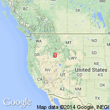
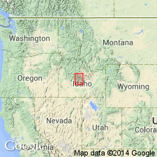
- Snake River basin
Summary:
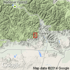
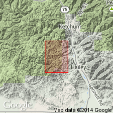
Named for exposures along ridge between Dollarhide Summit and Dollarhide Mountain, Dollarhide Mountain 7 1/2 min quad, Camas and Blaine Cos, ID, which are designated as the type locality. Formerly mapped as part of Wood River Formation. Crops out over an area of 100 sq km in the Snake River basin. Is composed of carbonaceous dark-gray fine-grained thin-bedded limestone; light-gray fine-grained quartzite; gray limy sandstone and siltstone; and dark-gray carbonaceous siltite. Graded bedding and convolute structures common. A locality measured on east side of Wolftone Creek, Mahoney Butte 7 1/2 min quad, 12 km west of Hailey, in sec 8, T2N, R17E, Blaine Co, designated the reference locality, where it is 653 m thick and where Early Permian fusulinids identified. Was intruded by Idaho batholith. Lower boundary is a thrust fault. Structurally overlies Grand Prize Formation (new).
Source: GNU records (USGS DDS-6; Denver GNULEX).
- Usage in publication:
-
- Dollarhide Formation
- Modifications:
-
- Reference
- Dominant lithology:
-
- Siltstone
- Sandstone
- Quartzite
- Limestone
- AAPG geologic province:
-
- Snake River basin
Summary:
Distribution shown on generalized geologic map in Wood River region of central ID, Blaine Co, Snake River basin. Outcrops in northwest-trending belt 50 km long by 10 km wide adjacent to eastern margin of Idaho batholith. Reference section along Wolftone Creek in SW/4 of Mahoney Butte quad. Divided into three informal members, lower (860 m thick), middle (650 m thick), and upper (750+ m thick). Consists primarily of fine-grained calcareous sandstone and sandy limestone interbedded with calcareous, carbonaceous, siliceous siltite; fine-grained calcareous quartzite; conglomerate; carbonaceous black limestone; and black pyritic-carbonaceous argillite. Lower and middle members correlate with upper part (upper half of subunit 6 and subunit 7) of Wood River Formation. Wood River structurally overlies Dollar hide. Dollarhide deposited on slope, distal (westward) of Wood River. Petrologic description; geochemistry. Ordovician Kinnikinic Quartzite is possible source for Dollarhide. Assigned Early Permian age based on rare occurrences of poorly preserved fusulinids including a form characteristic of PSEUDOFUSULINA.
Source: GNU records (USGS DDS-6; Denver GNULEX).
- Usage in publication:
-
- Dollarhide Formation*
- Modifications:
-
- Revised
- Reference
- Age modified
- AAPG geologic province:
-
- Snake River basin
Summary:
Newly assigned as 1 of 3 formations to Sun Valley Group (new name); these 3 formations are lateral variations of originally contiguous strata deposited in one sedimentary basin, the late Paleozoic Wood River basin. Dollarhide is the south and southwest part of the basin. Reference section designated at Willow Creek, lat 43 deg 32' 49" N, long 114 deg 37' 00" W, S1/2 sec 26, T3N, R15E to N1/2 sec 31, T3N, R16E, Camas Co, ID, Snake River basin, and at Deer Creek, in Dry Gulch, and north of Bear Gulch. Divided into: 1) lower member (Desmoinesian to early Wolfcampian) 800+/-m of rhythmically interbedded very fine grained micritic sandstone and carbonaceous silty micritic limestone, subordinate argillite, medium- to thick-bedded micritic sandstone and lenticular conglomerate; 2) middle member (early Wolfcampian) about 300 m of fine-grained micritic sandstone and sandy micrite, and subordinate dark gray to black siltstone and channelized conglomerate; 3) upper member (Wolfcampian and Leonardian) about 900 m of thin-bedded carbonaceous siltstone, laminated siltstone, silty micrite, and minor micritic sandstone and conglomerate. Fossils (listed): fusulinids, conodonts. Stratigraphic charts and figures. Geologic map. Correlates with Grand Prize Formation of Sun Valley Group in north part of basin and with Wood River Formation in central part of basin.
Source: GNU records (USGS DDS-6; Denver GNULEX).
- Usage in publication:
-
- Dollarhide Formation*
- Modifications:
-
- Mapped 1:24k
- AAPG geologic province:
-
- Snake River basin
Summary:
Lower and middle members separately mapped; is part of Sun Valley Group. Lower member mapped in central and southwestern part of quad around flanks of Deer Creek stock; consists of interbedded carbonaceous silty or sandy limestone, limy, very fine-grained sandstone, siltstone, and mudstone, conglomerate or breccia, quartzitic sandstone, minor bioclastic limestone, and barite. Lower member yielded corals, bryozoans, brachiopods, conodonts and fusulinids indicating Desmoinesian to Early Permian age. Stratigraphic base of lower member not recognized; exposed thickness is at least 2,600 ft. Middle member mapped in southwest corner and middle western and eastern margins of quad; consists of interbedded calcareous sandstone and sandy limestone, quartzite, carbonaceous siltstone, lenticular conglomerate, and interbedded slightly sandy, thick-bedded micritic limestone and micritic sandstone at base; no fossils found; disconformable with underlying lower member; minimum thickness about 985 ft. Wood River unconformably overlies Milligen Formation; unconformably underlies Late Cretaceous rocks of Idaho batholith. Dollarhide grades eastward into coeval Wood River Formation of Sun Valley. Deer Creek thrust, occurring sometime between Early Permian and Late Cretaceous, placed Middle Pennsylvanian part of Dollarhide over Upper Pennsylvanian to Lower Permian part of Wood River. Middle Pennsylvanian to Early Permian age.
Source: GNU records (USGS DDS-6; Denver GNULEX).
For more information, please contact Nancy Stamm, Geologic Names Committee Secretary.
Asterisk (*) indicates published by U.S. Geological Survey authors.
"No current usage" (†) implies that a name has been abandoned or has fallen into disuse. Former usage and, if known, replacement name given in parentheses ( ).
Slash (/) indicates name conflicts with nomenclatural guidelines (CSN, 1933; ACSN, 1961, 1970; NACSN, 1983, 2005, 2021). May be explained within brackets ([ ]).