

- Usage in publication:
-
- Dolgeville shale
- Modifications:
-
- Named
- Dominant lithology:
-
- Shale
- Limestone
- AAPG geologic province:
-
- Appalachian basin
Summary:
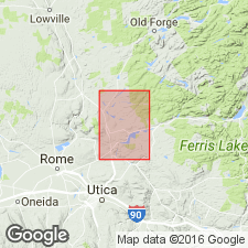
Dolgeville shale. Alternating thin-bedded limestones and shales, transitional in character. Evidently a shaly eastern representative of upper Trenton limestone of type section. Overlain, conformably, by Utica shale and underlain by Trenton limestones proper. It is separable from both of them throughout the Mohawk Valley. Fully exposed, with both contacts shown, in banks of East Canada Creek, just below Dolgeville, Herkimer Co. Previously called "Trenton-Utica passage series." Age is Middle Ordovician.
Source: US geologic names lexicon (USGS Bull. 896, p. 618).
- Usage in publication:
-
- Dolgeville Formation
- Modifications:
-
- Overview
- AAPG geologic province:
-
- Appalachian basin
Summary:
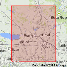
Upper part of Dolgeville Formation, called Dolgeville tongue, is here referred to as the High Falls division of the Russia Member of the Denley Limestone.
Source: GNU records (USGS DDS-6; Reston GNULEX).
- Usage in publication:
-
- Dolgeville Formation
- Modifications:
-
- Overview
- AAPG geologic province:
-
- Appalachian basin
Summary:
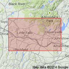
A tongue of the Dolgeville Formation in the Mohawk Valley divides the Utica Shale into upper and lower parts and these parts are here assigned member names. The lower portion of the Utica is named the Flat Creek Member and the upper, the Indian Castle Member. The top of the Dolgeville is of uppermost O. RUEDEMANNI Zone age across its entire outcrop area. In the Herkimer region, the top of the Dolgeville is probably equivalent to the top of the Russia Member of the Denley Limestone as originally suggested by Kay (1953). Authors' interpretation limits the duration of the Dolgeville Formation deposition while expanding the areal extent of the unit. Dolgeville beds simultaneously spread eastward into the black shale basin and westward replacing the shelly facies of the lower Denley Limestone. Diagram shows Dolgeville extending from just east of Canajoharie Creek to Trenton Falls in the west, where it interfingers with the Russia Member and unconformably underlies the Rust Member of the Denley Limestone. Age is Middle Ordovician (Shermanian).
Source: GNU records (USGS DDS-6; Reston GNULEX).
For more information, please contact Nancy Stamm, Geologic Names Committee Secretary.
Asterisk (*) indicates published by U.S. Geological Survey authors.
"No current usage" (†) implies that a name has been abandoned or has fallen into disuse. Former usage and, if known, replacement name given in parentheses ( ).
Slash (/) indicates name conflicts with nomenclatural guidelines (CSN, 1933; ACSN, 1961, 1970; NACSN, 1983, 2005, 2021). May be explained within brackets ([ ]).