

- Usage in publication:
-
- Dalles formation
- Modifications:
-
- Named
- AAPG geologic province:
-
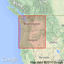
- Columbia basin
Summary:
Unit is named the Dalles formation. Is a lacustrine unit found on the Columbia River, OR. Materials are sometimes coarse and gravelly. Underlain by lava flow that served as source of materials; overlain by beds of the second great volcanic outflow. Contains plant remains. (B896)
Source: GNU records (USGS DDS-6; Menlo GNULEX).
- Usage in publication:
-
- Dalles formation*
- Modifications:
-
- Adopted
- Biostratigraphic dating
- Dominant lithology:
-
- Sandstone
- Shale
- Conglomerate
- Tuff
- Andesite
- AAPG geologic province:
-
- Blue Mountains province
- Great Basin province
Summary:
Dalles formation of Cope (1880) is adopted. Consists of thin- to medium-bedded semiconsolidated sandstone, sandy shale, conglomerate, tuff, and coarse mudflow breccia, all of andesitic and dacitic composition; to the west, includes intercalated andesite flows and in the Bend quadrangle includes a widespread dacite welded tuff. Age is Pliocene based on fossils [vertebrates, leaves, diatoms].
Source: GNU records (USGS DDS-6; Menlo GNULEX).
- Usage in publication:
-
- Dalles Formation*
- Modifications:
-
- Age modified
- AAPG geologic province:
-
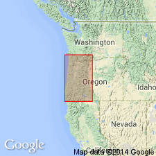
- Columbia basin
Summary:
Age of the Dalles Formation is revised from early and middle(?) Pliocene to: late Miocene (based on age of "mainly 9-7 Ma").
Source: GNU records (USGS DDS-6; Menlo GNULEX).
For more information, please contact Nancy Stamm, Geologic Names Committee Secretary.
Asterisk (*) indicates published by U.S. Geological Survey authors.
"No current usage" (†) implies that a name has been abandoned or has fallen into disuse. Former usage and, if known, replacement name given in parentheses ( ).
Slash (/) indicates name conflicts with nomenclatural guidelines (CSN, 1933; ACSN, 1961, 1970; NACSN, 1983, 2005, 2021). May be explained within brackets ([ ]).