

- Usage in publication:
-
- Dakota group*
- Modifications:
-
- Original reference
- Dominant lithology:
-
- Sandstone
- AAPG geologic province:
-
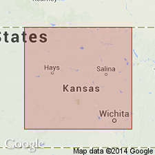
- Salina basin
Summary:
Pg. 419, 420. Dakota group (Formation No. 1 of Cretaceous). Yellowish, reddish, and occasionally white sandstone, with, at places, alternations of various-colored clays and lignite beds. Thickness 400 feet. Occurs in hills back of town of Dakota; extensively developed in Dakota County [Nebraska], below mouth of Big Sioux River, thence south into northeast Kansas and beyond. Underlies Fort Benton group, of which it may probably be only a member. Contains silicified wood, fossil dicotyledonous leaves, and casts of shells. Age is Early Cretaceous, based on fossils and stratigraphic position. Dakota group, Fort Benton group, and Niobrara division together represent the "lower," or "gray chalk," and probably the "upper green sand" of British geologists (=Turonien and Cenomanien, of D'Orbigny). [This paper by Meek and Hayden described the rocks of Nebraska, which at that time included Wyoming, Montana, and the Dakotas.]
Named from town of Dakota, NE.
Source: US geologic names lexicon (USGS Bull. 896, p. 566); supplemental information from GNU records (USGS DDS-6; Denver GNULEX).
- Usage in publication:
-
- Dakota sandstone*
- Modifications:
-
- Revised
- Age modified
- AAPG geologic province:
-
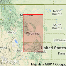
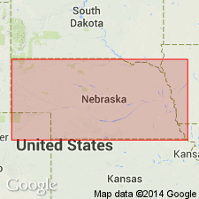
- Powder River basin
Summary:
Pg. 568-593. Newton's Dakota group of Black Hills is subdivided into five divisions 1 to 5, descending. Proposed names for the divisions, No. 5, Beulah clays, Upper Jurassic; No. 4, Hay Creek coal formation; No. 3, Barrett shales; No. 2, Oak Creek beds; and No. 1, Dakota sandstone. Dakota sandstone is Upper Cretaceous, the other units Lower Cretaceous. Dakota sandstone divided into two units, lower 30 to 45 feet thick and upper 35 to 45 feet. Unconformably underlies Fort Benton.
Source: US geologic names lexicon (USGS Bull. 1200, p. 1028-1037).
- Usage in publication:
-
- Dakota sandstone*
- Modifications:
-
- Revised
- AAPG geologic province:
-
- Las Vegas-Raton basin
- Denver basin
Summary:
Dakota sandstone described in Apishapa quadrangle, Colorado. Consists of massive gray sandstone, weathering rusty brown, generally in two ledges with variable thin dark shale parting. Thickness 63 to 83 feet. Overlies Purgatoire formation (new); underlies Graneros shale of Benton group. Purgatoire formation was formerly considered part of Dakota sandstone and is so mapped in Walsenburg and Pueblo folios. Fossils (leaves, wood). Age is Late Cretaceous (Cenomanian).
Source: US geologic names lexicon (USGS Bull. 1200, p. 1028-1037); supplemental information from GNU records (USGS DDS-6; Denver GNULEX).
- Usage in publication:
-
- Dakota group*
- Modifications:
-
- Revised
- AAPG geologic province:
-
- Denver basin
Summary:
Pg. A1-A22. Dakota group is divided into five informally named formations (ascending): Lower sandstone, Lower shale, Middle sandstone, Middle shale, and Upper sandstone. Group is well exposed about 2 miles north of Bellvue, [Larimer County], Colorado, and section measured here, about 325 feet thick, may be regarded as type section of group. Lower sandstone (40 feet at Bellvue) is a gray massive coarse-grained usually cross-bedded and conglomeratic sandstone, variable in thickness but everywhere present and readily identified; unconformably overlies Morrison formation. Lower shale (40 feet at Bellvue) consists of variable beds of sandy shale and thin layers of hard sandstone; commonly, but not invariably, highly colored (red, purple, green, blue). In Wyoming, this shale has been called middle member of Cloverly. It may prove to be age equivalent of Fuson formation of Black Hills and is probably included in Kootenai of Montana. Middle sandstone (10 feet at Bellvue) is gray, hard, quartzose, evenly bedded, and strongly ripple marked at many localities; variable in thickness, and, where the variegated underlying shale is absent or not distinctive, it cannot be differentiated from the lower sandstone. This middle sandstone has been called upper Cloverly, true Dakota, and second Muddy and probably is included in Purgatoire formation by different workers. Middle shale (200 feet at Bellvue) is thickest formation of group. It is dark-colored bituminous marine shale. In many areas in northern Colorado between Morrison and Boulder, it contains fossil plants which Knowlton refers to the Dakota flora. North of Boulder it has yielded fossil invertebrates which Reeside tentatively places in Kiowa fauna of Kansas and Purgatoire fauna of southeastern Colorado. Near Colorado Springs, this shale is called Glencairn member of Purgatoire formation. In southern Wyoming, it has been included in Graneros shale or lower part of the Benton. It is equivalent to upper part of Thermopolis shale of northern Wyoming. Upper sandstone (35 feet at Bellvue) is variable in character and thickness and in some places thins out entirely. Contains fossil plants, fragments of charcoal, streaks of coal and markings resembling fillings of worm borings. This sandstone is the upper Dakota of northern Colorado but is known in oil industry as Muddy sand. It is herein emphasized that there is no single definite persistent and easily recognized sandstone such as was formerly supposed to exist and was termed the Dakota sandstone. The group as a whole is interpreted as the result of accumulation of sediments near the strand line of the advancing Cretaceous sea, and as such it differs in age from place to place by length of time consumed by advance of strand line across the intervening distance. Whether this advance marks the beginning of Upper Cretaceous time remains to be determined. Area of report extends from Perry Park, Colorado, about 35 miles south of Denver, northward along foothills east of Rocky Mountains to Douglas, Wyoming, thence northwestward to Thermopolis, and includes section at Lander and Rawlins.
Source: US geologic names lexicon (USGS Bull. 1200, p. 1028-1037).
- Usage in publication:
-
- Dakota sandstone*
- Modifications:
-
- Revised
- AAPG geologic province:
-
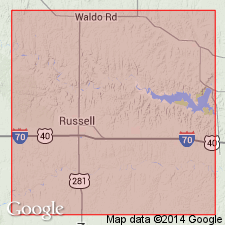
- Central Kansas uplift
Summary:
Pg. 16, 57-65. Dakota sandstone, in Russell County, Kansas, includes Rocktown channel sandstone member (new). Age is Late Cretaceous.
Source: US geologic names lexicon (USGS Bull. 1200, p. 1028-1037).
- Usage in publication:
-
- Dakota group*
- Modifications:
-
- Adopted
- AAPG geologic province:
-
- Denver basin
Summary:
Pg. 17-23. Name Dakota group, applied by writer [Lee] (1923) to beds as far west as Lander and as far north as Greybull, Wyoming, is accepted by the USGS only for section at Bellvue, Colorado, with understanding that if rocks of Comanche age are proved to be present in Dakota group of that section, they are to be excluded from group. The rocks to which the writer thus applied term Dakota group are described in present report according to their position. They are (ascending) lower conglomeratic sandstone; a variable division of sand shale separable toward north into a highly colored lower shale and sandstone that becomes the middle sandstone of the group where three sandstones are present; upper shale, which was called middle shale in 1923 publication, but which in many sections is the higher of two shales and is therefore designated the upper shale of this group; an upper sandstone which is the upper Dakota of northern Colorado and the Muddy sand of many Wyoming localities and is probably equivalent to Newcastle sandstone of eastern Wyoming. Writer believes that group is well defined from Colorado Springs, Colorado, northward nearly to southern boundary of Montana. According to this interpretation, it includes Cloverly formation of Wyoming and some rocks usually included in Benton shale.
Source: US geologic names lexicon (USGS Bull. 1200, p. 1028-1037).
- Usage in publication:
-
- Dakota sandstone
- Modifications:
-
- Not used
- AAPG geologic province:
-
- Chadron arch
Russell, W.L., 1928, The origin of artesian pressure: Economic Geology, v. 23, no. 2, p. 132-157.
Summary:
Pg. 134-137. Term Fall River formation replaces Dakota sandstone in Black Hills region.
Source: US geologic names lexicon (USGS Bull. 1200, p. 1028-1037).
- Usage in publication:
-
- Dakota stage
- Modifications:
-
- Revised
Summary:
Pg. 199-322. Discussion of Dakota stage of type locality. Meek and Hayden used term group. Other writers have used series, stage, formation, or sandstone. Lithology of the Dakota, distribution of the various zones, stratigraphic range and interpretations made in present study, all suggest that term stage be used to designate the sandstones, shales, and clays exposed near Dakota City, Nebraska, and described by Meek and Hayden as Dakota group. Dakota age is used for time. Best exposures are at Sioux City, Iowa, and its suburbs. This includes Prospect Hill section; exposures at Sioux City Brick Company pits, at Riverside; bluffs along Big Sioux River south of west entrance to Stone Park; Sergeant Bluff, south of Sioux City; Crill Mill section south of Westfield, Iowa; and several sections in vicinity of Homer, Nebraska.
Source: US geologic names lexicon (USGS Bull. 1200, p. 1028-1037).

- Usage in publication:
-
- Dakota sandstone*
- Dakota formation*
- Dakota group*
- Modifications:
-
- Overview
Summary:
The name Dakota sandstone has in the past been applied over large areas in the Western States where the correctness of its application has in recent years been seriously questioned. At present [ca. 1938] the name is restricted by the USGS to areas east of Front Range, and the rocks occupying approximately the same stratigraphic position in areas west of Front Range are tentatively called Dakota(?) formation. In some parts of eastern Colorado the name as used by Hayden and other early workers included marine beds of [Early] Creatceous age now called Purgatoire formation. The geographic extent of Purgatoire formation remains to be determined. In Bellevue section of Larimer County, Colorado, the rocks believed by some geologists to be wholly of Dakota age are divisible into several units, which, although unnamed, are at present collectively called Dakota group. Other geologists, however, believe that the Purgatoire is represented in Bellevue section. If the Purgatoire proves to be present in Bellevue section it will be removed from Dakota group of W.T. Lee. The Dakota is chiefly of continental origin.
The sandstone in Black Hills region, Wyoming-South Dakota, that for many years was called Dakota sandstone is now known not to be true Dakota sandstone, but a sandstone of [Early] Cretaceous age, to which the name Fall River sandstone is now applied. It is opinion of some geologists that the younger Newcastle sandstone may be true Dakota of this region, but this is undetermined.
Source: US geologic names lexicon (USGS Bull. 896, p. 566).
- Usage in publication:
-
- Dakota formation
- Modifications:
-
- Revised
- AAPG geologic province:
-
- Central Kansas uplift
Summary:
Pg. 315-348. Dakota formation of Kansas, as here defined, has been called variously "Dakota group," "Dakota formation," Ellsworth and Solomon formations, Rocktown channel sandstone member, and "Dakota sandstone." Dakota formation is here defined to include Cretaceous strata from top of Kiowa shale below to base of Graneros shale above. Subdivided into (ascending) Terra Cotta clay and Janssen clay (new) members.
[Typographical error (US geologic names lexicon, USGS Bull. 1200, p. 1031): Dakota formation includes strata to base of overlying Graneros shale, not top.]
Source: Publication; US geologic names lexicon (USGS Bull. 1200, p. 1028-1037).
- Usage in publication:
-
- Dakota group
- Dakota sandstone
- Modifications:
-
- Principal reference
- Revised
- AAPG geologic province:
-
- Salina basin
Summary:
Pg. 15 (fig. 7), 18-20. Dakota group. Named by Meek and Hayden in 1862. Since that time it has been separated as three formations, the upper one of which is yet called Dakota sandstone, a usage conflicting with name of the group. Lee (1927) correlates the subdivisions of Dakota group at east side of Laramie Range in Wyoming, in a section near Greenacre Ranch, as follows (ascending): Lakota sandstone, Fuson shale, Fall River sandstone, Skull Creek shale, and Newcastle sandstone. Studies reveal that Newcastle sandstone, Skull Creek shale, and Fall River sandstone correlate collectively with the so-called Dakota sandstone or top formation of Dakota group in eastern Nebraska. Name Omadi sandstone proposed for the so-called Dakota formation, to include section lying between Fuson and Graneros shales. Dakota group then includes (ascending) Lakota, Fuson, and Omadi. Meek and Hayden did not locate a very definite type locality; hence type locality is herein designated. Thickness at proposed type locality 392 feet.
Type locality: in Missouri River bluffs of Dakota Co., NE, located 1 mi southeast of Homer, NE, in NE/4 sec. 13, T. 27 N., R. 4 E.
Source: US geologic names lexicon (USGS Bull. 1200, p. 1028-1037).
- Usage in publication:
-
- Dakota sandstone*
- Modifications:
-
- Revised
- AAPG geologic province:
-
- Denver basin
- Las Vegas-Raton basin
Summary:
Pg. 6 (fig. 2), 11-26, pls. 1, 2, 4, 5. Dakota sandstone. Throughout large part of southeastern Colorado [e.g., Fremont, Pueblo, and Huerfano Counties], Dakota sandstone is prominent cliff-forming unit averaging about 100 feet in thickness and consisting largely of fine- and medium-grained cross-laminated sandstone. Consists of lower unnamed sandstone unit, Dry Creek Canyon member (new), and upper sandstone unit. Overlies Glencairn shale member of Purgatoire formation; underlies Graneros shale. Age is Early Cretaceous.
See also Waage's discussion of clay deposits of Denver-Golden area (1952 Colorado Sci. Soc. Proc., v. 15, no. 9, p. 375, fig. 1); Dakota sandstone, 80 feet thick, overlies Purgatoire formation and underlies Benton shale.
Source: US geologic names lexicon (USGS Bull. 1200, p. 1028-1037); supplemental information from GNU records (USGS DDS-6; Denver GNULEX).
- Usage in publication:
-
- Dakota group*
- Modifications:
-
- Revised
- AAPG geologic province:
-
- Denver basin
Summary:
Pg. 15-49. Discussion of Dakota group in northern Front Range foothills, Colorado. Area includes narrow belt of pre-Benton Cretaceous exposures extending from 2 miles south of Wyoming State line, in Larimer County, where beds emerge from under Cenozoic cover, to fault-terminated end of Dakota hogback just south of Indian Creek in Kassler quadrangle, Douglas County. Northern foothills area corresponds with area in which Lee (1923) applied name Dakota group to pre-Benton Cretaceous rocks of Colorado and divided it into five informal subdivisions. Terminology presented in this report is revision of Lee's (1923) Dakota group and is intended to apply only to northern foothills area. Name Lytle formation is applied to lower part of sequence and South Platte formation (new) to upper part of sequence. Overlies Morrison formation [see Morrison formation, this reference for discussion of Morrison-Lytle contact]; underlies Benton shale. First formal subdivision of Dakota formation was made by Stose (1912) in Apishapa quadrangle. He named lower sandstone and middle shale of the threefold sequence the Purgatoire formation and retained name Dakota sandstone for upper sandstone. Finlay (1916), in Colorado Springs quadrangle, named the sandstone and shale units in the Purgatoire the Lytle sandstone and Glencairn shale members, respectively. With exception of addition to Dakota sandstone of a local refractory shale unit, Dry Creek Canyon member (Waage, 1953), the subdivision and nomenclature have remained as designated by Stose and Finlay. Names Dakota sandstone, in restricted sense, and Purgatoire formation have been used throughout southeastern and central Colorado and as far north along Front Range foothills as Perry Park in Castle Rock quadrangle. Lee's work in northern foothills led to fivefold rather than threefold subdivision of the Dakota in this area. Lee used his terminology throughout Front Range foothills and correlated his subunits with subdivisions of Stose and Finlay to the south and with Wyoming terminology to the north. No formal changes have been made in nomenclature or subdivision of Lee's Dakota group since it was proposed, and it has existed side by side with southern classification of Stose and Finlay. Terminologies other than that of Lee have been used in northern Front Range foothills presumably because Lee's Dakota group is too broad a unit for detailed work and because some of his subdivisions lack lateral continuity and are difficult to apply. Stose and Finlay's terminology was used in Denver-Golden area by Waage (1952), but subsequent work leading to present report has shown that it was incorrectly applied and that it is equally as unsatisfactory as Lee’s in providing a logical subdivision of pre-Benton Cretaceous strata. George (1927, Colorado Univ. Semi-centennial Pub.) called Early Cretaceous rocks throughout eastern Colorado the Purgatoire and incorrectly used names Lakota and Fuson in northern foothills for members of the Purgatoire that he considered equivalent, respectively, for Finlay’s Lytle and Glencairn members in Colorado Springs area. This usage, based on incorrect correlation with Black Hills area, is still used to Colorado by some workers. Others have extended the Cloverly-Thermopolis-Muddy terminology southward from Wyoming, and some still use term Dakota formation in sense in which it was used in early reports of Geological Survey. Several sources of confusion in usage of pre-Benton Cretaceous terminology are apparent in the history of subdivision and nomenclature of the Dakota. First source is taxonomic change from use of terms formation and group as synonyms to their use as terms for separate ranks of rock units. More critical source was tendency to separate the Early Cretaceous from the Late Cretaceous parts of the pre-Benton Cretaceous sequence, a tendency that influenced, and is reflected in, Stose's formal subdivision of Dakota formation. Use of age as criterion for subdivision of rock units, a practice at the root of many nomenclatural problems, can lead only to confusion in correlation and to ambiguity in terminology when applied to complex transgressive deposits like the pre-Benton Cretaceous sequence. Much of the confusion associated with name Dakota stems from this cause. An unfortunate nomenclatural practice, that of retaining name Dakota for Late Cretaceous part of sequence in those areas where Early Cretaceous rocks can be identified and separated, has served to crystallize the confusion. This practice has been applied in Kansas and in Colorado, making it impossible to use name Dakota in a single sense for physical correlation between areas in which Early Cretaceous strata are separated from the Dakota and areas in which occurrence of Early Cretaceous rocks has not been sufficiently well established to permit their separation from the Dakota. Introduction of terminologies from other areas is a recent source of confusion in Colorado pre-Benton Cretaceous classification. Usage of Dakota in present report follows that of Meek and Hayden (1862) inasmuch as it includes all pre-Benton Cretaceous strata. In type area along Missouri River in Nebraska, the Dakota rests on Paleozoic rocks so its lower contact is unequivocal. The characteristic twofold lithogenetic division is present in type area where sharp break separates sandstone with variegated clay below from sandstone with dark-gray clay, carbonaceous clay, and lignite above. In light of previous attempts to make name Dakota reflect opinion on age of rock that it includes, it is emphasized that Dakota group, as used herein, is strictly a rock term, and whether or not the group contains both Lower and Upper Cretaceous rocks, is entirely Lower Cretaceous, or varies in age from region to region is irrelevant to this definition. Because of indefinite nature of Morrison-Lytle contact in parts of northern foothills, it may not be convenient in some places to use Dakota group as a unit for small-scale mapping; in such places, best map units would be Morrison and Lytle formations, undifferentiated, and South Platte formation.
Source: US geologic names lexicon (USGS Bull. 1200, p. 1028-1037).
- Usage in publication:
-
- Dakota group
- Modifications:
-
- Revised
- AAPG geologic province:
-
- Sierra Grande uplift
Summary:
Considered a group in Union Co that includes Purgatoire formation (base) and Dakota formation (top). [A group should not be divided into a unit that bears the same name as the group.] Dakota formation preferred to Dakota sandstone because unit is shaly. Thought to be of Early and Late(?) Cretaceous age. Lies between Morrison formation and Benton group.
Source: GNU records (USGS DDS-6; Denver GNULEX).
- Usage in publication:
-
- Dakota group*
- Modifications:
-
- Revised
Summary:
Pg. 13-26. Dakota group. A persistent disconformity separating continental deposits of varied facies from overlying marginal marine deposits and marine deposits was recognized in Dakota group of northern Colorado Front Range (Waage, 1955), where this twofold lithogenetic pattern was used as basis for subdivision of the group. Earlier (Waage, 1953) the same disconformity, whose regional significance was not recognized at the time, was used as contact between Lytle and Glencairn members of Purgatoire formation in south-central Colorado. Reconnaissance studies supplemental to those in Front Range and additional studies as yet unpublished reveal the disconformity and the two gross lithogenetic units it separates in the Purgatoire-Dakota sequence of southeastern Colorado and southwestern Kansas, in the Cloverly-Thermopolis-Muddy sequence of Bighorn basin area and eastern Wyoming, in type area of original Dakota formation along the Missouri River in Iowa and Nebraska, and in Inyan Kara-Skull Creek-Newcastle sequence of Black Hills region. Within the broad twofold lithogenetic framework, the Dakota group and its equivalents vary considerably from place to place. Changes in type of rock, sequence of rocks, and thickness of individual subunits locally obscure basic pattern. Many environments of deposition represented in the two parts of sequence account for much of the variation. Deposits of lower sequence are, in general, typified by fine- to coarse-grained buff to white lenses of sandstone and conglomeratic sandstone, irregularly interbedded with variegated red, green, yellow, gray, and black claystones; shale is rare and commonly limited to local lacustrine deposits; most of the coarser material is chert, quartzite, and quartz, obviously many cycles removed from parent rock. In some areas, such as south-central and southeastern Colorado, lower part of sequence is dominantly sandy, and variegated claystones are rare; in other areas such as the Bighorn basin, variegated claystone and argillaceous siltstone predominate. Fossils not common in lower part, but plant remains include coniferous wood, cycadeoids, charophytes, and other algae and foliage of ferns and cycods; animal remains include dinosaur bones, fresh-water mollusks, ostracodes, and branchiopods. Lower part of sequence is more closely related lithogenetically to underlying Morrison than to upper part of sequence. No obvious stratigraphic break marks contact with the Morrison, and at many places it is impossible to separate the two units except on some arbitrarily selected local feature. Upper part of Dakota sequence consists chiefly of fine-grained commonly thin-bedded laminated to tabular cross-laminated buff- to brown-weathering sandstone interbedded with gray to black shale and siltstone. Thin bedding and lamination characterize this part of sequence. In some areas, such as central Wyoming, that lay within central part of basin of deposition, nearly the entire sequence is shale and silty shale (Thermopolis) except for some sandy shale and local sandstone at top (Muddy) and base (Rusty beds). Fossils in marginal marine beds include dicotyledonous leaves, wood, false trunks of TEMPSKYA, some fresh-water clams, linguloid brachiopods, and foraminifera. Marine beds contain pelecypods, gastropods, linguloid brachiopods. Foraminifera, bones of fish, crocodiles, and plesiosaurs. Contact of the two parts of sequence is, in many places, a relatively plane surface of disconformity marking an abrupt lithic change. The gross twofold subdivision affords only consistent means of orientation within the varied local Dakota sequences. Whether or not this disconformity transgresses time, it is an excellent datum to use in working out equivalency of lithogenetic units in Dakota sequence, and, if local terminologies can be adjusted to it, many of the Dakota nomenclatural problems will resolve themselves. Many problems of stratigraphy of Dakota and equivalent rocks have their roots in the nomenclature. Report gives historical summary of usage of term Dakota in Black Hills area and points out, among other things, the fact that Darton (1901) miscorrelated these beds with the Dakota of eastern Colorado. He became convinced that the Fort Benton of the Black Hills was the "precise equivalent" of Gilbert's (1896) Graneros shale in eastern Colorado and introduced name Graneros into Black Hills terminology. This miscorrelation has had lasting effect. Name Fuson is still misapplied by some geologists to black shale of Glencairn member of Purgatoire formation, the Skull Creek equivalent in southern part of Colorado Front Range. Name Graneros is still used locally by most geologists in spite of the fact that it is a hangover from miscorrelation by Darton and is misleading in regional correlation. It is used both as a formation and group to include beds between Fall River formation and Greenhorn limestone. Black Hills area is one of several that have followed similar pattern in development of the terminology applied to its pre-Benton (Dakota equivalents) Cretaceous beds. In much of the central and northern Great Plains and Rocky Mountains, these beds vary in stratigraphic detail from place to place, but their sequence is uniform in its major lithogenetic features. This uniformity is obscured by complex and conflicting terminology that has resulted largely from the unfortunate practice of distinguishing stratigraphic units on the basis of their supposed age. Soon after name Dakota was introduced, it came to be used synonymously with sandy basal Upper Cretaceous rocks. Subsequent discovery of Early Cretaceous fossils in these rocks resulted in their subdivision, generally with name Dakota for that part of sequence still considered Upper Cretaceous. Division between Lower and Upper Cretaceous rocks in northern part of interior region has been placed higher and higher in the sequence. In Black Hills, each shift of this time boundary has resulted in change in nomenclature. For Black Hills, where name Dakota has passed from nomenclature, the principal subunits, Lakota, Fuson, and Fall River formations, have not proved to be satisfactory mappable units. This is the problem with which present report is concerned. In Black Hills, the transgressive disconformity discussed above falls within Inyan Kara group. Subdivision and nomenclature of Inyan Kara group is adjusted to conform to this twofold lithogenetic division.
Source: US geologic names lexicon (USGS Bull. 1200, p. 1028-1037).
- Usage in publication:
-
- Dakota group*
- Modifications:
-
- Revised
Summary:
Pg. 154-194. Dakota group. Basal Cretaceous deposits of Colorado Plateau can be subdivided into two formations on basis of carbonaceous content. The lower noncarbonaceous unit, Cedar Mountain formation, consists of mudstones and persistent conglomeratic sandstones which were deposited in an inclan floodplain environment. The upper carbonaceous unit, Naturita formation (new), consists of carbonaceous mudstone, coal, persistent conglomeratic sandstones, and beach sandstones deposited on or adjacent to shore of Mancos sea. Naturita deposits can be traced landward into Cedar Mountain deposits, indicating that they are facies of a larger unit, the Dakota group. Upper part of Naturita intertongues with and passes laterally into basal part of Mancos shale throughout much of Colorado Plateau. Group is unconformable above Morrison formation. Age is Early and Late Cretaceous.
Source: US geologic names lexicon (USGS Bull. 1200, p. 1028-1037).
- Usage in publication:
-
- Dakota Group
- Modifications:
-
- Revised
- AAPG geologic province:
-
- Denver basin
Summary:
Nomenclature of Waage (1955), in which Dakota Group divided into Lytle (base) and South Platte (top) Formations, is restricted to area south of Boulder, Boulder County, Colorado. North of Boulder, Lytle Formation recognized at base of Lower Cretaceous Dakota Group, but sequence about it modified. Plainview, formerly the basal member or lower sandstone of South Platte, raised to formation rank. [Intent to raise to formation not stated.] The overlying parts, formerly of the South Platte or the middle marine shale, are designated Skull Creek Shale, and the upper sandstone is designated Muddy Sandstone. Both Skull Creek and Muddy, therefore, are extended into north-central Colorado, Denver basin, from south-central Wyoming. Muddy has two newly named members: Fort Collins (base) and Horsetooth (top). Depositional environments of two new members discussed. Is 300 to 400 feet thick. Report includes correlation chart.
Source: GNU records (USGS DDS-6; Denver GNULEX).
- Usage in publication:
-
- Dakota Sandstone
- Modifications:
-
- Revised
- AAPG geologic province:
-
- San Juan basin
Summary:
Dakota Sandstone. Comprises (ascending): unnamed member, 127 feet thick; Whitewater Arroyo Shale Member (new), 80 feet thick; and Twowells Sandstone Member, 33 feet thick. Unconformably overlies Morrison Formation. Age is Cretaceous.
Source: Modified from GNU records (USGS DDS-6; Denver GNULEX).
- Usage in publication:
-
- Dakota Sandstone*
- Modifications:
-
- Revised
- AAPG geologic province:
-
- San Juan basin
Summary:
Dakota Sandstone. In west-central New Mexico subdivided into (ascending) Oak Canyon Member (new), Cubero Sandstone Tongue (new), Paguate Sandstone Tongue (new), and Twowells Sandstone Tongue. Intertongues with Mancos Shale. Age is Early and Late Cretaceous.
Source: Publication; Changes in stratigraphic nomenclature, 1973 (USGS Bull. 1395-A, p. A12-A13).

- Usage in publication:
-
- Dakota Sandstone*
- Modifications:
-
- Age modified
- AAPG geologic province:
-
- San Juan basin
Summary:
Age of Dakota Sandstone changed from Early and Late Cretaceous --to-- Late Cretaceous (Cenomanian). In report area includes (ascending) Oak Canyon Member, Cubero Sandstone Tongue, Paguate Sandstone Tongue, and Twowells Sandstone Tongue. Intertongues with Mancos Shale.
Source: Modified from GNU records (USGS DDS-6; Denver GNULEX).
- Usage in publication:
-
- Dakota Sandstone*
- Modifications:
-
- Revised
- Areal extent
- AAPG geologic province:
-
- Palo Duro basin
- Orogrande basin
Summary:
Twowells Tongue of Dakota Sandstone underlies the newly named Rio Salado Tongue of Mancos Shale from Atarque, San Miguel Co, Palo Duro basin to Puertocito, Socorro Co, Orogrande basin. Twowells cannot be recognized far east of Puertocito.
Source: GNU records (USGS DDS-6; Denver GNULEX).
- Usage in publication:
-
- Dakota Formation
- Modifications:
-
- Revised
- AAPG geologic province:
-
- Iowa shelf
Summary:
Revised, in northwest IA from Emmet Co west to Lyon Co and to south from Calhoun Co to Woodbury Co on the Iowa shelf, to include Nishnabotna Member--formerly spelled Nishnabotany Sandstones (White, 1870)--at base and Woodbury Member--formerly the Woodbury Sandstones and Shales (White, 1870). Upper contact of Dakota and its Woodbury Member changed to coincide with the base of the Graneros Shale rather than the top of the Graneros or base of Greenhorn Limestone (called INOCERAMUS beds by White in 1870). History of nomenclature chart, cross section, isopach map, nomenclature chart, measured sections. Overlies Pennsylvanian rocks in southeast part of report area. Rests on bands of older rocks to the northwest from Mississippian, Devonian, Ordovician, Cambrian, to Precambrian age. Of Cretaceous age.
Source: GNU records (USGS DDS-6; Denver GNULEX).
- Usage in publication:
-
- Dakota Sandstone*
- Modifications:
-
- Age modified
- AAPG geologic province:
-
- Palo Duro basin
- Las Vegas-Raton basin
Summary:
Within study area in Mora and San Miguel Cos, Palo Duro and Las Vegas-Raton basins, NM, Dakota mapped and divided into lower, medial, and upper parts; lower and medial parts, and possibly upper part, may be equivalent to Lower Cretaceous Purgatoire Formation. Authors (1984, U.S.G.S. I-1456) also divided Dakota into three parts and mapped unit to north in adjacent Mora River area, Mora Co. Dakota occurs in southeast part of map I-1456 where it is 170 ft thick at Mora River; extends south into eastern part of map I-1575 where it is 125-170 ft thick. Microflora [not specified on maps, though listed in Baltz and O'Neill, in press, IN New Mexico Geological Society Field Conference Guidebook] from near top of unit at Montezuma south of study area is probably Early Cretaceous (Albian) age (R. H. Tschudy, written communication, 1982). Assigned Early and Early? Cretaceous age.
Source: GNU records (USGS DDS-6; Denver GNULEX).
- Usage in publication:
-
- Dakota Group
- Modifications:
-
- Revised
- AAPG geologic province:
-
- Sierra Grande uplift
- Palo Duro basin
Summary:
Dakota Group. In valley of Dry Cimarron [Union County, New Mexico, and Cimarron County, Oklahoma], subdivided into (ascending) Mesa Rica Sandstone, Pajarito Formation, and Romeroville Sandstone. Mesa Rica and Pajarito formerly members of †Purgatoire Formation (abandoned). Overlies Glencairn Formation and underlies Graneros Shale. Age is Early Cretaceous. Report includes measured sections, correlation chart.
Source: Modified from GNU records (USGS DDS-6; Denver GNULEX).
- Usage in publication:
-
- Dakota Sandstone*
- Modifications:
-
- Revised
- AAPG geologic province:
-
- San Juan basin
Summary:
Dakota Sandstone. In New Mexico, the Upper Cretaceous Dakota Sandstone includes Encinal Canyon Member (new) at its base, below Oak Canyon Member. Unconformably overlies Morrison Formation.
Source: Publication.
- Usage in publication:
-
- Dakota Sandstone*
- Modifications:
-
- Biostratigraphic dating
- AAPG geologic province:
-
- San Juan basin
Summary:
Dakota Sandstone. In west-central New Mexico, includes (ascending): Oak Canyon Member, Cubero Tongue, Paguate Tongue, and Twowells Tongue (Laguna-San Ysidro area); Oak Canyon Member, Cubero Tongue, and Twowells Tongue (Acoma Pueblo area); Twowells Tongue (Gallup and Upper Nutria areas); and Paguate and Twowells Tongues (Moreno Hill area). Intertongues with Mancos Shale. Molluscan fossils indicate Late Cretaceous age (middle to early late Cenomanian). Ammonite biozones (ascending): CONLINOCERAS TARRANTENSE, ACANTHOCERAS AMPHIBOLUM, and PLESIACANTHOCERAS WYOMINGENSE (middle Cenomanian); and CALYCOCERAS CANITAURINUM and lower part of METOICOCERAS MOSBYENSE (early late Cenomanian).
Source: Modified from GNU records (USGS DDS-6; Denver GNULEX).
- Usage in publication:
-
- Dakota Conglomerate*
- Modifications:
-
- Redescribed
- AAPG geologic province:
-
- Great Basin province
Summary:
Dakota Conglomerate. Well rounded clasts of mostly quartzite and chert in an orangish-gray sandy matrix. Thickness 0 to 20 m. Rests on various horizons of underlying Carmel Formation (Middle Jurassic, Bathonian and Bajocian). Exposures from Gunlock Reservoir northwestward for about 2 km before pinching out. Age is Late Cretaceous, based on radiometric ages of underlying tuff (165 Ma) in Judd Hollow Member of Carmel Formation and overlying bentonite bed (80 Ma).
Source: Publication.
- Usage in publication:
-
- Dakota Sandstone
- Modifications:
-
- Revised
- AAPG geologic province:
-
- San Juan basin
Owen, D.E., and Owen, D.E., Jr., 2005, The White Rock Mesa Member of the Dakota Sandstone (Cretaceous) of the San Juan basin, New Mexico and Colorado, a formal new lithostratigraphic unit to replace the informal "Dakota main body": New Mexico Geological Society Field Conference Guidebook, no. 56, p. 227-230.
Summary:
Dakota Sandstone of Colorado and New Mexico revised. Includes White Rock Mesa Member (new) above the K-3 unconformity. Rocks previously called informal "Dakota main body." Age is early Late Cretaceous (Cenomanian).
Source: Publication.
For more information, please contact Nancy Stamm, Geologic Names Committee Secretary.
Asterisk (*) indicates published by U.S. Geological Survey authors.
"No current usage" (†) implies that a name has been abandoned or has fallen into disuse. Former usage and, if known, replacement name given in parentheses ( ).
Slash (/) indicates name conflicts with nomenclatural guidelines (CSN, 1933; ACSN, 1961, 1970; NACSN, 1983, 2005, 2021). May be explained within brackets ([ ]).