


- Usage in publication:
-
- Copper Ridge chert*
- Modifications:
-
- Original reference
- Dominant lithology:
-
- Dolomite
- Chert
- Limestone
- AAPG geologic province:
-
- Appalachian basin
Summary:
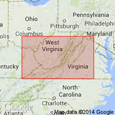
Pg. 548, 635-636, pl. 27. Copper Ridge chert. In Knox County, Tennessee, where the formation was first studied and from which it was named, the Knox consists mainly of a characteristically and profusely cherty middle division to which I am applying the name Copper Ridge chert. This is flanked above and beneath by much thinner and very sparingly cherty members, for which no names have been proposed. [Page 548.] [In chart, pl. 27, the subdivisions of the Knox in Knoxville trough are called Upper Knox, Copper Ridge, and Lower Knox.] Occassionally, as in River Ridge, 3 miles northwest of Morristown, Tennessee, the Copper Ridge chert rests on the Nolichucky. More commonly the Knox begins with an older division, 300 to 700 feet thick, while in vicinity of Montevallo, Alabama, three still older formations [Bibb, Ketona, and Brierfield], aggregating something near 2,500 feet of dolomite, intervene between base of typical Knox and top of the Conasauga. [Page 628.] Basal division of Knox dolomite (s.s.). –Rather generally in eastern Tennessee and southwestern Virginia grayish dolomite and limestone, practically free of chert, constitute lower part of Knox proper. So far as known, this lower division, which I formerly thought to represent the Ketona but now believe to be a younger and quite distinct formation, does not occur on western side of Murphrees Valley, Alabama, nor has it been recognized in Cahaba Valley. Even in Tennessee basin it varies considerably in thickness, possibly being absent altogether locally, as in River Ridge north of Norristown, while in other places it seems to exceed 600 or 700 feet. The latter figure is attained between Clinchport and Speers Ferry, Virginia. The formation, which for present remains unnamed, was recognized at Knoxville; hence it is a part of typical Knox dolomite of Safford. In Tennessee and southwestern Virginia, where the Brierfield, Ketona, and Potosi formations have not been detected, the Knox rests on upper Cambrian formations, either the Nolichucky or the Conasauga shale. When present the lower member of the Knox is readily distinguished by its more calcareous and much thicker beds. Most of its beds are magnesian, but few, if any, are dolomite. Many contain so little magnesia that they may justly be called limestone. The latter are fine-grained and not infrequently contain more or less shaly layers. Chert is very sparingly developed, not only in the unweathered rock but also in the residual clays of the surface. The practical absence or scarcity of chert and the presence of nearly pure and often shaly limestone distinguishes this lower member of the Knox from the profusely cherty main mass of the formation which overlies it and for which the name Copper Ridge chert is proposed. [Page 635.] Copper Ridge chert (new). –Of the three divisions commonly recognizable in the Knox, the highly cherty ridge-making middle division is most persistent and by far the greatest. This middle division, for which term Copper Ridge chert is here proposed, is readily distinguished from the lower and upper division by the hard white or gray chert which is developed by segregation and liberated under the slow process of subaerial decomposition of the dolomitic matrix. The resistant character and finally great abuncance of this chert almost invariably gives rise to broad and long ridges, among which that known as Copper Ridge, in northeastern Tennessee, is the excellent example chosen to supply the name and type of the member or formation. As a formation the Copper Ridge chert is best displayed, and probably also best developed, in middle and western parts of Appalachian Valley in Tennessee and Alabama. Here its average thickness is nearly 2,000 feet, and it rarely falls under 1,200 feet, except along the Rome barrier, where, as between Birmingham and Gadsden, it was greatly reduced locally by pre-Ordovician erosion. Maximum thickness observed is in Chestnut Ridge south of Sneedville, Tennessee. Here, deducting some 600 to 700 feet apparently repeated by faulting, an estimate based on dip and width of outcrop indicated a thickness of 2,800 +/- feet. Both the lower and upper members of the Knox are relatively thin in Chestnut Ridge, the former being 360 feet, the latter only 200+/- feet. [Pages 635-636.]
Source: US geologic names lexicon (USGS Bull. 896, p. 518-519).
- Usage in publication:
-
- Copper Ridge dolomite
- Modifications:
-
- Overview
- AAPG geologic province:
-
- Appalachian basin
Summary:
The Copper Ridge dolomite of the Knox group overlies the Nolichucky shale and extends upward to the Chepultepec limestone. Northwest of Greendale syncline, Washington Co., VA, the Copper Ridge and Beekmantown form continuous vertical mass 2400 feet thick with no recognizable break. Unit is equivalent to the Conococheague limestone.
Source: GNU records (USGS DDS-6; Reston GNULEX).
- Usage in publication:
-
- Copper Ridge dolomite*
- Modifications:
-
- Overview
- AAPG geologic province:
-
- Appalachian basin
Summary:
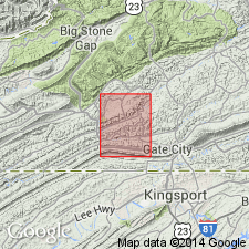
The Copper Ridge dolomite is the basal formation of the Knox group. In Lee Co., VA it underlies the Chepultepec dolomite and overlies the Chances Branch dolomite member of the Maynardville limestone. Thickness is 840 feet.
Source: GNU records (USGS DDS-6; Reston GNULEX).
- Usage in publication:
-
- Copper Ridge Dolomite
- Modifications:
-
- Areal extent
- Revised
- AAPG geologic province:
-
- Appalachian basin
Summary:
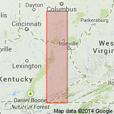
Geographically extended the Copper Ridge Dolomite to the subsurface of OH and revised it as part of the Lee Valley Group. Unit is divided into two informal members, a lower dark member and an upper light member. The lower dark member consists of mainly dark gray or brown, medium to coarsely crystalline, partly oolitic dolomite which is known as "stinkstone" because of its petroliferous odor when freshly broken. The basal part of the lower dark member includes interbeds of light gray, dense dolomite similar to the Maynardville Dolomite. The upper light member consists of white, light gray, or light brown, fine to coarsely crystalline, partly sandy, partly oolitic dolomite. Thickness of the Copper Ridge is 574 feet in OH with each member being of about equal thickness. The lower contact with the Maynardville Dolomite is arbitrarily defined as the horizon above which the dark brown "stinkstone" dolomite makes up more than 50 percent of the strata. The upper contact with the Chepultepec Dolomite is placed at the bottom of the lowest relatively thick sandstone bed which occurs below the conspicuous white, oolitic chert beds and above the commonly oolitic dolomite. The Copper Ridge is of Late Cambrian age.
Source: GNU records (USGS DDS-6; Reston GNULEX).
- Usage in publication:
-
- Copper Ridge formation
- Modifications:
-
- Revised
- AAPG geologic province:
-
- Appalachian basin
Summary:
Revised the Copper Ridge to the Copper Ridge formation in VA. Consists chiefly of dark dolomite in the lower part and light gray dolomite in the upper part. The base of the unit is gradational with the Chances Branch member of the Maynardville formation and contains different amounts of light gray fine-grained dolomite. Sand grains occur as scattered grains in dolomite and chert, and as thin sandstone lenses. Chert is most abundant in upper half of the formation. The top of the Copper Ridge is placed at the base of the first prominent thick sandstone above which sandstones are common in the overlying Chepultepec formation. Thickness of the Copper Ridge is 500 to 600 feet.
Source: GNU records (USGS DDS-6; Reston GNULEX).
- Usage in publication:
-
- Copper Ridge Dolomite
- Modifications:
-
- Areal extent
- AAPG geologic province:
-
- Appalachian basin
Summary:
Geographically extended the Copper Ridge Dolomite to the subsurface of WV. Columnar section for northeastern WV (Pendleton Co.) shows the Copper Ridge Dolomite overlying the Elbrook Formation and underlying the Beekmantown Dolomite. Thickness is 1850 feet.
Source: GNU records (USGS DDS-6; Reston GNULEX).
- Usage in publication:
-
- Copper Ridge Dolomite*
- Modifications:
-
- Areal extent
- AAPG geologic province:
-
- Appalachian basin
Summary:
Geographically extended the Copper Ridge Dolomite of the Knox Group to the subsurface of KY. Unit contains chert in lower part and upper part. Overlies the Maynardsville [sic] Limestone and underlies the Chepultepec Dolomite of the Knox Group.
Source: GNU records (USGS DDS-6; Reston GNULEX).
- Usage in publication:
-
- Copper Ridge Group
- Modifications:
-
- Revised
- AAPG geologic province:
-
- Appalachian basin
Summary:
Raised the Copper Ridge to the Copper Ridge Group of the Knox Supergroup in KY. The base of the Copper Ridge Group is placed at the contact between the dolomite and the underlying limestone and shale of the Conasauga Group. The top of the group is placed at the base of the sandstones of the Rose Run Formation; sandy dolomite beds are included in the Copper Ridge. The Copper Ridge Group is not divided into formations in this report.
Source: GNU records (USGS DDS-6; Reston GNULEX).
- Usage in publication:
-
- Copper Ridge Dolomite
- Modifications:
-
- Revised
- AAPG geologic province:
-
- Appalachian basin
Summary:
Revised the Copper Ridge Dolomite to be included in the Conasauga Group as the top formation of the group. Consists of light to dark gray, and brownish gray, finely crystalline to very fine-grained dolostone with silicified algal zones in the lower part, and light to dark gray, medium- to fine-grained dolostone with oolitic, cherty, and sandy zones in the upper part. Thickness is 630 feet. Overlies the Chances Branch Dolomite Member of the Maynardville Formation of the Conasauga Group and underlies the Chepultepec Dolomite of the Knox Group. The Copper Ridge is of Late Cambrian age.
Source: GNU records (USGS DDS-6; Reston GNULEX).
- Usage in publication:
-
- Copper Ridge Dolomite
- Modifications:
-
- Revised
- Areal extent
- AAPG geologic province:
-
- Appalachian basin
Summary:
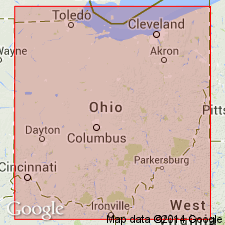
The Copper Ridge Dolomite of the Lee Valley Group (Knox Supergroup) is here divided into three members in the subsurface of northern OH. The formally named Steam Corners Member lies between the informal Upper and Lower Copper Ridge Dolomites and is described as a series of glauconitic quartzose dolomites and a basal sandstone, referred to as the Krysik sandstone facies. It is characterized on geophysical logs by a high gamma ray signature and a medium to high neutron response. It has been referred to previously as the "B" Zone (Calvert, 1962).
Source: GNU records (USGS DDS-6; Reston GNULEX).

- Usage in publication:
-
- Copper Ridge Dolomite
- Modifications:
-
- Overview
- AAPG geologic province:
-
- Appalachian basin
Summary:
The Copper Ridge Dolomite of the Knox Group in AL consists of light gray, thick-bedded, medium to coarsely crystalline, siliceous dolomite with dense, tough, hard, generally white or yellowish gray, stromatolitic chert. Unit outcrops in the Valley and Ridge province, but may also be present in the subsurface of the Plateau region. Thickness ranges from 1250 to 1800 feet. The Copper Ridge is of Late Cambrian (Franconian and Trempealeauan) age.
Source: GNU records (USGS DDS-6; Reston GNULEX).
- Usage in publication:
-
- Copper Ridge Dolomite
- Modifications:
-
- Areal extent
- AAPG geologic province:
-
- Appalachian basin
Summary:
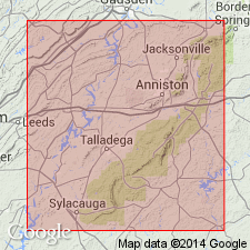
Although Butts (1926) suggested that the Knox Group in this area [Talladega and Calhoun Cos, AL] included Copper Ridge and Chepultepec Dolomites, criteria used to define these units in adjacent areas cannot be applied. Therefore, this nomenclature should not be used in report area.
Source: GNU records (USGS DDS-6; Reston GNULEX).
- Usage in publication:
-
- Copper Ridge Dolostone
- Modifications:
-
- Areal extent
- AAPG geologic province:
-
- Warrior basin
Summary:
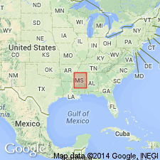
Geographically extended the Copper Ridge Dolostone of the Knox Group into the subsurface of MS. Thickness is 795 to 3200 feet. Overlies the Conasauga Limestone and underlies the Knox Dolostone of the Knox Group [in violation of North American Stratigraphic Code]. The Copper Ridge is of Late Cambrian age.
Source: GNU records (USGS DDS-6; Reston GNULEX).
- Usage in publication:
-
- Copper Ridge Dolomite
- Modifications:
-
- Overview
- AAPG geologic province:
-
- Black Warrior basin
Summary:
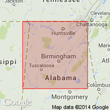
Copper Ridge Dolomite of Knox Group in the subsurface of northwestern AL may be divided into two gross lithologic units or members. In the ARCO Anschutz Alabama Properties No. 1 wildcat well in Shelby Co., AL, the upper member is 550 ft thick and is primarily a light-colored finely to coarsely crystalline cherty dolomite with algal laminations in beds of chert. The lower member here is 535 ft thick. Upper part of lower member is light-gray to brownish-black, finely to coarsely crystalline, oolitic cherty dolomite, while the lower part of this member is light- to dark-gray to brownish-gray cherty dolomite. Copper Ridge Dolomite cored in southern Greene Co. yielded total thickness of 2,580 ft. Underlies Chepultepec Dolomite and overlies Ketona Dolomite.
Source: GNU records (USGS DDS-6; Reston GNULEX).
- Usage in publication:
-
- Copper Ridge Dolomite*
- Modifications:
-
- Revised
- Age modified
- AAPG geologic province:
-
- Appalachian basin
Summary:
Revised the Copper Ridge Dolomite of the Knox Group in subsurface of central-western VA in section F-F' to include the lower part of what is generally called Chepultepec Dolomite. The Chepultepec is not recognized in this area because the upper dolomites of that unit cannot be distinguished from the remainder of the upper part of the Knox Group. By including the sandstone and dolomite of the interval equivalent to the Chepultepec, the Copper Ridge is of Late Cambrian and Early Ordovician(?) age in this area.
Source: GNU records (USGS DDS-6; Reston GNULEX).
For more information, please contact Nancy Stamm, Geologic Names Committee Secretary.
Asterisk (*) indicates published by U.S. Geological Survey authors.
"No current usage" (†) implies that a name has been abandoned or has fallen into disuse. Former usage and, if known, replacement name given in parentheses ( ).
Slash (/) indicates name conflicts with nomenclatural guidelines (CSN, 1933; ACSN, 1961, 1970; NACSN, 1983, 2005, 2021). May be explained within brackets ([ ]).