- Usage in publication:
-
- Concord Granite*
- Modifications:
-
- Geochronologic dating
- Age modified
- AAPG geologic province:
-
- New England province
Summary:
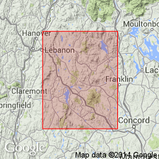
Rb-Sr whole-rock isochrons for the four main subdivisions of the New Hampshire Plutonic Series yield the following ages: Concord Granite, 359+/-11 m.y. (or 330+/-3 m.y.?); Spaulding Quartz Diorite, 402+/-5 m.y.; Bethlehem Gneiss, 405+/-78 m.y.; Kinsman Quartz Monzonite, 411+/-19 m.y. Concord Granite is at least 40 m.y. younger than other members of the New Hampshire Plutonic Series, making its time of emplacement Late Devonian(?) or Mississippian(?). However, there is enough doubt as to the absolute time scale for the Devonian that the use of Early, Middle, or Late Devonian is not yet warranted. [GNU records indicate an approved age of Middle(?) and Late(?) Devonian for Concord Granite.]
Source: GNU records (USGS DDS-6; Reston GNULEX).

- Usage in publication:
-
- Concord Granite*
- Modifications:
-
- Geochronologic dating
- AAPG geologic province:
-
- New England province
Summary:
Pg. 24, geologic time scale (inside front cover). Concord Granite. Sample from quarry at Concord, Lat. 43 deg. 13 min. 00 sec. N., Long. 71 deg. 33 min. 30 sec., W., Concord quadrangle, Merrimack County, New Hampshire, yielded a Pb-alpha ages of 370 +/-40 Ma (zircon) and 350 +/-40 Ma (monazite) [Devonian]. Ages calculated using decay constants of Steiger and Jager, 1977 (Earth Planet. Sci. Letters, v. 36, p. 359-362).
Source: Publication.

- Usage in publication:
-
- Concord Granite*
- Modifications:
-
- Overview
- Age modified
- Geochronologic dating
- AAPG geologic province:
-
- New England province
Summary:
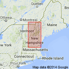
Used as Concord Granite of New Hampshire Plutonic Suite. Consists of gray, two-mica granite, locally grading to tonalite. Age changed from Middle(?) and Late(?) Devonian of previous workers to Late Devonian based on isotope ages of 365 +/-20 Ma by U/Pb method (J.N. Aleinikoff, oral commun., 1986), and 375 +/-? Ma by U/Pb methods on monazite from pegmatite in Concord Granite (Eusden and Barreiro, 1988). Report includes geologic map and correlation chart, and 1:500,000-scale map showing plutons and sample localities for age dating.
Source: GNU records (USGS DDS-6; Reston GNULEX).
For more information, please contact Nancy Stamm, Geologic Names Committee Secretary.
Asterisk (*) indicates published by U.S. Geological Survey authors.
"No current usage" (†) implies that a name has been abandoned or has fallen into disuse. Former usage and, if known, replacement name given in parentheses ( ).
Slash (/) indicates name conflicts with nomenclatural guidelines (CSN, 1933; ACSN, 1961, 1970; NACSN, 1983, 2005, 2021). May be explained within brackets ([ ]).

