

- Usage in publication:
-
- Chase formation
- Modifications:
-
- Original reference
- Dominant lithology:
-
- Limestone
- Shale
- Flint
- AAPG geologic province:
-
- Nemaha anticline
- Sedgwick basin
Summary:
Pg. 771-786. Chase formation. Massive limestones and flints separated by varicolored shales; 265 feet thick. Includes (ascending) Strong flint, Florence flint, Florence limestone [Fort Riley limestone], Marion flint, and Marion concretionary limestone. Overlies Neosho formation; underlies Marion formation. Fossiliferous (brachiopods, lamellibranchs). Age is Permian.
Named for Chase Co., KS. Forms region known as "Flint Hills." Covers greater part of western half of Chase County and is well exposed in bluffs along Cottonwood River and its tributaries.
See "Modern classifications of the Permian rocks of Kansas and Nebraska," compiled by M.G. Wilmarth, Secretary of Committee on Geologic Names, USGS unpub. corr. Chart, Oct. 1936, 1 sheet.
Source: US geologic names lexicon (USGS Bull. 896, p. 403); supplemental information from GNU records (USGS DDS-6; Denver GNULEX).

- Usage in publication:
-
- Chase limestones
- Modifications:
-
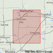
- Areal extent
- AAPG geologic province:
-
- Nemaha anticline
- Forest City basin
Summary:
In Osage, Cowley, and Butler Counties, Kansas, Chase limestones are included in upper part of Flint Hills division of Big Blue series. Overlie Neosho shales, in lower part of Flint Hills division; underlie Geuda salt-measures in Sumner division of Big Blue series. Age is Permian.
Source: Modified from GNU records (USGS DDS-6; Denver GNULEX).
- Usage in publication:
-
- Chase stage
- Modifications:
-
- Revised
- AAPG geologic province:
-
- Sedgwick basin
- Nemaha anticline
Summary:
Chase stage. Includes (descending) Winfield formation, Doyle shale, Fort Riley limestone redefined, Florence flint, Matfield shale, and Wreford limestone. Below Sumner stage and above Council Grove stage. Age is late Paleozoic [Permian].
Source: GNC KS-NE Permian Corr. Chart, Oct. 1936.

- Usage in publication:
-
- Chase group
- Modifications:
-
- Revised
- AAPG geologic province:
-
- Nemaha anticline
- Sedgwick basin
- Chautauqua platform
- Forest City basin
Summary:
Chase group. Includes (descending): Winfield, Doyle, Barneston, Matfield, and Wreford formations. Overlies Council Grove group and underlies Sumner group. Recognized in southeastern Nebraska, eastern Kansas, and northeastern Oklahoma. Age is Permian (Big Blue).
Source: GNC KS-NE Permian Corr. Chart, Oct. 1936.

- Usage in publication:
-
- Chase group*
- Modifications:
-
- Overview
Summary:
Chase adopted [ca. 1902] as group term, to include the following formations (descending): Winfield limestone, Doyle shale, Fort Riley limestone, Florence flint, Matfield shale, and Wreford limestone. This definition has been followed for many years by both Kansas Geol. Survey and USGS. In Sept. 1936, however, R.C. Moore (Kansas Geol. Soc. 10th Ann. Field Conf. Gdbk., p. 12) shifted the upper boundary to top of Luta limestone, which he treated as top member of Winfield limestone. This change has not yet [ca. 1938] been considered by USGS for its publications.
Source: US geologic names lexicon (USGS Bull. 896, p. 403).
- Usage in publication:
-
- Chase group*
- Modifications:
-
- Revised
Summary:
Pg. 68-71; R.C. Moore and others, 1951, Kansas Geol. Survey Bull., no. 89, p. 41-45. Chase group. Stratigraphically expanded upward to include the Odell and Nolans formation; that is, the upper boundary is at top of Herington limestone member of Nolans limestone. As redefined, includes (ascending) Wreford limestone, Matfield shale, Barneston limestone, Doyle shale, Winfield limestone, Odell shale, and Nolans limestone. Underlies Wellington formation of Sumner group (Leonard series); overlies Speiser shale of Council Grove group (Wolfcamp series). Thickness in Kansas about 335 feet. Age is Permian.
Source: US geologic names lexicon (USGS Bull. 1200, p. 727).

- Usage in publication:
-
- Chase group*
- Modifications:
-
- Areal extent
- AAPG geologic province:
-
- Anadarko basin
Summary:
Chase group (undivided). Extended into the subsurface of Baca County, Colorado. Overlies Council Grove group (undivided) and underlies Sumner group (undivided). Report includes correlation chart.
Source: Modified from GNU records (USGS DDS-6; Denver GNULEX).
- Usage in publication:
-
- Chase group*
- Modifications:
-
- Mapped 1:500k
Summary:
Chase group. In Oklahoma, Herington limestone and Fort Riley limestone are only units of group mapped. Age is Permian.
Source: US geologic names lexicon (USGS Bull. 1200, p. 727).
- Usage in publication:
-
- Chase group*
- Modifications:
-
- Areal extent
Summary:
Pg. 73 (table 3), 105-119. Chase group. As presently defined, group includes beds from base of Wreford limestone upward to top of Nolans (Herington) limestone. In southern Kansas and northern Oklahoma, group consists of over 340 feet of red and green shales and persistent chert-bearing limestones. Southward, limestones thin and chert content diminishes abruptly. In Pawnee County, includes (ascending) Wreford limestone, Matfield shale, Fort Riley limestone, Doyle shale, and Winfield limestone. Wolfcamp series. South of Pawnee County, rocks of group grade laterally into Asher formation of central Oklahoma.
Source: US geologic names lexicon (USGS Bull. 1200, p. 727).
- Usage in publication:
-
- Chase group
- Modifications:
-
- Revised
Summary:
Suggest that term Lyon series be used for Permian rocks in Kansas, Oklahoma, and Nebraska. Series would comprise Admire, Council Grove, and Chase groups.
Source: US geologic names lexicon (USGS Bull. 1200, p. 727).
- Usage in publication:
-
- Chase Group
- Modifications:
-
- Not used
- AAPG geologic province:
-
- Chautauqua platform
Summary:
Oscar and Vanoss Groups are preferred name of the Oklahoma Geol. Survey rather than Kansas name Chase. [See entries under Oscar and Vanoss.]
Source: Publication.
For more information, please contact Nancy Stamm, Geologic Names Committee Secretary.
Asterisk (*) indicates published by U.S. Geological Survey authors.
"No current usage" (†) implies that a name has been abandoned or has fallen into disuse. Former usage and, if known, replacement name given in parentheses ( ).
Slash (/) indicates name conflicts with nomenclatural guidelines (CSN, 1933; ACSN, 1961, 1970; NACSN, 1983, 2005, 2021). May be explained within brackets ([ ]).