

- Usage in publication:
-
- Capefear formation
- Modifications:
-
- Original reference
- Dominant lithology:
-
- Sand
- Clay
- AAPG geologic province:
-
- Atlantic Coast basin
Summary:
Pg. 93-99. Capefear formation. Arkosic and micaceous sands and clays and various intergradations of arenaceous clays and argillaceous sands. Beds range in thickness from a few feet to 10 or 12 feet. Name used tentatively, since future investigations may prove equivalency with established formations elsewhere. [See also Wilmarth (1938) remarks.] Believed to be approximately synchronous with Patuxent division of Potomac series of Maryland and Virginia, although it may include a portion of the Potomac younger than the Patuxent. Thickness 300 feet. Unconformably underlies Bladen [Black Creek] formation. [Age is Late Cretaceous.]
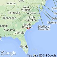
[Named from exposures on Cape Fear River, coastal plain of NC.]
Source: US geologic names lexicon (USGS Bull. 896, p. 341).

- Usage in publication:
-
- Cape Fear formation†
- Modifications:
-
- Abandoned
- AAPG geologic province:
-
- Atlantic Coast basin
Summary:
By 1910 the equivalency of the †Cape Fear formation with the Lower Cretaceous Patuxent formation was believed to have been established, and the local name "Cape Fear" was dropped. Further work, however, furnished satisfactory proof that the deposits are chiefly if not wholly of Late Cretaceous age, and that if they contain any representative of Patuxent formation it must be in their lower part. (See C.W. Cooke, USGS Prof. Paper 140-F, p. 138-139, 1926.) Additional work established fact that these deposits are chiefly if not wholly the northward extension of the Tuscaloosa formation, and they are now called by that name, although some beds of Early Cretaceous age may be included; but if present they will hereafter be excluded. (See C.W. Cooke, USGS Bull. 867, 1936.)
Source: US geologic names lexicon (USGS Bull. 896, p. 341).

- Usage in publication:
-
- Cape Fear formation
- Modifications:
-
- Age modified
- AAPG geologic province:
-
- Atlantic Coast basin
Summary:
Chart 1. Cape Fear formation. Age shown on correlation chart as [Early] Cretaceous.
Source: US geologic names lexicon (USGS Bull. 1200, p. 621).
- Usage in publication:
-
- Cape Fear formation
- Modifications:
-
- Areal extent
- AAPG geologic province:
-
- Atlantic Coast basin
Summary:
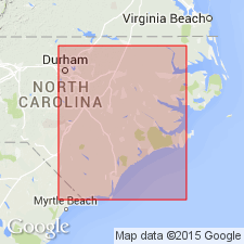
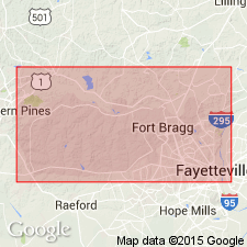
Pg. 1-2, 5-6, 16-18. Cape Fear formation. Outcrop relationships of Cape Fear, Middendorf, and Bladen units are open to several interpretations. View that Middendorf represents an updip portion of Bladen member of Black Creek seems preferable. Bladen rests on Cape Fear formation in downdip exposures, and Middendorf rests on Cape Fear in updip exposures in Fort Bragg. Age is Early(?) Cretaceous.
Source: US geologic names lexicon (USGS Bull. 1200, p. 621).
- Usage in publication:
-
- Cape Fear Formation*
- Modifications:
-
- Reinstated
- AAPG geologic province:
-
- Atlantic Coast basin
Summary:
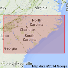
Cape Fear Formation is reinstated in NC and geographically extended into eastern SC. Overlies Piedmont complex, underlies Black Creek Formation toward the coastal areas and the Middendorf Formation in the updip areas. Its rocks were formerly assigned to the Tuscaloosa Formation, and it therefore follows that the Tuscaloosa is no longer used in the Carolinas. Age is Late Cretaceous (pre-late Austinian).
Source: GNU records (USGS DDS-6; Reston GNULEX).
- Usage in publication:
-
- Cape Fear Formation
- Modifications:
-
- Areal extent
- AAPG geologic province:
-
- Atlantic Coast basin
Summary:
Cretaceous section in the subsurface at the Savannah River site is divided into (ascending) Cape Fear, Middendorf, Black Creek, and Steel Creek (new) Formations. The Cape Fear is composed of gray, yellow, orange, red brown, tan, and blue poorly sorted, silty to clayey quartz sands and interbedded clays. Sands are commonly medium and coarse, arkosic in places with pebbly zones present in many parts of the section. Bedding thickness varies from 5 to 20 ft. Correlated with the type Cape Fear Formation in southeastern NC on the basis of lithology and fossils. About 30 ft thick at the northwestern boundary of the study area and thickens to about 200 ft near the southeastern boundary. Overlies rocks of the Triassic Newark Supergroup in the southeastern part of the area. Sediments deposited in fluvial and delta plain environments. Appears to correlate with the lower part of the Eutaw Formation of AL. Age suggested from plant fragments, spores, and pollen assemblages is Santonian.
Source: GNU records (USGS DDS-6; Reston GNULEX).
- Usage in publication:
-
- Cape Fear Formation*
- Modifications:
-
- Revised
- Age modified
- Biostratigraphic dating
- AAPG geologic province:
-
- Atlantic Coast basin
Summary:
Pg. 11 (fig. 8), 12-13, 15, 31 (fig. 22), 32-33. Cape Fear Formation. Occurs in subsurface between 1,861 and 2,338 feet in Clubhouse Crossroads No. 1 drill core, near Clubhouse Crossroads, Dorchester County, southeastern South Carolina. Sediments previously included in the Middendorf and upper part of Cape Fear by Hazel and others (1977) and Gohn and others (1977). Consists mostly of alternating coarse feldspathic sands and reddish clays. As revised, is lithologically similar to outcropping Cape Fear. Thickness 477 feet. Fossils. Age is Late Cretaceous (Turonian?, Coniacian?, and early Santonian; late Eaglefordian? and Austinian Provincial Age; MARGINOTUNCANA SIGALI? to DICARINELLA CONCAVATA planktic foram zone, EIFFELLITHUS EXIMIUS? to CALCULITES OBSCURUS (NC14? to NC17) calcareous nannofossil zone).
The sediments previously assigned to Cape Fear Formation (2,268 to 2,462 feet) by Hazel and others (1977) and Gohn and others (1977) are reallocated to (descending) lower part of Cape Fear Formation (2,268 to 2,338 feet), Clubhouse Formation (new; 2,338 to 2,417 feet), and Beech Hill Formation (new; 2,417 to 2,464 feet).
Source: Publication.
For more information, please contact Nancy Stamm, Geologic Names Committee Secretary.
Asterisk (*) indicates published by U.S. Geological Survey authors.
"No current usage" (†) implies that a name has been abandoned or has fallen into disuse. Former usage and, if known, replacement name given in parentheses ( ).
Slash (/) indicates name conflicts with nomenclatural guidelines (CSN, 1933; ACSN, 1961, 1970; NACSN, 1983, 2005, 2021). May be explained within brackets ([ ]).