

- Usage in publication:
-
- Canajoharie shale
- Modifications:
-
- Named
- Dominant lithology:
-
- Shale
- AAPG geologic province:
-
- Appalachian basin
Summary:
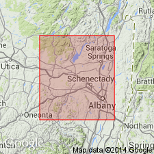
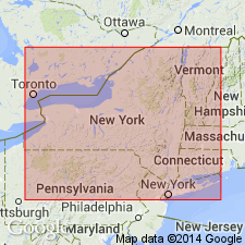
In the investigation of Frankfort and Utica beds of Mohawk Valley, it was found that Utica and Frankfort stages consist of two divisions. Lower division of Utica contains fauna that allows correlation with Martinsburg shale; division is therefore of upper Trenton age. Because of this, the lower part is separated from typical Utica stage and is named Canajoharie shale. Occurs along Hudson River and in Albany and Saratoga Cos. Thins out westward, doesn't reach meridian of Utica.
Source: GNU records (USGS DDS-6; Reston GNULEX).
- Usage in publication:
-
- Canajoharie shale
- Modifications:
-
- Overview
- AAPG geologic province:
-
- Appalachian basin
Summary:
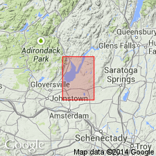
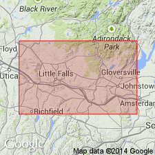
All black shale of the lower Mohawk valley region is considered Canajoharie shale (based on unpublished work by R. Ruedemann). In Broadalbin quad, it overlies Lower Trenton limestone. Consists of dark-gray to black, fine-grained, thin- and straight-bedded shales, rather calcareous toward base. Dark color is due to finely divided and partially decomposed organic matter. Extends from North Broadalbin westward to Munsonville and south to map corner; represents great shale area around Amsterdam and Gloversville. South of Vail Mills and in vicinity of Munsonville, outcrops are obscured by glacial drift, but presence of shale is indicated by numerous shale fragments in drift. Good exposures found in creek just east of Maysville station; on Kenyetto Creek 1 mi west, 1 mi northwest, and 2 mi north of Broadalbin; 3 mi west-southwest of Broadalbin; at lower road crossing on Beaver Creek; and in creek just west of North Broadalbin. Canajoharie and Trenton are almost in contact 1 mi south of North Broadalbin, but exposures are poor. Thickness cannot be determined because no complete section can be seen. Graptolites are common near base, especially along creek just east of Maysville station.
Source: GNU records (USGS DDS-6; Reston GNULEX).
- Usage in publication:
-
- Canajoharie shale
- Modifications:
-
- Age modified
- Biostratigraphic dating
- AAPG geologic province:
-
- Appalachian basin
Summary:
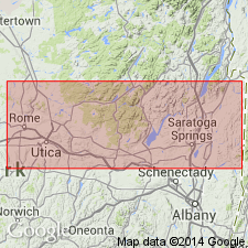
Characterized by CORYNOIDES CALICULARIS, DIPLOGRAPTUS AMPLEXICAULIS, DIPLOGR. (MESOGR.) MOHAWKENSIS, GLOSSOGRAPTUS QUADRIMUCRONATUS var. CORNUTUS, PTERINEA (PROLOBELLA) TRENTONENSIS, P. INSUETA, ULRICHIA? BIVERTEX, and PRIMITIELLA UNICORNIS. All are unknown in Utica shale. Canajoharie contains other fossils that occur rarely, but become more dominant in Utica. Brachiopods such as LEPTOBOLUS INSIGNIS and LINGULA CURTA are common to both formations. This evidence means that Canajoharie is older than true Utica and is partly of Trenton age. Fossils of underlying Trenton and transition shale are basal Trenton only. Lower Trenton, characterized by a PRASOPORA SIMULATRIX zone and its base by NEMATOPORA beds, is apparently, at Canajoharie, merged into Canajoharie formation; horizon of PRASOPORA SIMULATRIX is high in Canajoharie beds. Canajoharie formation corresponds roughly to lower and possibly middle Trenton age at Trenton Falls. Disappears westward; eastward is cut off by Hoffmans Ferry fault, but reappears north of Schenectady from under Schenectady beds and eastward in folded shales of Hudson valley in Rural Cemetery beds. This belt can be followed through Saratoga Co. to Hudson Falls where it rests on Glens Falls limestone of basal Trenton age.
Source: GNU records (USGS DDS-6; Reston GNULEX).
- Usage in publication:
-
- Canajoharie shale
- Modifications:
-
- Revised
- Overview
- Biostratigraphic dating
- AAPG geologic province:
-
- Appalachian basin
Summary:
Includes older shales of the Mohawk valley of Trenton age. Overlies Shoreham limestone; overlain by subdivisions of Utica shale (Nowadaga and Loyal Creek). Type section designated along Canajoharie Creek and along Flat Creek at Sprakers, the two parts being 4 mi apart. Is divided into the lower Minaville member and the upper Fairfield member. Members are lithologically similar, but can be differentiated by fauna. Minaville includes lowest two of Ruedemann's (1921) five zones, MESOGRAPTUS MOHAWKENSIS (Ruedemann), and DIPLOGRAPTUS AMPLEXICAULIS (Hall) and is composed mainly of block [black?] shales, somewhat silty in upper part, and containing a few metabentonites. Thickness of Minaville is about 750 ft. Fairfield includes upper three of Ruedemann's (1921) zones, GLOSSOGRAPTUS CORNUTUS (Ruedemann), LASIOGRAPTUS EUCHARIS (Hall), and CLIMACOGRAPTUS SPINIFERUS (Ruedemann), and consists of interbedded black shales and gray-weathering silty shales, and metabentonites. Thickness of Fairfield is at least 275 ft and possibly as great as 400 ft. Canajoharie shale thickens eastward; Snake Hill formation probably represents a sandy facies of Canajoharie and consists of initial deposits of clastic rocks resulting from Vermontian (middle Trenton) Orogeny; upper part of Schenectady formation contains characteristic Fairfield graptolites.
Source: GNU records (USGS DDS-6; Reston GNULEX).
- Usage in publication:
-
- Canajoharie Shale
- Modifications:
-
- Age modified
- Revised
- AAPG geologic province:
-
- Appalachian basin
Summary:
Age of Canajoharie Shale is Middle Ordovician. Is assigned to Trenton Group.
Source: GNU records (USGS DDS-6; Reston GNULEX).

- Usage in publication:
-
- Canajoharie Shale
- Modifications:
-
- Not used
- AAPG geologic province:
-
- Appalachian basin
Summary:
Name is used in quotes on chart (column 5) in this report. The name Utica Shale has priority for black shale of Mohawk Valley.
Source: GNU records (USGS DDS-6; Reston GNULEX).
- Usage in publication:
-
- Canajoharie Shale
- Modifications:
-
- Overview
- AAPG geologic province:
-
- Appalachian basin
Summary:
Middle Ordovician Canajoharie Shale is one of several black shales in a belt of autochthonous Paleozoic rocks (exclusive of the Taconic sequence) that occupies the Champlain, Hudson, and Mohawk valleys. The black shales also include Hortonville Slate, Snake Hill Formation, or Normanskill Shale; these are all correlative with each other.
Source: GNU records (USGS DDS-6; Reston GNULEX).

- Usage in publication:
-
- Canajoharie Shale†
- Modifications:
-
- Abandoned
- AAPG geologic province:
-
- Appalachian basin
Summary:
In the Roster of Pre-Silurian Stratigraphic Names in this report, the name Canajoharie Shale is rejected and recommended for abandonment. Lithologically, it is no different from Utica Shale except that its lower portion is slightly calcareous. Top is lithologically indefinable within Utica. Can be recognized by different graptolites, but has no status as a rock-stratigraphic unit. There is merit, however, in using the name Canajoharie as a stage term to emphasize that the eastern part of Utica is older than the western part. Accordingly, Canajoharie Stage includes graptolite zone of CORYNOIDES AMERICANUS (older) and ORTHOGRAPTUS RUEDEMANNI (younger)--an interval very close to Ruedemann's original definition of Canajoharie shale. [Clarke, not Ruedemann, named the Canajoharie, although this was probably based on Ruedemann's research.]
Source: GNU records (USGS DDS-6; Reston GNULEX).

- Usage in publication:
-
- Canajoharie Shale*
- Modifications:
-
- Areal extent
- AAPG geologic province:
-
- Appalachian basin
Summary:
Paleozoic cover sequence adjacent to Adirondack massif in western part of Glens Falls quad consists of (ascending): Late Cambrian Potsdam Sandstone, Late Cambrian Ticonderoga Formation, Late Cambrian and Early Ordovician Beekmantown Group (with Whitehall Formation at base), early Middle Ordovician Chazy Group, Middle Ordovician Black River and Trenton Groups, and Mohawk Valley shales (Canajoharie Shale and Snake Hill Formation). Potsdam and Ticonderoga are partly correlative with Danby Formation of Middlebury synclinorium in VT. Beekmantown and part of Chazy correlate directly with limestones and dolomites above Danby. Paleozoic cover sequence is interpreted as a platform sequence. [Text states Beekmantown "as used by Fisher (1984)", but this appears to be an error because Fisher (1984) included Potsdam and Ticonderoga in his Beekmantown. Fisher (1977) abandoned Canajoharie, but USGS still recognizes it.]
Source: GNU records (USGS DDS-6; Reston GNULEX).
- Usage in publication:
-
- Canajoharie
- Modifications:
-
- Not used
- AAPG geologic province:
-
- Appalachian basin
Summary:
The Utica Shale is divided in the Mohawk Valley into upper and lower parts by a tongue of the Dolgeville Formation and these parts are here assigned member names. The lower portion of the Utica is named the Flat Creek Member and the upper, the Indian Castle Member. These lithostratigraphic units replace earlier names such as the Canajoharie Shale, which are primarily biostratigraphic, and were abandoned by Fisher (1977).
Source: GNU records (USGS DDS-6; Reston GNULEX).
For more information, please contact Nancy Stamm, Geologic Names Committee Secretary.
Asterisk (*) indicates published by U.S. Geological Survey authors.
"No current usage" (†) implies that a name has been abandoned or has fallen into disuse. Former usage and, if known, replacement name given in parentheses ( ).
Slash (/) indicates name conflicts with nomenclatural guidelines (CSN, 1933; ACSN, 1961, 1970; NACSN, 1983, 2005, 2021). May be explained within brackets ([ ]).