

- Usage in publication:
-
- Brannon bed
- Modifications:
-
- Original reference
- Dominant lithology:
-
- Chert
- AAPG geologic province:
-
- Cincinnati arch
Summary:
Pg. 324. Brannon bed. Siliceous limestone, 15 feet thick, which weathers to chert. Is weathered phase of lower part of Flanagan chert of Campbell; upper part is bouldery. Extends south of Kentucky River. Overlies Bigby formation and underlies Woodburn bed of Flanagan member of Lexington limestone.
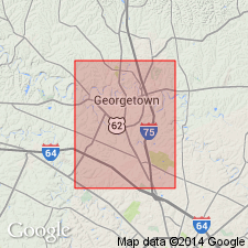
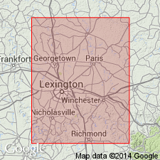
Named from exposures at Brannon Station [on the Q & C RR, Nicholasville 7.5-min quadrangle], Jessamine Co., north-central KY.
[Adopted by the USGS as Brannon cherty member of Flanagan limestone. Age is Middle Ordovician.]
Source: US geologic names lexicon (USGS Bull. 896, p. 253).
- Usage in publication:
-
- Brannon limestone
- Modifications:
-
- Revised
- AAPG geologic province:
-
- Cincinnati arch
Summary:
Pg. 41 (fig. 2), 42. Referred to as Brannon limestone; consists of finely crystalline siliceous limestone which weathers to a very cherty residue. Thickness about 15 feet. Overlies Benson limestone; underlies Woodburn limestone. [Age is Middle Ordovician.]
Source: US geologic names lexicon (USGS Bull. 1200, p. 455).
- Usage in publication:
-
- Brannon limestone [unranked]
- Modifications:
-
- Revised
- AAPG geologic province:
-
- Cincinnati arch
Summary:
Pg. 1636-1637. Brannon limestone [unranked] in Lexington limestone. Forms middle part of Lexington limestone. Fine-grained siliceous gnarly limestone with much shale in lower part. On weathering, gives rise to conspicuous zone of chert drift and forms greater part of Campbell's ( 1898) Flanagan chert. Thickness 15 to 20 feet; in some places 30 feet. Includes Woodburn phosphatic member. On the north in Bourbon, Harrison, Franklin, and Fayette Counties, the Brannon fades in a short distance as a useful lithologic unit. Woodburn also thins. Recognition of these beds becomes difficult as Brannon wedges out (lithologic change), but horizon is still well marked wherever STROMATOCERIUM and its associates of upper Benson are presented. Age is Middle Ordovician (pre-Cincinnatian).
Source: US geologic names lexicon (USGS Bull. 1200, p. 455).
- Usage in publication:
-
- Brannon limestone member*
- Modifications:
-
- Revised
- AAPG geologic province:
-
- Cincinnati arch
Summary:
Pg. 18. Brannon limestone member of Cynthiana formation. All subdivisions of interval between top of Benson limestone and base of Eden formation should be referred to as members of the Cynthiana. This includes lithologic and paleontologic units heretofore defined as Brannon, Woodburn, Greendale, Millersburg, Nicholas, Rogers Gap, Bromley, and Gratz. [Adopted by the USGS. Age is Middle Ordovician.]
Source: US geologic names lexicon (USGS Bull. 1200, p. 455).
- Usage in publication:
-
- Brannon Member*
- Modifications:
-
- Revised
- AAPG geologic province:
-
- Cincinnati arch
Summary:
Brannon Limestone Member of the Cynthiana Formation changed to Brannon Member of Lexington Limestone.
Source: GNU records (USGS DDS-6; Reston GNULEX).

- Usage in publication:
-
- Brannon Member*
- Modifications:
-
- Areal extent
- AAPG geologic province:
-
- Cincinnati arch
Summary:
The Brannon Member of the Lexington Limestone consists of interbedded medium to light gray, tabular bedded calcisiltite and medium to dark gray, calcareous shale. Unit is generally unfossiliferous, but a few brachiopods are present. In the southern outcrop area, unit overlies the Perryville Limestone Member and underlies the Sulphur Well Member, both of the Lexington Limestone. Toward the central area of KY, the Brannon intertongues with the Tanglewood Limestone Member of the Lexington, and further north in the central area, it overlies the Grier Limestone Member and underlies the Tanglewood Limestone Member. The environment of deposition is interpreted to be deeper quiet water, below wave base.
Source: GNU records (USGS DDS-6; Reston GNULEX).

- Usage in publication:
-
- Brannon Member*
- Modifications:
-
- Age modified
- AAPG geologic province:
-
- Cincinnati arch
Summary:
Brannon Member of Lexington Limestone is Champlainian (Shermanian) in age.
Source: GNU records (USGS DDS-6; Reston GNULEX).
- Usage in publication:
-
- Brannon Member*
GNC Staff, 2012, [U.S. Geologic Names Committee remarks on changes to Ordovician geologic units of the Cincinnati arch, Ohio, Indiana, Kentucky, Tennessee]: U.S. Geological Survey, unpublished Geologic Names Committee note
Summary:
For more information, please contact Nancy Stamm, Geologic Names Committee Secretary.
Asterisk (*) indicates published by U.S. Geological Survey authors.
"No current usage" (†) implies that a name has been abandoned or has fallen into disuse. Former usage and, if known, replacement name given in parentheses ( ).
Slash (/) indicates name conflicts with nomenclatural guidelines (CSN, 1933; ACSN, 1961, 1970; NACSN, 1983, 2005, 2021). May be explained within brackets ([ ]).