


- Usage in publication:
-
- Boston Bay Group
- Modifications:
-
- Not used
- AAPG geologic province:
-
- New England province
Summary:
Proterozoic Z to earliest Paleozoic Cambridge Argillite and Roxbury Conglomerate shown on map, but assignment to Boston Bay Group is not used; instead, correlation chart shows them under grouping of Boston basin. Brighton Melaphyre not used; instead, Roxbury Conglomerate includes separately mapped, unnamed melaphyre.
Source: GNU records (USGS DDS-6; Reston GNULEX).
- Usage in publication:
-
- Boston Bay Group
- Modifications:
-
- Age modified
- Overview
- AAPG geologic province:
-
- New England province
Summary:
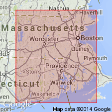
Age of the metasediments and associated volcanic rocks of the Boston Bay Group is considered here to be Late Proterozoic. Authors state that metamorphism affecting the Boston Bay Group is of low-grade greenschist facies, while the Cambrian strata above are very weakly metamorphosed. They suggest the greenschist-facies metamorphic event is Proterozoic and that an unconformity separates this unit from the Cambrian Weymouth Formation. Boston Bay Group overlies and is interbedded with the Mattapan Volcanics, which in turn unconformably overlies the Middlesex Fells Volcanic Complex. Overall thickness of the Boston Bay Group is 3 to 5 km.
Source: GNU records (USGS DDS-6; Reston GNULEX).
- Usage in publication:
-
- Boston Bay Group
- Modifications:
-
- Revised
- Overview
- AAPG geologic province:
-
- New England province
Summary:
Authors state, "...historic stratigraphy and stratigraphic units of the Boston basin are suspect." They suggest that the only formal nomenclature that should be retained is Boston Bay Group, undifferentiated, and perhaps the Weymouth Formation and the Braintree Argillite. Units within the Boston Bay Group--the Cambridge Argillite, and the Brookline, Dorchester, and Squantum (Tillite) Members of the Roxbury Conglomerate--were defined largely on the basis of the percentage of conglomerate, diamictite, argillite, sandstone, siltstone, tuff, and matrix present. Authors believe that recognition of these units in the field is nearly impossible and propose a facies-derived model for the Boston basin. They suggest that the Boston Bay Group was deposited in a submarine fan/slope/apron environment.
Source: GNU records (USGS DDS-6; Reston GNULEX).
- Usage in publication:
-
- Boston Bay Group*
- Modifications:
-
- Age modified
- Biostratigraphic dating
- AAPG geologic province:
-
- New England province
Summary:
Boston Bay Group includes Roxbury Conglomerate with its Brookline, Dorchester, and Squantum Members, Brighton Melaphyre, and Cambridge Argillite. Roxbury lies nonconformably over Dedham Granite and Mattapan Volcanic Complex. Its three members were not shown separately on MA State bedrock map of Zen and others (1983). Only Brighton Melaphyre is shown within Roxbury on the map [MA State bedrock map lists it "Melaphyre in the Roxbury Conglomerate"]. Brighton is younger than Mattapan Volcanic Complex and intrudes it, although some may be contemporaneous with it. Cambridge Argillite includes unit shown as Milton quartzite unit of Billings (1976) and Tufts Quartzite Member (described by Billings, 1929, and LaForge, 1932) [neither quartzite is shown on MA State bedrock map]. Age of Boston Bay Group has been controversial, ranging from Cambrian to Pennsylvanian, the latter on basis of lithologic correlation with rocks of Narragansett basin and now discounted plant fossils. Age is Proterozoic Z and possibly Early Cambrian age based on presence of Cambrian acritarchs in Cambridge Argillite, including diagnostic species that ranges in age from Proterozoic Z to Early Cambrian, but that was most abundant during Proterozoic Z time. No other reliable diagnostic fossils have been found in Boston Bay Group rocks. Supporting evidence for this age is: 1) plant fossils so common in Narragansett basin are not found in Boston Bay Group, 2) Quincy Granite contains argillite inclusions on strike with Cambridge Argillite, and 3) primarily marine stratigraphy of Boston Bay Group is not similar to terrestrial stratigraphy of Narragansett basin. Report includes geologic maps and correlation charts. [Chapters A-J in U.S. Geological Survey Professional Paper 1366 are intended as explanations and (or) revisions to 1:250,000-scale MA State bedrock geologic map of Zen and others (1983).]
Source: GNU records (USGS DDS-6; Reston GNULEX).
- Usage in publication:
-
- Boston Bay Group*
- Modifications:
-
- Overview
- AAPG geologic province:
-
- New England province
Summary:
On the correlation chart for Precambrian rocks of the conterminous United States, the Boston Bay Group of the New England Avalonian terranes is shown to be of Late Proterozoic and Early Cambrian age (ranging from about 610 Ma into the Early Cambrian).
Source: GNU records (USGS DDS-6; Reston GNULEX).
For more information, please contact Nancy Stamm, Geologic Names Committee Secretary.
Asterisk (*) indicates published by U.S. Geological Survey authors.
"No current usage" (†) implies that a name has been abandoned or has fallen into disuse. Former usage and, if known, replacement name given in parentheses ( ).
Slash (/) indicates name conflicts with nomenclatural guidelines (CSN, 1933; ACSN, 1961, 1970; NACSN, 1983, 2005, 2021). May be explained within brackets ([ ]).