

- Usage in publication:
-
- Bidahochi formation
- Modifications:
-
- Original reference
- Dominant lithology:
-
- Sand
- AAPG geologic province:
-
- Black Mesa basin
Summary:
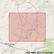
Pg. 366 and map on p. 357. Bidahochi formation. For most part the surface of Hopi Buttes volcanic fleld, on both sides of middle, inner, valley of Pueblo Colorado Wash from Steamboat on north nearly to Santa Fe Railroad to south, is a sandy, rolling bad-land country. The same formation also skirts southern edge of Black Mesa, and extends west to Hopi Buttes, where it has not been removed by erosion. In this paper this deposit will be termed Bidahochi formation. Age is Tertiary and Pleistocene.
[Type locality not stated, but fm. is mapped 15 to 20 mi. to east and north of settlement of Bidahochi (p. 355), near Twin Buttes, northeastern AZ.]
Source: US geologic names lexicon (USGS Bull. 896, p. 179).
- Usage in publication:
-
- Bidahochi formation*
- Modifications:
-
- Reference
- Dominant lithology:
-
- Conglomerate
- Sandstone
- Mudstone
- Claystone
- Ash
- AAPG geologic province:
-
- Black Mesa basin
Summary:
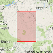
Section exposed along Pueblo Colorado Wash 15 mi east of Bidahochi [near Indian Wells], Navajo Co, AZ in the Black Mesa basin, designated the reference section because no type section was selected by Regan (1924). At reference section Bidahochi: is 488 ft thick; unconformably overlies Wingate sandstone; divided into lower, volcanic, and upper members. Lower member has distorted cross-bedding, ripple marks, plant impressions, and petrified wood. Lower member (214 ft thick) has a basal conglomerate of rounded to subrounded gray limestone and siltstone in a matrix of medium to very fine grained subangular quartz. The conglomerate is overlain by gray to brown mudstone, brown to pink, fine to very fine grained sandstone, gray to brown claystone, and one volcanic ash bed. The volcanic member (5 ft thick) is a brown conglomerate of subangular to angular quartzite and basalt pebbles in a matrix of medium- to fine-grained subround to round clear quartz. Upper member (274+ ft thick) forms ledges and slopes, and consists of gray laminated claystone and flat-bedded to thin-bedded mudstone, and gray, coarse- to fine-grained sandstone. Areal extent map of upper and lower members. Entire thickness not measurable because of erosion. Geologic map. Measured section. Lower member of Bidahochi thought to be correlative with Chuska sandstone. Considered middle Pliocene age.
Source: GNU records (USGS DDS-6; Denver GNULEX).
- Usage in publication:
-
- Bidahochi Formation*
- Modifications:
-
- Geochronologic dating
- AAPG geologic province:
-
- Black Mesa basin
Summary:
Three members mapped in west part of area in Apache Co, AZ in the Black Mesa basin. Divided into: 1) lower member--a banded gray, brown, and pink, flat-bedded mudstone, argillaceous, fine-grained sandstone, few beds of rhyolitic ash, mostly of lacustrine origin, 0-160 ft thick that weathers to a ledgy slope; 2) volcanic member--dense dark lavas with phenocrysts of augite, some hornblende and biotite, 0-197 ft thick, that cap mesas; 3) upper member--predominantly white to pale-brown, poorly cemented, medium- to fine-grained, argillaceous sandstone and few rhyolitic ash beds in lower part, 0-600 ft thick, most fluvial origin that weathers to ledges and steep slopes. One flow from volcanic member west of mapped area has a K-Ar age of 4.1 m.y. Assigned a Pliocene age.
Source: GNU records (USGS DDS-6; Denver GNULEX).
- Usage in publication:
-
- Bidahochi Formation*
- Modifications:
-
- Areal extent
- AAPG geologic province:
-
- Black Mesa basin
Summary:
Bidahochi Formation. Geographically restricted from New Mexico. On Zuni Plateau of New Mexico, rocks that were formerly called upper member of Bidahochi Formation by Repenning and Irwin (1954, AAPG Bull., v. 38, no. 8, p. 1821-1826), are named Fence Lake Formation in this report.
[GNU concerns (ca. 1981; 1983; 1986): uncertain if Fence Lake extends into Arizona. Arizona exposures of Repenning and Irwin's upper member of Bidahochi not addressed in this report. See Repenning and Irwin (1954, AAPG Bull., v. 38, no. 8, p. 1822 (fig. 1).]
Source: GNC index card files (USGS-Menlo).
- Usage in publication:
-
- Bidahochi Formation
- Modifications:
-
- Areal extent
- AAPG geologic province:
-
- San Juan basin
Summary:
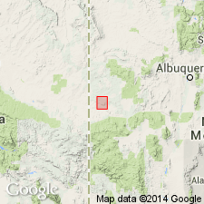
Upper member mapped in two exposures in south-central part of quad, McKinley Co, NM in the San Juan basin. Most of the Bidahochi in the Zuni area has been assigned to the upper member. Consists of about 75 ft of red- to light-brown argillaceous sandstone with numerous beds of nodular pedogenic carbonate, suggesting source area was the Zuni uplift to the east. Columnar section. Unconformably overlies Crevasse Canyon Formation. Locally covered by windblown sand. Of Pliocene age.
Source: GNU records (USGS DDS-6; Denver GNULEX).
- Usage in publication:
-
- Bidahochi Formation
- Modifications:
-
- Areal extent
- AAPG geologic province:
-
- San Juan basin
Summary:
Is the youngest Tertiary unit in report area. Mapped in many areas at the west side of the map, McKinley Co, NM in the San Juan basin. Has a maximum thickness of 300 ft. Mapping of Bidahochi compiled from earlier mapping of the Cantalaro Spring and Twentytwo Spring quads. Columnar section.
Source: GNU records (USGS DDS-6; Denver GNULEX).
- Usage in publication:
-
- Bidahochi Formation
- Modifications:
-
- Areal extent
- Overview
- AAPG geologic province:
-
- Black Mesa basin
- San Juan basin
Summary:
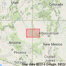
Covers an area of more than 16,000 sq km in eastern AZ and western NM, from about 110 deg 30' east to Zuni Mountains, and from north of Springerville, AZ and south of Defiance Plateau, an area in part of Black Mesa and San Juan basins. Areal extent map. May be as much as 240 m thick. Lower boundary coincides with Upper Tertiary-Mesozoic boundary. Except where covered by eolian or surficial deposits, is uppermost unit in area. Includes alluvial, lacustrine, eolian, and spring deposits, silicic windborne ash and eruptive materials. Members of previous authors considered depositional facies in this study. Is not layered stratigraphic unit that many thought it represented. Lacustrine deposits may have been deposited in widespread long lasting or temporary lake and one dammed by lava flows. Volcanic rocks crop out mainly at Hopi Buttes, Navajo Co at northwest margin of formation's extent; eruptions of basaltic and monchiquitic lavas spanned 8.5 to 6 m.y. and 4.5 to 4 m.y.; volcanic rocks not confined to particular stratigraphic level. Alluvial deposits make up most of Bidahochi. Neither upper nor lower boundary well constrained by fossils or by radiometric dates. Hemphillian fossils found at Bidahochi; Clarendonian age vertebrate fossils near base at one locality; Blancan-Irvingtonian fossils near Hopi Buttes. Igneous rocks that cut or are in or above formation give it range 9 to 4 m.y. Lower part = upper Fence Lake Formation.
Source: GNU records (USGS DDS-6; Denver GNULEX).
For more information, please contact Nancy Stamm, Geologic Names Committee Secretary.
Asterisk (*) indicates published by U.S. Geological Survey authors.
"No current usage" (†) implies that a name has been abandoned or has fallen into disuse. Former usage and, if known, replacement name given in parentheses ( ).
Slash (/) indicates name conflicts with nomenclatural guidelines (CSN, 1933; ACSN, 1961, 1970; NACSN, 1983, 2005, 2021). May be explained within brackets ([ ]).