


- Usage in publication:
-
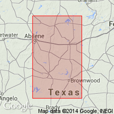
- Belle Plains formation
- Modifications:
-
- Original reference
- Dominant lithology:
-
- Limestone
- Shale
- AAPG geologic province:
-
- Bend arch
Summary:
Pg. 192-198 and charts. Belle Plains formation, middle formation of Wichita group. Includes all strata between top of Elm Creek limestone below and top of next higher persistent escarpment-forming stratum, named by Drake Bead Mountain bed, which forms top of high escarpment west of Baird. These beds form a strikingly characteristic unit. In many places a thin, buff or yellowish-brown lentil forms prominent bench about half way up escarpment and provides a good horizon marker in mapping structure of Baird district, and aids in distinguishing formation from one below. Thickness 300 feet in Callahan County and 200 to 250 feet in Coleman County. Includes (descending) following beds described by Drake (in Colorado coal field): Bead Mountain limestone [includes more than Drake's Bead Mountain limestone], Valera shale, Jagger Bend limestone, and "bed No. 8" shale. Underlies Clyde formation and overlies Admiral formation. Age is Permian. Report includes measured sections.
Named from town of Belle Plains, Callahan Co., TX [which is in midst of the formation as mapped].
Source: Publication; US geologic names lexicon (USGS Bull. 896, p. 152).

- Usage in publication:
-
- Belle Plains formation
- Modifications:
-
- Overview
- AAPG geologic province:
-
- Bend arch
Summary:
In central northern Texas the Beaverburk limestone and overlying Bluff bone bed of Udden are now included in Belle Plains formation by Texas Geological Survey. See under Beaverburk limestone.
Source: US geologic names lexicon (USGS Bull. 896, p. 152).

- Usage in publication:
-
- Belle Plains group
- Modifications:
-
- Revised
- AAPG geologic province:
-
- Bend arch
Summary:
Pg. 66 (fig. 1), 93. Belle Plains group. Rank raised to group and expanded below to include Elm Creek limestone and Jim Ned shale (new), which strata had been included in the Admiral herein given group status and stratigraphically restricted above. As redefined, the Belle Plains includes (ascending) Jim Ned shale, Elm Creek limestone, Jagger Bend limestone, Valera shale and anhydrite, and Bead Mountain limestone. Underlies Clyde group. [Age is Permian.]
Source: US geologic names lexicon (USGS Bull. 1200, p. 287-288).
- Usage in publication:
-
- Belle Plains formation
- Modifications:
-
- Revised
- AAPG geologic province:
-
- Bend arch
Summary:
Sheets 3, 4. Belle Plains formation. Formation further subdivided to include Voss shale member between Jagger Bend limestone member above and the Elm Creek limestone member below. [Age is Permian.]
Source: US geologic names lexicon (USGS Bull. 1200, p. 287-288).

- Usage in publication:
-
- Belle Plains formation
- Modifications:
-
- Mapped
- AAPG geologic province:
-
- Bend arch
Summary:
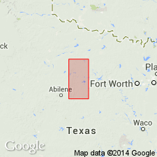
Sheet 2. Belle Plains formation. Described in Colorado River valley as a formation. Consists mainly of gray limestone beds, 1 to 5 feet thick, separated by shale or marl in beds of comparable thickness. Near Colorado River is 400 feet thick. Includes (ascending) Jim Ned shale, Elm Creek limestone, Voss shale, Jagger Bend limestone, Valera shale, and Bead Mountain limestone members. Overlies Admiral formation; underlies Grape Creek member of Clyde formation; boundary somewhat arbitrarily defined. Age is Early Permian (Leonard?).
Source: Publication; US geologic names lexicon (USGS Bull. 1200, p. 287-288).
- Usage in publication:
-
- Belle Plains formation
- Modifications:
-
- Areal extent
- AAPG geologic province:
-
- Bend arch
Summary:
Pls. 11, 12. Belle Plains formation. Described in Brazos River area where it is 525 to 640 feet thick. Consists of six members as listed by Moore (1949). Overlies Admiral formation; underlies Clyde formation. [Age is Permian.]
Source: US geologic names lexicon (USGS Bull. 1200, p. 287-288).
For more information, please contact Nancy Stamm, Geologic Names Committee Secretary.
Asterisk (*) indicates published by U.S. Geological Survey authors.
"No current usage" (†) implies that a name has been abandoned or has fallen into disuse. Former usage and, if known, replacement name given in parentheses ( ).
Slash (/) indicates name conflicts with nomenclatural guidelines (CSN, 1933; ACSN, 1961, 1970; NACSN, 1983, 2005, 2021). May be explained within brackets ([ ]).