

- Usage in publication:
-
- Beekmantown limestone
- Modifications:
-
- Original reference
- Dominant lithology:
-
- Limestone
- AAPG geologic province:
-
- Appalachian basin
Summary:
Pg. 874-878. Beekmantown limestone (new). The Calciferous sand rock of Eaton and authors generally. [C.A. Hartnagel (New York State Mus. Hdbk., no. 19, p. 33, 1912) stated that Calciferous sand rock of Eaton included the Little Falls dolomite.] At Beekmantown, New York, the normal fauna is finely developed and the rock section essentially complete. Underlies Chazy limestone and overlies Potsdam sandstone and limestone.
[Named for exposures at Beekmantown, Clinton Co., northeast corner of NY.]
Source: US geologic names lexicon (USGS Bull. 896, p. 145-148).

- Usage in publication:
-
- Beekmantown group*
- Beekmantown limestone*
- Modifications:
-
- Overview
- AAPG geologic province:
-
- New England province
Summary:
In 1890 (GSA Bull., v. 1, p. 501-516) E. Brainerd and H.M. Seely divided the †Calciferous of Champlain Valley, Vermont, into (descending): E, fine-grained magnesium limestone in beds 2 feet thick, weathering drab, yellowish, or brown, 450 to 500 feet; D, blue limestone, magnesium limestone, sandy limestone, drab and brown magnesium limestone, some tough sandstone, some conglomerate, 375 feet; C, alternating sandstone and magnesium limestone 350 feet; B, masses of nearly pure reticulated limestone weathering white, intermingled with light-colored dolomite, 295 feet; A, drab magnesium limestone, 310 feet. Overlain by Chazy limestone (division A) and underlain by Potsdam sandstone. In 1891 (Amer. Mus. Nat. Hist. Bull., v. 3, p. 1-3) Brainerd and Seely published the following subdivisions of division D (descending): No. 4, 100 feet of blue limestone in thin beds separated by very thin, tough, slaty layers, which protrude on weathered edges in undulating lines, the limestone often appearing to be a conglomerate, the small enclosed pebbles being somewhat angular and arenaceous; No. 3, 120 feet of sandy limestone in thin beds, weathering on edges in horizontal ridges 1 or 2 inches apart, giving to escarpments a peculiar banded appearance, interstratified with a few thin beds of pure limestone; No. 2, 75 feet of drab and brown magnesium limestone containing toward middle several beds of tough sandstone; No. 1, 80 feet of blue limestone in beds 1 or 2 feet thick, breaking with flinty fracture; considerable dolomitic matter often intermixed.
R.P. Whitfield, 1890 (Amer. Mus. Nat. Hist. Bull., v. 3, p. 25-28), stated that Brainerd and Seely included "Fort Cassin layers" in division D, 375 feet thick, which contains OPHILETA at base "and the Fort Cassin fauna in a very few feet at the very top, the intervening layers being essentially unfossiliferous." In his opinion the line between division C and division D should have been made above the OPHILETA bed; and "there is certainly a much greater affinity between Fort Cassin fossils and those of the rocks above them than those of the Calciferous, and as latter name applies to beds having peculiar lithological characters, and containing a very limited fauna, it appears to me much more natural to associate the later fauna with that of the rocks above, and place the limestones there also, or else consider them as distinct from those below or above, and use a distinct name, as Fort Cassin, or Philipsburg formation, or any other appropriate one."
Source: US geologic names lexicon (USGS Bull. 896, p. 145-148).
- Usage in publication:
-
- Beekmantown group*
- Beekmantown limestone*
- Modifications:
-
- Overview
- AAPG geologic province:
-
- New England province
Summary:
In 1903 (New York State Mus. Hdbk., no. 19, p. 16 and chart) J.M. Clarke introduced Little Falls dolomite for "the highly magnesium sparsely fossiliferous phase of 'Calciferous sandrock' in Mohawk valley."
In 1905 (New York State Mus. Bull., no. 77) H.P. Cushing mapped Beekmantown formation and Little Falls dolomite in Little Falls quadrangle, and the same year (New York State Mus. Bull., no. 95) he proposed Cassin formation (from Fort Cassin, Vermont) for Brainerd and Seely's divisions E1, D4 and D3 of the Beekmantown, and stated that these beds "are confined to Champlain Valley so far as the immediate region is concerned, and have therefore the same restricted distribution as the following Chazy"; also that he agreed with Whitfield that these beds have more natural affinity with Chazy than with Beekmantown, and that they should either be placed with that formation or considered distinct from either and given a separate name. He also stated that at Beekmantown type section these rocks are not exposed; that to south and around into Mohawk Valley they are absent; and that the question as to whether the rocks involved are to be classed with Chazy or Beekmantown, or with neither, is not at issue in the giving of the name; but he assigned his Cassin limestone to upper Beekmantown.
In 1906 (New York State Mus. Bull., no. 90) R. Ruedemann included Fort Cassin beds, as he called them, in the Beekmantown, but stated (p. 525) that "all evidence goes to show that the Philipsburg beds, like the typical beds at Beekmantown, are older than Fort Cassin beds."
In 1907 (New York State Mus. Bull., no. 114) C.A. Hartnagel stated Beekmantown dolomite (Little Falls dolomite) is not exposed in Rochester and Ontario Beach quadrangles.
In 1908 (GSA Bull., v. 19, p. 171) H.P. Cushing excluded division A from Beekmantown, stating that it is unconformable with division B and of Cambrian age, and he named these beds in Jefferson County the Theresa formation, and doubtfully correlated them with Little Falls dolomite of Mohawk Valley.
In 1909 (Jour. Geol., v. 17, p. 251) A.W. Grabau included division A, also Little Falls dolomite and Theresa formation, in the Beekmantown.
Source: US geologic names lexicon (USGS Bull. 896, p. 145-148).
- Usage in publication:
-
- Beekmantown group*
- Beekmantown limestone*
- Modifications:
-
- Overview
- AAPG geologic province:
-
- New England province
Summary:
In 1910 (New York State Mus. Bull., no. 138) R. Ruedemann included division A in Beekmantown, but stated that "it will probably in time be separated from the rest of the Beekmantown by Dr. Ulrich, who considers it the eastern representative of a separate formation having possibly even the value of a system fully developed in the Mississippi basin," and that there is a strong unconformity between divisions A and B. He also included in Beekmantown the Cassin formation, as he called it, "although its recognition as a distinct unit is urged by Prof. Cushing, apparently on good grounds. This Cassin formation is to comprise upper part of D and all of E."
In 1910 (GSA Bull., v. 21, p. 780-781) E.O. Ulrich and H.P. Cushing divided Little Falls dolomite of Mohawk Valley [type region] into (descending): (1) Tribes Hill limestone (new name); heretofore described as "fucoidal beds" of Calciferous; contains Beekmantown fossils and represents lowest known division of Beekmantown of New York; fauna not yet recognized in Champlain Valley, and if present there the formation is represented in upper part of division B; (2) Little Falls dolomite restricted; unconformably underlies Tribes Hill limestone, and traced to Champlain Valley constitutes division A and lower half of division B of Beekmantown of Brainerd and Seely; is not Beekmantown but Late Cambrian (Saratogan or Ozarkian); rests on passage beds [Theresa dolomite] to Potsdam sandstone. [This classification (which restricted Beekmantown to Brainerd and Seely's divisions E, D, C, and upper part of division B, assigned Tribes Hill limestone to the Beekmantown, and excluded Little Falls dolomite) was continued for many years, by geologists generally, although A.W. Grabau in 1916 (GSA Bull., v. 27, p. 589) still considered the Little Falls dolomite as lowest Beekmantown.]
In 1914 (New York State Mus. Bull., no. 169, btw. P. 66-99) R. Ruedemann stated Fort Cassin beds correspond to unknown parts of Brainerd and Seely's divisions D and E of the Beekmantown. In 1915 C. Schuchert (Textbook of geology, p. 629 and index) excluded Fort Cassin formation from Beekmantown. Ulrich’s later charts show Fort Cassin zone, as he called it, between division D and division E, and that it is properly a part of the Beekmantown.
Source: US geologic names lexicon (USGS Bull. 896, p. 145-148).
- Usage in publication:
-
- Beekmantown group*
- Beekmantown limestone*
- Modifications:
-
- Overview
- AAPG geologic province:
-
- New England province
Summary:
E.J. Foyles, 1923 (Rpt. Vermont State Geol. 1921-22, p. 71-86) and 1924 (Rpt. Vermont State Geol. 1923-24), reported that Fort Cassin rocks are not Beekmantown but belong to 2 formations, one of Chazy and the other of Trenton age; but A. Keith, C. Schuchert, and other geologists still consider the beds at Fort Cassin to be of Beekmantown age.
W. Goldring, 1931 (New York State Mus. Hdbk., no. 10, p. 263, 268), stated that Beekmantown submergence in New York in general begins with Tribes Hill limestone, which overlies Little Falls dolomite nearly everywhere in Mohawk Valley, and includes Beekmantown E, D, C, and part of B.
In Jan. 1936 the USGS decided to adopt Ulrich’s classification, which correlated, by faunas and lithology, Chepultepec dolomite of Alabama and Tennessee, Gasconade and Van Buren dolomites of Missouri, and Oneota dolomite of Upper Mississippi Valley with the 30+/- feet of cherty beds forming top part of Little Falls dolomite in Champlain Valley, New York, but locally absent in Mohawk Valley, the type region of Little Falls dolomite. This classification restricted Little Falls dolomite to lower (major) part of the beds included in it since 1910, or to the typical Little Falls, which is said by Ulrich to be unconformable with the overlying cherty beds. These upper cherty beds (for which no New York name has been adopted) correspond to part of Beekmantown B of Brainerd and Seely, are older than Tribes Hill limestone, and contain a fauna that is not Cambrian and which, although differing slightly from that of the Tribes Hill, shows many relationships to the latter fauna. These beds are, therefore, restored to the Beekmantown, although they are said by Ulrich to be unconformable with overlying Beekmantown beds. The Chepultepec, Gasconade, Van Buren, Oneota and equivalent formations; are now classified by USGS as of [Early] Ordovician (Beekmantown) age.
See also under Little Falls dolomite.
The USGS treats the beds at Fort Cassin as of Beekmantown age, but has not adopted either Cassin formation or Fort Cassin formation.
In central Pennsylvania the Beekmantown group is divided into (descending) Bellefonte dolomite, Axemann limestone, Nittany dolomite, and Stonehenge limestone. In western Maryland and Virginia the rocks are not subdivided and are called Beekmantown limestone.
Source: US geologic names lexicon (USGS Bull. 896, p. 145-148).
- Usage in publication:
-
- Beekmantown group
- Modifications:
-
- Overview
- AAPG geologic province:
-
- Appalachian basin
Summary:
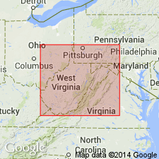
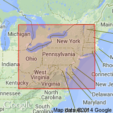
In Virginia the Beekmantown group is overlain by Chazyan age rocks and overlies the Chepultepec limestone. Three distinct facies of the Beekmantown are recognized: 1) dolomite in area southwest of Lexington and in northwestern belts from Lee Co. to Highland Co., 2) dolomite and limestone southwest of Frederick Co., and 3) dominantly limestone in Frederick and Clarke Cos. Thickness of Beekmantown in northeastern Virginia is between 2500 and 3000 feet. Formations of the Beekmantown group in PA cannot be distinguished in VA.
Source: GNU records (USGS DDS-6; Reston GNULEX).
- Usage in publication:
-
- Beekmantown group*
- Modifications:
-
- Overview
- AAPG geologic province:
-
- Appalachian basin
Summary:
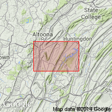
In Pennsylvania, the Beekmantown group includes the (ascending) Mines dolomite (250 feet of thick-bedded dolomite with chert), Larke dolomite (250 feet of thick-bedded dolomite without chert), Nittany dolomite (1000 feet of thick-bedded crystalline dolomite), Axemann limestone (150 feet of thin-bedded blue limestone), and Bellefonte limestone (1000 feet of thick-bedded crystalline dolomite). The Beekmantown group overlies the Gatesburg formation and underlies the Carlim limestone. The Beekmantown group is of Early Ordovician age.
Source: GNU records (USGS DDS-6; Reston GNULEX).
- Usage in publication:
-
- Beekmantown group
- Modifications:
-
- Areal extent
- AAPG geologic province:
-
- Appalachian basin
Summary:
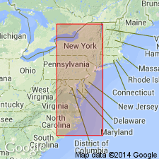
On the Taconic plate New York and Pennsylvania the Beekmantown group sediments in overthrust sheets consist of the Schagticoke shale and all but the topmost part of the Deepkill shale. In central PA, the Beekmantown group consists of (ascending) Stonehenge limestone, Nittany dolomite, Axemann limestone, and Bellefonte dolomite. In the Mohawk Valley of NY, the Tribes Hill limestone represents the thin featheredge of Beekmantown deposits lapping from the south onto the margin of the old Adirondack Peninsula.
Source: GNU records (USGS DDS-6; Reston GNULEX).
- Usage in publication:
-
- Beekmantown group
- Modifications:
-
- Areal extent
- AAPG geologic province:
-
- Appalachian basin
Summary:
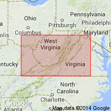
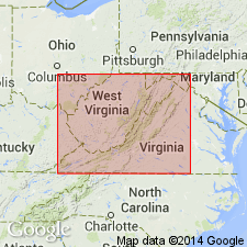
Although the Beekmantown was previously reported south of the WV eastern panhandle in VA and north in MD, this is the first report to discuss the Beekmantown group in WV. The Beekmantown is considered the body of calcareous Lower Ordovician rocks above Stonehenge-Chepultepec limestone, which has been withdrawn from the Beekmantown group. Precise identification of formations recognized in PA is difficult.
Source: GNU records (USGS DDS-6; Reston GNULEX).
- Usage in publication:
-
- Beekmantown group*
- Modifications:
-
- Revised
- Reference
- AAPG geologic province:
-
- Appalachian basin
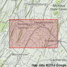
Summary:
In Maryland, the Beekmantown group consists of (ascending) the Stonehenge limestone, Rockdale Run formation (new), and Pinesburg Station dolomite (new). The thickness of the group is 3600 feet. The Beekmantown overlies the Conococheague formation and underlies the St. Paul group. Reference section is designated.
Source: GNU records (USGS DDS-6; Reston GNULEX).
- Usage in publication:
-
- Beekmantown group
- Modifications:
-
- Revised
- AAPG geologic province:
-
- Appalachian basin
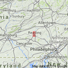
Summary:
In Berks Co., PA, the Beekmantown group comprises (ascending) Stonehenge, Rickenbach (new), Epler (new), and Ontelaunee (new) formations. Thickness of the group is 2305 feet. The Beekmantown underlies the Jacksonburg limestone.
Source: GNU records (USGS DDS-6; Reston GNULEX).
- Usage in publication:
-
- Beekmantown group
- Modifications:
-
- Overview
- AAPG geologic province:
-
- Appalachian basin
- New England province
Summary:
The Beekmantown group in the central Champlain Valley consists of (ascending) the Whitehall formation, Cutting formation, Cassin limestone, and Bridport dolostone. The Beekmantown overlies the Ticonderoga formation (new) and underlies the Day Point formation of Chazy group.
Source: GNU records (USGS DDS-6; Reston GNULEX).
- Usage in publication:
-
- Beekmantown group
- Modifications:
-
- Areal extent
- AAPG geologic province:
-
- New England province
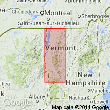
Summary:
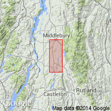
In west-central VT, the Beekmantown group comprises (ascending) the Shelburne formation, Cutting dolomite, Bascom formation, and Chipman formation. The group overlies the Clarendon Springs dolomite and underlies the Middlebury limestone.
Source: GNU records (USGS DDS-6; Reston GNULEX).
- Usage in publication:
-
- Beekmantown group
- Modifications:
-
- Overview
- AAPG geologic province:
-
- New England province
Summary:
On the Vermont State geologic map, the Beekmantown group includes the Chipman, Bridport, Beldens, Bascom, Morgan Corner, Wallace Creek, Highgate, Shelburne, Whitehall, and Strites Pond formations, and Providence Island dolomite, and Luke Hill, Naylor Ledge, Hastings Creek limestones, Cutting dolomite, Sutherland Falls marble, and Columbian marble. The Beekmantown group is of Early Ordovician age.
Source: GNU records (USGS DDS-6; Reston GNULEX).
- Usage in publication:
-
- Beekmantown Group
- Modifications:
-
- Areal extent
- Revised
- AAPG geologic province:
-
- Appalachian basin
Summary:
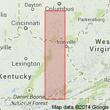
Geographically extended the Beekmantown Group to the subsurface of Ohio. Unit is divided into the lower Chepultepec Dolomite and the upper Lambs Chapel Dolomite. The Beekmantown Group is considered the upper part of the Knox Supergroup and is of Cambrian age.
Source: GNU records (USGS DDS-6; Reston GNULEX).
- Usage in publication:
-
- Beekmantown Formation
- Modifications:
-
- Revised
- AAPG geologic province:
-
- Appalachian basin
Summary:
On the Virginia State geologic map, the Beekmantown Formation is the upper formation in the Knox Group.
Source: GNU records (USGS DDS-6; Reston GNULEX).
- Usage in publication:
-
- Beekmantown Formation
- Modifications:
-
- Areal extent
- AAPG geologic province:
-
- Appalachian basin
Summary:
Geographically extended Beekmantown Formation to NJ. Unit consists of microcrystalline, dark gray, massive dolomite and contains nine metabentonite beds.
Source: GNU records (USGS DDS-6; Reston GNULEX).
- Usage in publication:
-
- Beekmantown Group*
- Modifications:
-
- Overview
- AAPG geologic province:
-
- Appalachian basin
Summary:
In eastern PA and western NJ, the Beekmantown Group consists of (ascending) the Rickenbach Dolomite (635 feet thick) and Epler Formation (800 feet of interbedded limestone and dolomite). In other areas of PA, the group also includes the (ascending) Stonehenge Limestone and Ontelaunee Formation; in the study area, the Stonehenge pinches out and the Ontelaunee is cut out by an unconformity.
Source: GNU records (USGS DDS-6; Reston GNULEX).
- Usage in publication:
-
- Beekmantown Group
- Modifications:
-
- Revised
- AAPG geologic province:
-
- Appalachian basin
Summary:
In New York, the Beekmantown Group is revised to include the Ticonderoga Dolostone as its lowest formation, along with the (ascending) Whitehall, Cutting, Spellman, Fort Cassin, and Providence Island Dolostones (and limestones).
Source: GNU records (USGS DDS-6; Reston GNULEX).
- Usage in publication:
-
- Beekmantown Dolomite*
- Modifications:
-
- Revised
- AAPG geologic province:
-
- Appalachian basin
Summary:
In southwestern VA (only), the Beekmantown is revised to the Beekmantown Dolomite of the Knox Group as the upper formation of that group. The Beekmantown is 1250 feet thick and consists of very light-gray to medium-light gray, even bedded (3 feet thick) dolomite. Also includes numerous beds of white weathering nonoolitic chert. Unit overlies the Copper Ridge Dolomite of the Knox Group and unconformably underlies undivided Middle Ordovician limestones. The Beekmantown is of Early Ordovician age.
Source: GNU records (USGS DDS-6; Reston GNULEX).
- Usage in publication:
-
- Beekmantown Group*
- Modifications:
-
- Age modified
- Biostratigraphic dating
- AAPG geologic province:
-
- Appalachian basin
Summary:
The age of the Beekmantown Group is changed to Early and Middle Ordovician in western MD and northern VA based on an Early and Middle Ordovician age for its Rockdale Run Formation (uppermost formation in group). This age change is based on conodont biostratigraphy which shows a late Canadian through Chazyan age for the Beekmantown Group. Elsewhere in MD and VA, and in NY, NJ, PA, VT, WV, and TN, the age of the Beekmantown varies.
Source: GNU records (USGS DDS-6; Reston GNULEX).
- Usage in publication:
-
- Beekmantown Group*
- Modifications:
-
- Revised
- AAPG geologic province:
-
- Appalachian basin
Summary:
The Beekmantown Group is assigned to the Kittatinny Supergroup in the Lehigh Valley of NJ and PA. The group includes (ascending) the Stonehenge Limestone (in PA only), Rickenbach Dolomite, Epler Formation, and Ontelaunee Formation. The Beekmantown is of Early and Middle Ordovician age. It overlies the Allentown Dolomite and underlies the Jacksonburg Limestone.
Source: GNU records (USGS DDS-6; Reston GNULEX).
- Usage in publication:
-
- Beekmantown Group
- Modifications:
-
- Overview
- AAPG geologic province:
-
- Appalachian basin
Summary:
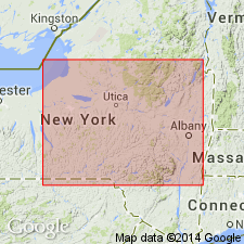
The Beekmantown Group in east-central NY includes the (ascending) Potsdam Sandstone, Ticonderoga Formation, Whitehall Formation, Great Meadows Formation, Fort Ann Formation, and Fort Cassin Formation. The Cambrian-Ordovician boundary is within the Whitehall Formation, and therefore, the Beekmantown Group is of Late Cambrian to Early Ordovician age (Croixan to Canadian). Unit overlies the Lake George Group and underlies the Black River Group.
Source: GNU records (USGS DDS-6; Reston GNULEX).
- Usage in publication:
-
- Beekmantown Formation
- Modifications:
-
- Revised
- AAPG geologic province:
-
- Appalachian basin
Summary:
Revised the Beekmantown Formation of the Knox Group in VA by including (reduction of ranks) the (ascending) Chepultepec Dolomite Member, Longview Dolomite Member, Kingsport Dolomite Member, and the Mascot Dolomite Member. Revision shows up on figure 3 for the southern Appalachian region but is not discussed in text. Unit overlies the Copper Ridge Dolomite and underlies the New Market Formation.
Source: GNU records (USGS DDS-6; Reston GNULEX).
- Usage in publication:
-
- Beekmantown Dolomite
- Modifications:
-
- Revised
- AAPG geologic province:
-
- Appalachian basin
Summary:
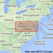
In subsurface of WV, the Beekmantown is revised to the Beekmantown Dolomite of the Knox Group. The Beekmantown is 765 to 1105 feet thick. It overlies the Rose Run Sandstone and underlies the St. Peter Sandstone.
Source: GNU records (USGS DDS-6; Reston GNULEX).
- Usage in publication:
-
- Beekmantown Group
- Modifications:
-
- Overview
- AAPG geologic province:
-
- Appalachian basin
Summary:
The Beekmantown Group of the Knox Supergroup in the subsurface of OH includes the (ascending) Rose Run Sandstone and the Chepultepec Dolomite. It overlies the Lee Valley Group of the Knox Supergroup and unconformably underlies the Chazy Limestone.
Source: GNU records (USGS DDS-6; Reston GNULEX).
- Usage in publication:
-
- Beekmantown Group
- Modifications:
-
- Revised
- AAPG geologic province:
-
- Appalachian basin
Summary:
Beekmantown Group. In central Champlain Valley (type locality), actually extends from Late Cambrian to early Middle Ordovician; it includes the basal Whitehall Dolostone (Late Cambrian and Early Ordovician), the Bascom subgroup [informal] (Early Ordovician) and the Providence Island Formation (Early and Middle Ordovician). Subgroup is a new rank designation for the Bascom and represents the entire carbonate clastic core of the Beekmantown Group. Assigned to the Bascom are the Cutting Hill Formation [Cutting Formation of Cady (1945) redefined and renamed], the Lemon Fair Formation (new) and the Fort Cassin Formation.
["Subgroup" not recognized as a formal stratigraphic rank term (CSN, 1933; ACSN, 1961, 1970; NACSN, 1983, 2005, 2021). Considered informal and should not be capitalized.]
Source: Modified from GNU records (USGS DDS-6; Reston GNULEX).

- Usage in publication:
-
- Beekmantown Group*
- Modifications:
-
- Overview
- AAPG geologic province:
-
- Adirondack uplift
Summary:
Paleozoic cover sequence adjacent to Adirondack massif in western part of Glens Falls quad consists of (ascending): Late Cambrian Potsdam Sandstone, Late Cambrian Ticonderoga Formation, Late Cambrian and Early Ordovician Beekmantown Group (with Whitehall Formation at base), early Middle Ordovician Chazy Group, Middle Ordovician Black River and Trenton Groups, and Mohawk Valley shales (Canajoharie Shale and Snake Hill Formation). Potsdam and Ticonderoga are partly correlative with Danby Formation of Middlebury synclinorium in VT. Beekmantown and part of Chazy correlate directly with limestones and dolomites above Danby. Paleozoic cover sequence is interpreted as a platform sequence. [Text states Beekmantown "as used by Fisher (1984)", but this appears to be an error because Fisher (1984) included Potsdam and Ticonderoga in his Beekmantown. Fisher (1977) abandoned Canajoharie but USGS still recognizes it.]
Source: GNU records (USGS DDS-6; Reston GNULEX).
- Usage in publication:
-
- Beekmantown Group*
- Modifications:
-
- Revised
- AAPG geologic province:
-
- Appalachian basin
Summary:
In cross section E-E', in the subsurface of central WV, consists of three-part sequence of dolomite and sandstone: lower unnamed dolomite, middle unnamed sandstone, and upper unnamed anhydritic dolomite. Subdivisions established by Butts (1954) or Sando (1957) cannot be identified. Lower part correlates with dolomite previously assigned to Mines Dolomite Member of Gatesburg Formation by Wagner (1966). Entire section correlates with this sequence of Donaldson and others (1988): Beekmantown Dolomite, St. Peter Sandstone, and unnamed Middle Ordovician dolomite and anhydrite dolomite. In the Rome trough, upper part correlates with dolomite of the Beekmantown Group as used by Cable and Beardsley (1984), middle sandstone correlates with their St. Peter Sandstone, and lower part correlates with their dolomite, shale, and sandstone and local evaporite of the Chazy Group. West of Ohio-West Virginia hinge zone, Beekmantown replaced by Knox Dolomite of Janssens (1973) and the Wells Creek Formation as used in OH by Wickstrom and Gray (1988) and other workers. Upper part is laterally equivalent to Row Park Limestone of St. Paul Group in eastern WV. In VA, Beekmantown consists of lower Stonehenge Limestone and upper Rockdale Run Formation. Age ranges from Early and Middle Ordovician in western West Virginia to Early Ordovician in western VA.
Source: GNU records (USGS DDS-6; Reston GNULEX).
- Usage in publication:
-
- Beekmantown Group*
- Modifications:
-
- Age modified
- AAPG geologic province:
-
- Appalachian basin
Summary:
In OH, Beekmantown is used as a group and is restricted in age to Early Ordovician.
Source: GNU records (USGS DDS-6; Reston GNULEX).
For more information, please contact Nancy Stamm, Geologic Names Committee Secretary.
Asterisk (*) indicates published by U.S. Geological Survey authors.
"No current usage" (†) implies that a name has been abandoned or has fallen into disuse. Former usage and, if known, replacement name given in parentheses ( ).
Slash (/) indicates name conflicts with nomenclatural guidelines (CSN, 1933; ACSN, 1961, 1970; NACSN, 1983, 2005, 2021). May be explained within brackets ([ ]).