

- Usage in publication:
-
- Austin limestone
- Modifications:
-
- Original reference
- Dominant lithology:
-
- Limestone
- AAPG geologic province:
-
- Ouachita folded belt
- South Oklahoma folded belt
- Strawn basin
Summary:
Pg. 583, 585. Austin limestone. Fossiliferous cream-colored and bluish earthy limestone; 100 feet exposed in vicinity of Austin, [Travis County, eastern Texas]. Some beds soft and crumble on exposure, other beds moderately hard and furnish handsome building rock. At base shaly layers of fossiliferous dark bluish gray calcareous sandstone. Overlies EXOGYRA ARIETINA marl [Del Rio clay] and underlies Comanche Peak group. [Age is Late Cretaceous (Gulf).]
[Type area: Travis Co., southeastern TX. Named from Austin, in Travis Co.]
Source: US geologic names lexicons (USGS Bull. 896, p. 93; USGS Bull. 1200, p. 173).
- Usage in publication:
-
- Austin limestone
- Modifications:
-
- Revised
Summary:
Pg. 40. Austin limestone. Includes strata named Austin limestone by B.F. Shumard in 1860, but true relations not then recognized. Underlies Navarro beds [as here used included at base the Taylor marl] and overlies Eagle Ford shales.
Source: US geologic names lexicon (USGS Bull. 896, p. 93).

- Usage in publication:
-
- Austin chalk
- Modifications:
-
- Overview
Summary:
Austin chalk. The present [ca. 1938] generally accepted definition of Austin chalk applies to the beds below Taylor marl and above Eagle Ford clay. But to [the] northeast, the upper part of the chalk (Gober tongue) overlies Brownstown marl, and basal part of the chalk (Ector tongue) underlies Bonham clay (formerly erroneously included in Eagle Ford clay). (See L.W. Stephenson, USGS Prof. Paper 186-G, 1937).
Source: US geologic names lexicon (USGS Bull. 896, p. 93).
- Usage in publication:
-
- Austin chalk*
- Modifications:
-
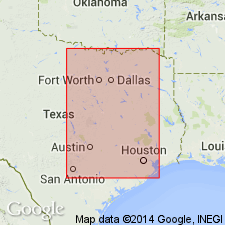
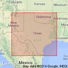
- Areal extent
- AAPG geologic province:
-
- Ouachita folded belt
Summary:
Pg. 133-146. Austin chalk. Consists of interbedded layers of hard chalk, softer chalk, and chalky marl; some of marly layers are strongly argillaceous as in upper part that Adkins (1933) called Burditt marl. Estimated thickness at type locality 420 feet. Relation of faunal zones in upper part of Austin chalk to top of chalk indicates presence of unconformity of regional extent separating the Austin and beds of Austin age from overlying Taylor marl and beds of Taylor age. Time value of this unconformity varies from place to place along strike. [Age is Late Cretaceous (Gulf).]
Source: US geologic names lexicon (USGS Bull. 1200, p. 173).
- Usage in publication:
-
- Austin group
- Modifications:
-
- Revised
- AAPG geologic province:
-
- Ouachita folded belt
Summary:
Pg. 34-39. Austin group comprises Ector tongue, Bonham clay, Blossom sand, Brownstown marl, Gober tongue, Austin chalk, and Burditt marl. Below Taylor group and above Eagle Ford group. Foraminifera described. [Age is Late Cretaceous (Gulf).]
Source: US geologic names lexicon (USGS Bull. 1200, p. 173).

- Usage in publication:
-
- Austin Chalk
- Modifications:
-
- Mapped 1:250k
- Dominant lithology:
-
- Chalk
- Marl
- AAPG geologic province:
-
- Ouachita folded belt
- East Texas Basin
Summary:
Austin Chalk. Chalk and marl; mostly microgranular calcite with minor foraminifer tests, averages 85 percent calcium carbonate, ledge-forming, grayish white to white, alternates with marl, bentonitic seams locally, recessive, medium-gray. Thickness 150 to 300 feet. Lies above South Bosque Formation of Eagle Ford Group and below Ozan Formation ("lower Taylor marl"). Age is Late Cretaceous.
Mapped in Bell, McLennan, Hill, and Falls Cos., eastern TX.
Source: Publication.
- Usage in publication:
-
- Austin Chalk
- Modifications:
-
- Areal extent
- AAPG geologic province:
-
- East Texas basin
Summary:
Austin Chalk. Age is Late Cretaceous.
Not separately mapped. Occurs on Brooks dome, southwestern Smith Co., northeastern TX.
Source: Publication.

- Usage in publication:
-
- Austin Chalk
- Modifications:
-
- Mapped 1:250k
- Dominant lithology:
-
- Chalk
- Limestone
- AAPG geologic province:
-
- Gulf Coast basin
Summary:
Austin Chalk. Chalk and limestone; hard lime mudstone to soft chalk, glauconitic; marine megafossils common. Only upper 20 to 30 feet present at surface; total thickness about 1,200 feet. Lies below Upson Clay. Age is Late Cretaceous; is oldest unit mapped in this sheet.
[Mapped in northwestern Maverick Co., southwestern TX.]
Source: Publication.

- Usage in publication:
-
- Austin Chalk
- Modifications:
-
- Mapped 1:250k
- Dominant lithology:
-
- Mudstone
- Chalk
- AAPG geologic province:
-
- Ouachita folded belt
- Gulf Coast basin
- Permian basin
Summary:
Austin Chalk. Hard lime mudstone to soft chalk. Grayish white to white, mostly microgranular calcite with minor foraminifer tests and INOCERAMUS prisms, sparsely glauconitic, pyrite nodules in part weathered to limonite common, occasional beds with large-scale cross-stratification, ledge-forming; locally highly fossiliferous. Thickness about 580 feet in eastern part of sheet; thickens southwestward. Mapped in southern Kinney, southwestern Uvalde, northwestern Maverick, southern Val Verde, and southern Terrell Counties, Texas. West of Devils River, in Val Verde County, overlies Boquillas Flags; east of Devils River, overlies Eagle Ford Group. In northwestern Maverick and southern Kinney Counties, underlies Upson Clay; eastward in Anacacho Mountains, Kinney and Uvalde Counties, where the Upson feathers out, underlies Anacacho Limestone. Age is Late Cretaceous.
Source: Modified from GNU records (USGS DDS-6; Denver GNULEX).

- Usage in publication:
-
- Austin Chalk
- Modifications:
-
- Mapped 1:250k
- Dominant lithology:
-
- Chalk
- Marl
- AAPG geologic province:
-
- Ouachita folded belt
Summary:
Pamphlet [p. 5]. Austin Chalk. Alternating chalk and marl. Chalk mostly microgranular calcite with minor foraminifer tests and INOCERAMUS prisms, averages about 85 percent calcium carbonate, ledge-forming, grayish white to white. Marl, bentonitic seams locally, recessive, medium-gray, sparsely glauconitic, pyrite nodules in part weathered to limonite common, occasional beds with large-scale cross-stratification. Locally highly fossiliferous. Thickness 350 to 580 feet; thickens westward. [Commonly faulted; locally (e.g., in Comal County, Texas) is faulted-out entirely.] Underlies, and in part correlative with, Anacacho Limestone (west of San Antonio) and Pecan Gap Chalk (east of Medina River). Overlies Eagle Ford Group. Age is Late Cretaceous.
[Mapped in Uvalde, Medina, Bexar, Comal, and Hays Cos., southern TX.]
Source: Publication; supplemental information from GNU records (USGS DDS-6; Denver GNULEX).

- Usage in publication:
-
- Austin Chalk
- Modifications:
-
- Mapped 1:250k
- Dominant lithology:
-
- Chalk
- Marl
- Clay
- AAPG geologic province:
-
- Fort Worth syncline
- Ouachita folded belt
Summary:
Austin Chalk. Upper and lower parts, chalk, mostly microgranular calcite, massive, some interbeds and partings of calcareous clay, thin bentonitic beds locally in lower part, lower part forms westward-facing scarp; light gray. Middle part, mostly thin-bedded marl with interbeds of massive chalk, locally burrowed, marcasite-pyrite nodules common, light gray. Weathers white, marine megafossils scarce. Thickness 300 to 500 feet, thins southward. Lies above Eagle Ford Group and below Ozan Formation ("lower Taylor marl"). Age is Late Cretaceous.
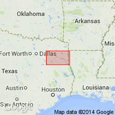
[Mapped in Collin, Dallas, Denton, Ellis, and Hill Cos., central northern TX.]
Source: Publication.

- Usage in publication:
-
- Austin Group
- Modifications:
-
- Mapped 1:250k
- Dominant lithology:
-
- Chalk
- Marl
- AAPG geologic province:
-
- East Texas basin
- Fort Worth syncline
- Ouachita folded belt
- South Oklahoma folded belt
Summary:
Pamphlet [p. 3]. Austin Group on maps (1967 ed. and revised 1991 ed.). Austin [Group] undivided southward [Grayson, Collins, and Denton Counties, Texas]. Upper and lower parts, chalk, light-gray, massive, some interbeds and partings of calcareous clay, marine megafossils scarce. Middle part, mostly thin-bedded marl with interbeds of massive chalk, light-gray, weathers white, marine megafossils scarce. Austin [Group] subdivided eastward into six units: Roxton Limestone, Gober Chalk, Brownstown Marl, Blossom Sand, Bonham Marl, and Ector Chalk [see also entries under individual formations]. Thickness of Austin Group approximately 600 feet. Lies above Eagle Ford Formation and below Ozan Formation. Age is Late Cretaceous.
[Typographical error, p. 3 of pamphlet (revised 1991 ed.): Austin Group listed as Austin Chalk.]
Source: Publication.
For more information, please contact Nancy Stamm, Geologic Names Committee Secretary.
Asterisk (*) indicates published by U.S. Geological Survey authors.
"No current usage" (†) implies that a name has been abandoned or has fallen into disuse. Former usage and, if known, replacement name given in parentheses ( ).
Slash (/) indicates name conflicts with nomenclatural guidelines (CSN, 1933; ACSN, 1961, 1970; NACSN, 1983, 2005, 2021). May be explained within brackets ([ ]).