


- Usage in publication:
-
- Ashe Formation*
- Modifications:
-
- Named
- Dominant lithology:
-
- Gneiss
- Schist
- Amphibolite
- AAPG geologic province:
-
- Piedmont-Blue Ridge province
Summary:
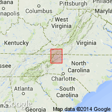
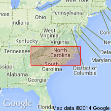
Named for Ashe Co., northwestern NC. Occurs in northwestern NC and southwestern VA. Includes rocks called Roan Gneiss and Carolina Gneiss, abandoned by Bryant (1962) and Brobst (1962). Includes rocks mapped as Lynchburg Formation near Galax, VA by Stose and Stose (1957). Author concurs with previous work by Keith (1903) and Bryant (1962, 1963) who studied rocks both northeast and southwest of Grandfather Mountain window and concluded that layered amphibolites, mica gneisses, and schists in Spruce Pine district (southwest of window) correlated with those northwest of window; therefore, rocks on both sides of window are included in Ashe. Consists of fine- to medium-grained biotite-muscovite gneiss and amphibolite interlayered in places with biotite-muscovite schist. Thickness unknown because of intense deformation, but probably measurable in miles. Gneiss beds range in thickness from 1 to 2 ft up to 10 ft. Amphibolite beds range from less than 1 in. to hundreds of feet. Contact with Cranberry Gneiss is nonconformable on both sides of Grandfather Mountain window, contrary to many previous studies. Ashe is clearly younger than Cranberry, dated at 1050 m.y by Davis and others (1962). In Spruce Pine district, Ashe is cut by pegmatites and alaskite dated at 350 m.y. Ashe is in part correlative with Lynchburg Formation, and may correlate with Catoctin and Swift Run Formations to the north. Thus, age is late Precambrian. Report includes geologic map.
Source: GNU records (USGS DDS-6; Reston GNULEX).
- Usage in publication:
-
- Ashe Formation*
- Modifications:
-
- Areal extent
- Overview
- AAPG geologic province:
-
- Piedmont-Blue Ridge province
Summary:
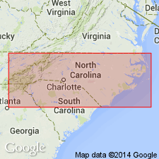
Ashe Formation mapped in Blue Ridge belt north of Grandfather Mountain window, from north of Boone, northwestern NC, to eastern edge of quad where it passes into southwestern VA. South of Grandfather Mountain window, Ashe is mapped only in the southwestern corner of the quad, near Crossnore. Age is late Precambrian. Equivalent to parts of Roan and Carolina Gneisses of Keith (1903). Divided into biotite-muscovite gneiss, mica schist, amphibolite, and basal conglomerate (shown only in two locations: 1) 7.8 mi northeast of Jefferson, NC, and 2) south of Independence, VA, on north bank of New River, about 1000 ft east of US Hwy 21.
Source: GNU records (USGS DDS-6; Reston GNULEX).
- Usage in publication:
-
- Ashe Formation
- Modifications:
-
- Areal extent
- AAPG geologic province:
-
- Piedmont-Blue Ridge province
Summary:
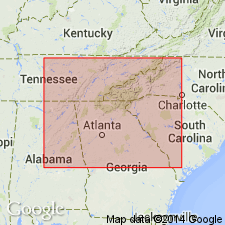
Rocks mapped as Ashland Mica Schist by Crickmay (1952) in GA and NC, and by Adams and others (1926) in AL, are actually two different rock sequences which are better embraced by the term "Group" rather than "Mica Schist." Lithologic distribution of amphibolites suggests that Ashland Group correlates with Ashe Formation in NC and with Mount Rogers Formation farther to the northeast. [Note that Ashland Group contains no named formations, only an unnamed upper and lower sequence.]
Source: GNU records (USGS DDS-6; Reston GNULEX).
- Usage in publication:
-
- Ashe Formation*
- Modifications:
-
- Areal extent
- Overview
- AAPG geologic province:
-
- Piedmont-Blue Ridge province
Summary:
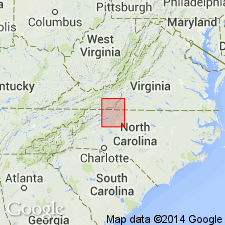
Ashe Formation shown as extending from Galax in Carroll Co., southwestern VA, northeast to the corner of the quadrangle, around Pigg River in Franklin Co., VA. Equivalent in part to Lynchburg Formation of Stose and Stose (1957). Divided into biotite-muscovite gneiss, mica schist, amphibolite, and marble. Age is younger Precambrian.
Source: GNU records (USGS DDS-6; Reston GNULEX).
- Usage in publication:
-
- Ashe Metamorphic Suite
- Modifications:
-
- Revised
- Redescribed
- Dominant lithology:
-
- Gneiss
- Schist
- Marble
- Metaconglomerate
- Breccia
- AAPG geologic province:
-
- Piedmont-Blue Ridge province
Summary:
Ashe Formation raised in rank to Ashe Metamorphic Suite. Major lithologies include amphibole gneiss and schist, mica gneiss and schist, quartz-feldspar semischist and gneiss, and various ultramafic lithologies. Locally includes dolomitic marble, possible polymict metaconglomerate, and amphibole schist breccia. Because of heterogeneous nature and structural complexity, rank has been changed in accordance with North American Code of Stratigraphic Nomenclature (1983).
Source: GNU records (USGS DDS-6; Reston GNULEX).
- Usage in publication:
-
- Ashe Metamorphic Suite
- Modifications:
-
- Overview
- AAPG geologic province:
-
- Piedmont-Blue Ridge province
Summary:
Ashe Metamorphic Suite and Tallulah Falls Formation are lumped together and divided into five unnamed lithologic subdivisions: amphibolite, biotite gneiss, muscovite schist, muscovite-biotite gneiss, and metagraywacke.
Source: GNU records (USGS DDS-6; Reston GNULEX).
- Usage in publication:
-
- Ashe Metamorphic Suite
- Modifications:
-
- Overview
- Age modified
- Geochronologic dating
- AAPG geologic province:
-
- Piedmont-Blue Ridge province
Summary:
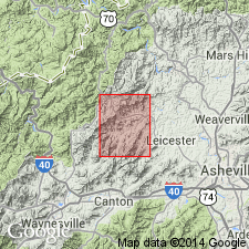
Ashe Metamorphic Suite consists of mixed assemblage of clastic sediments and metavolcanic rocks. In Sandymush and Canton quads, dominant rock types include two-mica schist, metagraywacke, and two-mica gneiss; minor rock types includes amphibolite and calc-silicate granofels. For mapping purposes, Ashe is divided into a schist-dominated unit and metagraywacke- and gneiss-dominated unit. Late Proterozoic age is supported by correlation with Lynchburg-Catoctin sequence of Virginia, dated at 820 Ma by Rankin and others (1969). Relations with Bakersville Gabbro, dated at 734 +/-24 Ma by Goldberg and others (1986) shows Bakersville does not intrude Ashe, so Ashe is younger than 734 Ma. Whiteside, Looking Glass, and Pink Beds plutons intrude Ashe and have Rb-Sr whole-rock isochrons of about 390 Ma. Rabun Gneiss intrudes Ashe and is dated at 450-500 Ma by Fullagar (1983); however, zircon ages of Rabun Gneiss by T. Stern (USGS) are 373-351 Ma (A.E. Nelson, 1988, written commun.). Alaskites and pegmatites intruding Ashe are dated at 435 to 390 Ma. Metamorphism, dated at 470-430 Ma by Butler (1973) affected Ashe. Ashe overlies Middle Proterozoic rocks; upper contact is not present in study area. Ashe is younger than 734 Ma and no younger than Early or Middle Ordovician. A Late Proterozoic age is accepted in this report.
Source: GNU records (USGS DDS-6; Reston GNULEX).
- Usage in publication:
-
- Ashe Metamorphic Suite
- Modifications:
-
- Age modified
- AAPG geologic province:
-
- Piedmont-Blue Ridge province
Summary:
The Toe terrane, a block-in-block matrix tectonostratigraphic terrane, consists of Ashe Metamorphic Suite, Alligator Back Metamorphic Suite, Tallulah Falls Metamorphic Suite, and Coweeta Group. Ashe is crosscut by Devonian Spruce Pine Intrusive Suite rocks (about 400 Ma), which are quartz diorite to granitoid, just west of Grandfather Mountain window. This sets a minimum age limit for Ashe.
Source: GNU records (USGS DDS-6; Reston GNULEX).

- Usage in publication:
-
- Ashe Formation
- Modifications:
-
- Revised
- AAPG geologic province:
-
- Piedmont-Blue Ridge province
Summary:
Ashe Formation is assigned to the Lynchburg Group on the State map. It is divided into three lithologic map units: amphibolite, mica schist or phyllite, and biotite gneiss. Intertonguing in the lower portion of the Ashe is a hornblende-biotite gneiss, the Moneta Gneiss, which is also here assigned to the Lynchburg Group. Underlies the Alligator Back Formation of the Lynchburg Group. The Ashe is shown as Late Proterozoic.
Source: GNU records (USGS DDS-6; Reston GNULEX).
- Usage in publication:
-
- Ashe Formation*
- Modifications:
-
- Age modified
- AAPG geologic province:
-
- Piedmont-Blue Ridge province
Summary:
Age of Ashe Formation changed to Cambrian and Early Ordovician to agree with Rankin and others (1993) that the Ashe was formed as an accretionary wedge during subduction of Iapetan oceanic crust. Thus, age of Ashe is bracketed between opening of Iapetus sea, at roughly the beginning of the Cambrian, and Taconian closing of Iapetus in Early Ordovician time.
Source: GNU records (USGS DDS-6; Reston GNULEX).
- Usage in publication:
-
- Ashe Formation*
- Modifications:
-
- Revised
- AAPG geologic province:
-
- Piedmont-Blue Ridge province
Summary:
Ashe Formation revised to include only those rocks within Jefferson terrane stratigraphically(?) below Alligator Back Formation. Base of Ashe is not preserved because it would have been cut out by sole thrust fault of Jefferson terrane. Rocks here named Wills Ridge Formation were previously mapped as Ashe Formation by Espenshade and others, 1975). Rocks mapped as Moneta Gneiss Conley and Henika (1970), Henika (1971), and Conley (1978) have long been thought to be Ashe Formation (Rankin and others, 1973). Type section of Ashe was defined by Rankin and others (1973) as those exposures along South Fork of New River between Cranberry Gneiss contact and Obids Creek. Structurally lowest ultramafic body in Ashe, which is here designated as northern terminus of type section, is 1.8 km south of Cranberry Gneiss contact along the South Fork. Report includes geologic maps, correlation chart, and isotopic data.
Source: GNU records (USGS DDS-6; Reston GNULEX).
For more information, please contact Nancy Stamm, Geologic Names Committee Secretary.
Asterisk (*) indicates published by U.S. Geological Survey authors.
"No current usage" (†) implies that a name has been abandoned or has fallen into disuse. Former usage and, if known, replacement name given in parentheses ( ).
Slash (/) indicates name conflicts with nomenclatural guidelines (CSN, 1933; ACSN, 1961, 1970; NACSN, 1983, 2005, 2021). May be explained within brackets ([ ]).