- Usage in publication:
-
- Alum Bluff beds*
- Modifications:
-
- Named
- Dominant lithology:
-
- Sand
- Clay
- AAPG geologic province:
-
- South Georgia sedimentary province
Summary:
Named for exposures at Alum Bluff [on Apalachicola River, Liberty Co., FL]. Consists of gray, siliceous sand and a little clay, without fossils. Thickness is 5 to 15 feet. Underlain by richly calcareous, rather ferruginous Chipola marl; overlain by unnamed fossiliferous bed containing ECPHORA. Alum Bluff represents a transition zone; name is applied provisionally until more information is gathered. Represents top of older Miocene.
Source: GNU records (USGS DDS-6; Reston GNULEX).
- Usage in publication:
-
- Alum Bluff formation
- Modifications:
-
- Revised
- AAPG geologic province:
-
- South Georgia sedimentary province
Summary:
Alum Bluff formation. As here defined is underlain by Chattahoochee formation and overlain by Choctawhatchee marl. It includes Chipola marl member (=Chipola marl of Dall), Oak Grove sand of Dall, and, in upper part, Shoal River marl member (new). [Age is early and middle Miocene.]
Source: US geologic names lexicon (USGS Bull. 896, p. 42-43).
- Usage in publication:
-
- Alum Bluff formation*
- Modifications:
-
- Age modified
- Biostratigraphic dating
- AAPG geologic province:
-
- South Georgia sedimentary province
Summary:
Flora represent Oligocene or basal Miocene; can be considered either Aquitanian (more likely) or Burdigalian. Alum Bluff flora is younger than Vicksburg Oligocene and older than Chesapeake Miocene.
Source: GNU records (USGS DDS-6; Reston GNULEX).
- Usage in publication:
-
- Alum Bluff formation*
- Modifications:
-
- Areal extent
- AAPG geologic province:
-
- Mid-Gulf Coast basin
Summary:
In part 1 by Matson, Oligocene Alum Bluff formation is shown in AL, correlative with Hattiesburg formation of AL, MS, LA, and TX. Overlies Chattahoochee formation; underlies Miocene Pascagoula clay.
Source: GNU records (USGS DDS-6; Reston GNULEX).
- Usage in publication:
-
- Alum Bluff group*
- Modifications:
-
- Revised
- AAPG geologic province:
-
- South Georgia sedimentary province
Summary:
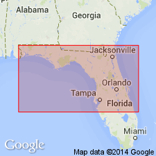
Alum Bluff raised to group rank. Consists of (ascending) Chipola formation, Oak Grove sand, and Shoal River formation (all ranks raised). Unconformably underlies Choctawhatchee marl; unconformably overlies Chattahoochee formation. Thickness ranges from 0 to 400 ft. Rocks are of marine origin.
Source: GNU records (USGS DDS-6; Reston GNULEX).
- Usage in publication:
-
- Alum Bluff group*
- Modifications:
-
- Revised
- AAPG geologic province:
-
- South Georgia sedimentary province
Summary:
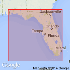
Alum Bluff group. At Alum Bluff, the type locality, the Alum Bluff group consists of Chipola formation, but there is possibility that 6 feet of beds overlying the Chipola there may represent Oak Grove sand or Shoal River formation, or they may belong to the post-Alum Bluff Choctawhatchee formation. The Hawthorn formation of Florida and southern Georgia is contemporaneous with Chipola formation, but of different lithology, and it is now included in Alum Bluff group. [Age is early and middle Miocene.]
Source: US geologic names lexicon (USGS Bull. 896, p. 42-43).
- Usage in publication:
-
- Alum Bluff group*
- Modifications:
-
- Revised
- Areal extent
- AAPG geologic province:
-
- South Georgia sedimentary province
- Florida platform
Cooke, C.W., 1945, Geology of Florida: Florida Geological Survey Bulletin, no. 29, 339 p.
Summary:
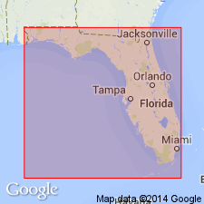
Pg. 18 (table), 136-144. Alum Bluff group. Formations now included in group are (descending) Shoal River formation, Chipola formation, and Hawthorn formation (east of Apalachicola River). Oak Grove sand included in Shoal River formation. Group consists predominantly of micaceous sand, sandy clay, fuller's earth, and limestone. Conformably overlies Tampa limestone [formerly Chattahoochee formation], or, where Tampa is absent, Ocala limestone or Suwanee limestone forms the bedrock. Unconformably underlies Duplin marl or Pliocene or Pleistocene deposits.
Outcrop extends eastward to Columbia County and from there southward to Marion, Manatee, and Sarasota Counties, northern to west-central Florida.
[Misprint (US geologic names lexicon, USGS Bull. 1200, p. 69): date of publication is 1945, not 1954.]
Source: US geologic names lexicon (USGS Bull. 1200, p. 69).
- Usage in publication:
-
- Alum Bluff stage
- Modifications:
-
- Revised
- Age modified
- AAPG geologic province:
-
- South Georgia sedimentary province
Summary:
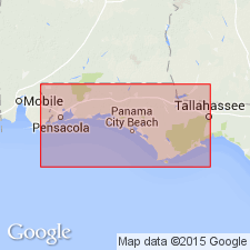
Pg. 16 (table 1), 18 (fig. 2), 21-27, fig. 3 facing p. 18. Alum Bluff stage. Embraces all sediments of post-Tampa and pre-Choctawhatchee age, the middle Miocene of most authors, in Florida Panhandle and their equivalents in Central and Western Gulf States. In Florida Panhandle, includes Chipola, Shoal River, Oak Grove, and Hawthorn facies.
Source: US geologic names lexicon (USGS Bull. 1200, p. 69).
- Usage in publication:
-
- Alum Bluff Group
- Modifications:
-
- Not used
- AAPG geologic province:
-
- South Georgia sedimentary province
Summary:
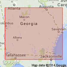
Alum Bluff Group is restricted from GA. Hawthorne Formation is raised in rank to Group and this name applied to all rocks formerly mapped as Alum Bluff, exclusive of the Altamaha Formation. The Hawthorne is an Atlantic continental shelf deposit, while the Alum Bluff Group of FL is an eastern Gulf of Mexico continental shelf deposit. The Altamaha Formation, here recognized as a formation separate from the Hawthorne and Alum Bluff Groups, is a fluvial to upper estuary deposit. The Alum Bluff Group of western FL is distinguished from the equivalent and adjacent Hawthorne Group in four ways: 1) the Alum Bluff is never dolomitic, but commonly calcareous and macro- and microfossiliferous, while dolomite is the characteristic carbonate mineral of the Hawthorne and macro-and microfossils are generally lacking; 2) phosphate occurrence in the Alum Bluff is very minor, while most Hawthorne deposits are phosphatic; 3) Alum Bluff clays do not contain palygorskite or sepiolite, while Hawthorne deposits commonly contain an appreciable amount of these magnesium-rich clay minerals; and 4) chert, siliceous claystone and diatomaceous sediments are not known to occur in Alum Bluff deposits, but are common and conspicuous in the Hawthorne.
Source: GNU records (USGS DDS-6; Reston GNULEX).
- Usage in publication:
-
- Alum Bluff Group
- Modifications:
-
- Revised
- AAPG geologic province:
-
- Mid-Gulf Coast basin
Summary:
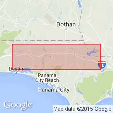
Alum Bluff Group referred to as undifferentiated in this report. Because formations assigned by previous workers were differentiated on the basis of micro- and macrofossil faunas and implied age, not lithology, and do not satisfy the requirements of the Code, they are not used by this author. Unit is described in several outcrops and includes sediments differentiated as Chipola, Shoal River, Oak Grove, Whites Creek, Choctawhatchee, Red Bay, and Yellow River by others. The Alum Bluff (undifferentiated) is exposed in the panhandle to the west as far as Oak Grove, Okaloosa Co., and as far east as Jackson Bluff, Leon Co. The 122-ft outcrop at the type section of the Alum Bluff in Liberty Co. is here redescribed. The lower 30-ft-thick sequence of sand and limestone and a middle 34.5-ft-thick sequence of clay and sand ("Aluminous beds"), are referred to the Alum Bluff. The intervening 14 ft are assigned to the Jackson Bluff Formation and the upper 43.5 ft to the Citronelle Formation and undifferentiated sand and clay sediments. This interpretation differs dramatically from that of Dall and Harris (1892), Cooke and Mossom (1929), Cooke (1945), DuBar and Beardsley (1961), and Puri and Vernon (1964).
Source: GNU records (USGS DDS-6; Reston GNULEX).
- Usage in publication:
-
- Alum Bluff Group
- Modifications:
-
- Biostratigraphic dating
- Revised
- Age modified
- AAPG geologic province:
-
- Florida platform
Summary:
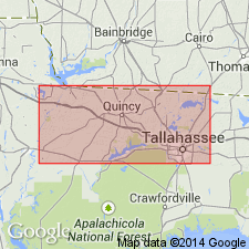
New data supports the view that the Alum Bluff and Hawthorn Groups are relatively contemporaneous. Age of the Torreya Formation of the Hawthorn Group is constrained to late early to early middle Miocene (19 to 15.3 Ma). The Chipola Formation of the Alum Bluff Group, which interfingers with the Torreya at Alum Bluff, is largely older than the Torreya. 87Sr/86Sr ages from four mollusk samples at the top of the Chipola yield estimates between 18.3 and 18.9 (+/-1.0) Ma. The "Fort Preston sand," an informal unit here assigned to the Alum Bluff, overlies the Chipola and correlates, in part, with the upper part of the Torreya Formation. The Fort Preston contains a small vertebrate fauna of late Hemingfordian or early Barstovian age.
Source: GNU records (USGS DDS-6; Reston GNULEX).
For more information, please contact Nancy Stamm, Geologic Names Committee Secretary.
Asterisk (*) indicates published by U.S. Geological Survey authors.
"No current usage" (†) implies that a name has been abandoned or has fallen into disuse. Former usage and, if known, replacement name given in parentheses ( ).
Slash (/) indicates name conflicts with nomenclatural guidelines (CSN, 1933; ACSN, 1961, 1970; NACSN, 1983, 2005, 2021). May be explained within brackets ([ ]).

