

- Usage in publication:
-
- Alibates dolomite lentil*
- Modifications:
-
- Original reference
- Dominant lithology:
-
- Dolomite
- Clay
- AAPG geologic province:
-
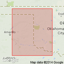
- Amarillo arch
- Palo Duro basin
Summary:
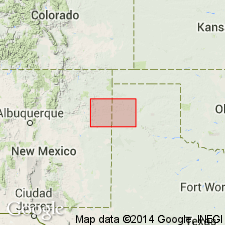
Pg. 17-20. Alibates dolomite lentil of Quatermaster formation. Massive white dolomite more or less flinty, usually in two ledges, the lower on 8 feet thick and upper one 2 feet thick, separated by 4 or more feet of red clay. Total thickness 15 feet. Local lentil in Quartermaster formation, near top. Separated from underlying Saddlehorse gypsum lentil by 50 to 60 feet of red shale with white bands and ledges of soft sandstone. [Age is Permian.]
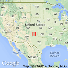
[Named from Alibates Creek, Potter Co., TX Panhandle. Type locality considered to be on Alibates Creek near Lat. 35 deg. 35 min. 39 sec. N., Long. 101 deg. 41 min. 08 sec. W., Alibates Ranch 7.5-min quadrangle, Potter Co., TX Panhandle (see R.K. Pabian, 2007, Agate Lexicon, Univ. Nebraska-Lincoln).]
Source: US geologic names lexicon (USGS Bull. 896, p. 32).
- Usage in publication:
-
- Alibates dolomite
- Modifications:
-
- Not used
Summary:
Pg. 8-25. Alibates dolomite is approx. = Day Creek dolomite and we recommend "Alibates" be dropped.
Source: US geologic names lexicon (USGS Bull. 896, p. 32).
- Usage in publication:
-
- Alibates dolomite
- Modifications:
-
- Not used
Summary:
Pg. 438. Alibates dolomite of Panhandle of Texas is same as Day Creek dolomite of western Oklahoma, which underlies Cloud Chief gypsum and overlies Whitehorse sandstone.
Source: US geologic names lexicon (USGS Bull. 896, p. 32).
- Usage in publication:
-
- Alibates dolomite
- Modifications:
-
- Not used
Summary:
Pl. 8. Mapped Day Creek dolomite, Whitehorse sandstone, and Dog Creek dolomite in Hutchison, Carson, Potter, Moore, and Oldham Counties, Texas, and did not show any Quatermaster formation as present there. The exposures, however, are rather widely separated from the exposures of these formations in Oklahoma. Age is Permian.
Source: US geologic names lexicon (USGS Bull. 896, p. 32).
- Usage in publication:
-
- Alibates dolomite lentil*
- Modifications:
-
- Overview
- AAPG geologic province:
-
- Anadarko basin
- Palo Duro basin
Summary:
Pg. 167, 243. Alibates dolomite lentil of Quartermaster formation. Placed Alibates dolomite and Saddlehorse gypsum in Quartermaster formation, stating that Alibates is in upper part of that formation and the Saddlehorse 60 to 80 feet above base of Quartermaster. Age is Permian.
Source: US geologic names lexicon (USGS Bull. 896, p. 32).
- Usage in publication:
-
- Alibates Dolomite
- Modifications:
-
- Mapped
- Dominant lithology:
-
- Dolomite
- Shale
- Chert
- AAPG geologic province:
-
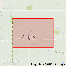
- Palo Duro basin
- Amarillo arch
Summary:
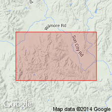
Alibates Dolomite [unranked] separately mapped at top of Quartermaster Formation, Cloud Chief Gypsum, and Whitehorse Sandstone (undivided) in two areas along Canadian River drainage, in Texas Panhandle portion of this map sheet. Is mapped in northwest Oldham County and in vicinity of Tecoyas Creek, in western Potter County, Texas. Map unit comprises an upper and lower dolomite separated by shale; upper dolomite locally absent; dolomite locally replaced by chert, which is banded and mottled red, pink, pale blue, pale purple, gray, brown, and black; forms ledges; average thickness 15 feet. Age is Permian.
Source: Modified from GNU records (USGS DDS-6; Denver GNULEX).
For more information, please contact Nancy Stamm, Geologic Names Committee Secretary.
Asterisk (*) indicates published by U.S. Geological Survey authors.
"No current usage" (†) implies that a name has been abandoned or has fallen into disuse. Former usage and, if known, replacement name given in parentheses ( ).
Slash (/) indicates name conflicts with nomenclatural guidelines (CSN, 1933; ACSN, 1961, 1970; NACSN, 1983, 2005, 2021). May be explained within brackets ([ ]).