

- Usage in publication:
-
- Saturday Mountain formation*
- Modifications:
-
- Named
- Dominant lithology:
-
- Dolomite
- Limestone
- AAPG geologic province:
-
- Idaho Mountains province
Summary:
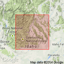
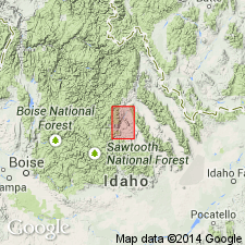
Named for a ridge [called Saturday Mountain], T11N, R17E, its type locality, west of lower Squaw Creek, Bayhorse quad, Custer Co, ID in the Idaho Mountains province. Mapped only near Squaw Creek. Composed of dirty buff (weathered) shaly dolomite and magnesian limestone, most of which is black on fresh fracture. Argillaceous [shaly] beds are banded and break into thin slabs parallel to bedding. Some beds have rounded pebbles of quartz and quartzite about 0.1 mm in diameter. Some carbonaceous lenses. Estimated to be about 3,000 ft thick. Is slightly more than 300 ft thick in exposures near Saturday Mountain. Is younger than Kinnikinic quartzite (new) and older than Trail Creek formation (new). Poorly preserved coral fossils suggest late Richmond age. Fossil graptolites of Late Ordovician age. Fossils listed. Contains same fossils as Fish Haven Dolomite. Of Late Ordovician age. Correlation chart.
[NOTE: The Department of the Interior's Secretarial Order 3404, issued on November 19, 2021, formally identifies the term “squaw” as derogatory. That Order will create a federal Derogatory Geographic Names Task Force, to find replacement names for geographic features in use by federal agencies. We’re awaiting guidance from the Task Force, and will then take the appropriate actions.]
Source: GNU records (USGS DDS-6; Denver GNULEX).
- Usage in publication:
-
- Saturday Mountain Formation
- Modifications:
-
- Areal extent
- AAPG geologic province:
-
- Idaho Mountains province
Summary:
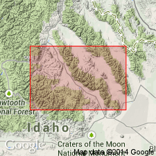
Considered to be the transitional facies between Phi Kappa Formation on south and Fish Haven Dolomite on east. Type Saturday Mountain bears no resemblance to pure dolomites of Late Ordovician age. Author restricts Saturday Mountain to its type and uses Fish Haven for pure dolomites. Section 1,500 to 1,700 ft thick measured in "type area" at Squaw Creek valley east of Saturday Mountain in T11N, R17E, Custer Co, ID in the Idaho Mountains province where it overlies Kinnikinic Quartzite and underlies Milligen Formation. Contains corals, brachiopods, and graptolites. Of Ordovician [but not clear whether formation is only Late Ordovician]. Correlation chart. Block diagram. Cross sections.
[NOTE: The Department of the Interior's Secretarial Order 3404, issued on November 19, 2021, formally identifies the term “squaw” as derogatory. That Order will create a federal Derogatory Geographic Names Task Force, to find replacement names for geographic features in use by federal agencies. We’re awaiting guidance from the Task Force, and will then take the appropriate actions.]
Source: GNU records (USGS DDS-6; Denver GNULEX).
- Usage in publication:
-
- Saturday Mountain Formation*
- Modifications:
-
- Overview
- AAPG geologic province:
-
- Idaho Mountains province
- Snake River basin
Summary:
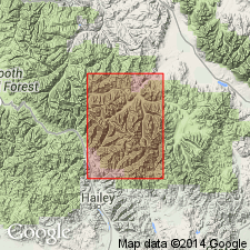
Mapped in western, southwestern, and northeastern margins of Pioneer window within east-central part of study area, Blaine and Custer Cos, ID, Snake River basin and Idaho Mountains province. Consists predominantly of dark-gray marble containing disseminated diopside, graphite?, and quartz. Top truncated by thrust faults; minimum thickness is 240 m. Youngest Paleozoic unit within Pioneer window; conformably overlies Kinnikinic Quartzite with sharp contact. Deformed crinoid columnals and unidentifiable remnants of shelly fossils occur in lower part; contains few fragments of Middle Ordovician trilobites. Assigned Middle and Late Ordovician age.
Source: GNU records (USGS DDS-6; Denver GNULEX).
- Usage in publication:
-
- Saturday Mountain Formation*
- Modifications:
-
- Age modified
- Revised
- Areal extent
- AAPG geologic province:
-
- Idaho Mountains province
Summary:
Mapped in isolated outcrops in Beaverhead Mountains, and in central and southern parts of Lemhi Range, central Lemhi Co, ID in Idaho Mountains province, in preference to Fish Haven Formation. Name applied to rocks between Kinnikinic Quartzite below and Laketown Dolomite above. Lower contact modified to include Lost River Member (formerly a member of Fish Haven Dolomite of Churkin, 1962). Averages 370 m thick in central Lemhis. Thins to 85 m at south end of range. Thins east to 0 in Beaverhead Mountains. Lost River is a thin (up to 17 m) interbedded sandstone, quartzite, shale, and mudstone sequence. Overlying main part of Saturday Mountain is light to dark gray fossiliferous, finely crystalline dolomite that has abundant black chert as irregular nodules. Fossils (trilobites, brachiopods, stromatoporoids, cephalopods) listed. Is of Late Ordovician age at south end of Lemhi Range. Early Silurian coral HALYSITES recovered from upper 140-150 cm in central part of range. Age changed from Middle and Late Ordovician to Middle and Late Ordovician and Early Silurian. Measured section on east flank Rocky Peak, Leadore quad. Generalized columnar section diagram.
Source: GNU records (USGS DDS-6; Denver GNULEX).
- Usage in publication:
-
- Saturday Mountain Formation*
- Modifications:
-
- Areal extent
- AAPG geologic province:
-
- Idaho Mountains province
Summary:
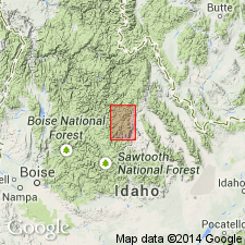
Outcrops in Bayhorse region, Custer Co, ID, Idaho Mountains province, total less than 6 mi square, and they occur 1) along lower Squaw Creek, 2) 2 mi east of west edge and 3) in northeast part of Lone Pine Peak quad. Has no uninterrupted sections due to folding and faulting. Thickness at type estimated as 3,000 to 4,000 ft. At type basal contact with Kinnikinic sharp and conformable. Basal black shale or siltstone becomes dolomitic a few tens of ft above basal contact. Sequence changes above contact over several hundred ft from black shale through a 1) fine sandy or silty zone to an impure limestone, 2) medium-bedded, dark-gray, mottled, fine-grained, fetid dolomite with carbonate veinlets, 3) resistant dolomitic quartzite and black crystalline dolomite and black brittle shale with a graptolite fauna, to gray calcareous shale and siltstone, 4) gray and green shale and siltstone, 5) medium- to thin-bedded, gray, fine-grained dolomite with beds and stringers of chert, 6) laminated gray, fine-grained, impure limestone, 7) brown-gray, medium-bedded, dolomitic sandstone which may be Roberts Mountains Formation, rather than Saturday Mountain. In Lone Pine Peak quad, formation is medium- to thick-bedded, gray, microgranular to very fine grained pure dolomite, 900-1,000 ft thick, that is locally laminated, and silty or sandy in lower part. Faunas of Middle to Late Ordovician age, and perhaps Lower Silurian. Columnar sections.
[NOTE: The Department of the Interior's Secretarial Order 3404, issued on November 19, 2021, formally identifies the term “squaw” as derogatory. That Order will create a federal Derogatory Geographic Names Task Force, to find replacement names for geographic features in use by federal agencies. We’re awaiting guidance from the Task Force, and will then take the appropriate actions.]
Source: GNU records (USGS DDS-6; Denver GNULEX).
For more information, please contact Nancy Stamm, Geologic Names Committee Secretary.
Asterisk (*) indicates published by U.S. Geological Survey authors.
"No current usage" (†) implies that a name has been abandoned or has fallen into disuse. Former usage and, if known, replacement name given in parentheses ( ).
Slash (/) indicates name conflicts with nomenclatural guidelines (CSN, 1933; ACSN, 1961, 1970; NACSN, 1983, 2005, 2021). May be explained within brackets ([ ]).