

- Usage in publication:
-
- Quadrant formation*
- Modifications:
-
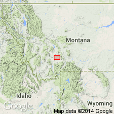
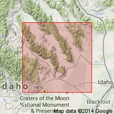
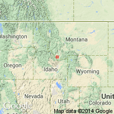
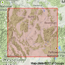
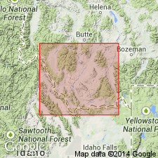
- Areal extent
- Dominant lithology:
-
- Limestone
- Quartzite
- AAPG geologic province:
-
- Montana folded belt
Summary:
Quadrant formation. Thin-bedded cherty limestones and quartzite layers (150 feet thick) underlain by 200 feet of red arenaceous limestones. At one place (north of Gallatin) the basal bed of formation is a conglomerate limestone. Boundary between the red limestones and the cherty limestones is a shifting one. The formation rests conformably on Madison limestone and is overlain by Ellis formation [Upper Jurassic] in vicinity of Three Forks, Montana. Fossils [Mississippian and Pennsylvanian] listed. The names for Paleozoic formations in this area were selected after consultation with Mr. Arnold Hague's division [to which Mr. Weed belonged].
Source: US geologic names lexicon (USGS Bull. 896, p. 1750).
- Usage in publication:
-
- Quadrant quartzite*
- Modifications:
-
- Principal reference
- Dominant lithology:
-
- Quartzite
- Limestone
- AAPG geologic province:
-
- Yellowstone province
Summary:
Quadrant quartzite. White, yellowish, and occasionally pink beds of quartzite, with intercalated beds of drab saccharoidal limestones. The quartzite is generally compact and in beds 4 to 25 feet thick. Thickness of formation averages 400 feet in Gallatin Range. [At type locality] rests on Madison limestone, and is separated from overlying Ellis formation by 200 feet of sandstones, gray limestones, and calcareous shales named Teton formation [Permian and Triassic].
Named from Quadrant Mountain, in southern Gallatin Range [northwest corner of Yellowstone Park, Wyoming], where it forms a picturesque bluff encircling the mountain, [in the vicinity of Lat. 44 deg. 55 min. N., Long. 110 deg. 50 min. W.], northwest WY. [Considered type locality by the US Geologic Names Committee (ca. 1938).]
Source: US geologic names lexicon (USGS Bull. 896, p. 1750).
- Usage in publication:
-
- Quadrant formation
- Modifications:
-
- Revised
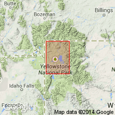
- Areal extent
Summary:
Pg. 1011-1032. Basal 100 feet of type section of Quadrant formation, consisting of limestone and shale, were originally called "talus," and cannot be considered part of the formation. This lower zone is Amsden formation, which rests on Madison limestone. [Scott's graphic section at Quadrant Mountain (p. 1016) shows his Amsden formation as consisting in upper half of massive limestone and in lower half of shaly sandstone and shale, from which it looks as if Weed included these beds in his Madison limestone.] The Quadrant is westward extension of Tensleep sandstone; it is marine; stratigraphic and paleontologic evidence indicates it is basal Pennsylvanian. The stratigraphic and paleontologic evidence shows Amsden is Mississippian, probably Chester. [Lower part of Amsden formation has long been correlated by the USGS with Brazer limestone, of upper (Chester) and middle Mississippian age.] As determined by tracing, true Quadrant wedges out 5 miles northeast of Lombard, Montana. It is unknown in central Montana, where the rocks that have been called Quadrant formation consist of the older Amsden formation underlain by Big Snowy group, divided into 3 formations. [See under Big Snowy group.] The Quadrant is present northwest of Lombard, also in vicinity of Helena, and in extreme southwestern and west-central Montana (Phillipsburg, Melrose, and Dillon areas). In most areas the Quadrant and the Tensleep are unconformable on Amsden formation, but the unconformity is not angular, and in vicinity of Three Forks there is evidence that would support theory of continuous deposition. A few sections show uper part of Amsden limestone interbedded with quartzite, which becomes more and more abundant until massive quartzites of the Quadrant are reached.
Source: US geologic names lexicon (USGS Bull. 896, p. 1750).

- Usage in publication:
-
- Quadrant quartzite*
- Quadrant formation*
- Modifications:
-
- Overview
Summary:
In this [Weed 1896] original definition of Quadrant formation at its type locality the Permian strata were included in Weed's overlying Teton formation. In subsequent reports on areas in Montana to northwest of Yellowstone Park Quadrant formation was applied to rocks that included the Permian strata later identified as northward extension of Phosphoria formation. In 1919 (USGS Prof. Paper 120F) D.D. Condit restricted Quadrant formation to Weed's original definition, called the overlying Permian strata Phosphoria formation and the underlying rocks Madison limestone, and stated that typical Quadrant had yielded Mississippian and Pennsylvanian fossils. In many subsequent reports the name was applied to strata of Pennsylvanian and Mississippian age resting on Madison limestone over large areas in Montana, but in Stillwater and Rosebud Counties region of [south-central] Montana the corresponding rocks have been divided into Tensleep sandstone and Amsden formation.
Source: US geologic names lexicon (USGS Bull. 896, p. 1750).
- Usage in publication:
-
- Quadrant Formation*
- Modifications:
-
- Age modified locally
- AAPG geologic province:
-
- Idaho Mountains province
- Snake River basin
Summary:
Pg. 4, figs. 1, 4. Quadrant Formation. In the central Beaverhead Mountains, Scholten and Ramspott (1968, GSA Spec. Paper, no. 104), Ruppel (1968, USGS Geol. Quad. Map GQ-733), and Lucchitta (1966, Penn. State Univ. PhD thesis) assigned beds to the "Pennsylvanian Quadrant Quartzite" and "Pennsylvanian Quadrant Limestone" which probably correlate with the Bluebird Mountain and Snaky Canyon Formations. Age is Late Mississippian to Early Permian (Chesterian to Wolfcampian).
Source: Publication.
- Usage in publication:
-
- Quadrant Sandstone*
- Modifications:
-
- Age modified
- AAPG geologic province:
-
- Montana folded belt
Summary:
Overlies newly named Conover Ranch Formation of Snowcrest Range Group in northern Tendoy Mountains, MT in the Montana folded belt province. Conodonts of latest Mississippian age found in lower 7 m. Age of formation ranges from Late Mississippian to Pennsylvanian.
Source: GNU records (USGS DDS-6; Denver GNULEX).
- Usage in publication:
-
- Quadrant Sandstone*
- Modifications:
-
- Age modified
- AAPG geologic province:
-
- Montana folded belt
Summary:
Quadrant Sandstone.
The lowest beds vary in age from latest Mississippian to Early Pennsylvanian, generally becoming younger northeastward in southwest MT, Montana folded belt province. Overlies and intertongues with Conover Ranch Formation (new) of Snowcrest Range Group (new). Overlies Lombard Limestone (new) of Snowcrest Range. Correlation chart.
Source: GNU records (USGS DDS-6; Denver GNULEX).
- Usage in publication:
-
- Quadrant Formation
- Modifications:
-
- Biostratigraphic dating
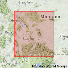
- Areal extent
- AAPG geologic province:
-
- Montana folded belt
Summary:
Early Desmoinesian fusulinid WEDEKINDELLINA sp. collected from about 125 ft below top of Quadrant about one mile east of Garfield Peak, in Beaverhead Mountains, Beaverhead Co, MT, Montana folded belt province. Authors consider Garfield Peak-Lima Peaks as southern end of Tendoy Mountains rather than an eastern spur of Beaverhead Mountains. Weart (1950, unpub. PhD thesis) reports FUSULINA sp. and WEDEKINDELLINA sp. 171 and 380 ft below top of Quadrant in Big Sheep Creek Canyon, in Tendoy Mountains, Beaverhead Co, MT. These fossils establish that Quadrant is no younger than early Desmoinesian in this part of southwest MT. Other workers have speculated that age of Quadrant in this area may be as young as Permian. Authors propose that contact with overlying Phosphoria Formation is probably disconformable, rather than conformable as suggested by Sloss and Moritz (1951, AAPG Bull, p. 2135-2169), and rocks of late Desmoinesian to Wolfcampian age are missing or very thin. Quadrant restricted from area of Morrison Lake, in Beaverhead Mountains, Beaverhead Co; here, interval is assigned to Snaky Canyon Formation.
Source: GNU records (USGS DDS-6; Denver GNULEX).
For more information, please contact Nancy Stamm, Geologic Names Committee Secretary.
Asterisk (*) indicates published by U.S. Geological Survey authors.
"No current usage" (†) implies that a name has been abandoned or has fallen into disuse. Former usage and, if known, replacement name given in parentheses ( ).
Slash (/) indicates name conflicts with nomenclatural guidelines (CSN, 1933; ACSN, 1961, 1970; NACSN, 1983, 2005, 2021). May be explained within brackets ([ ]).