

- Usage in publication:
-
- Pinyon conglomerate*
- Modifications:
-
- Original reference
- Dominant lithology:
-
- Conglomerate
- AAPG geologic province:
-
- Yellowstone province
Summary:
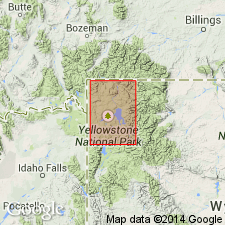
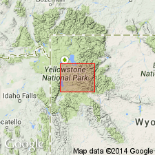
Pinyon conglomerate. A series of conglomerate beds with local intercalations of sandstone, resting unconformably on upturned Laramie (Cretaceous). Best exposed on Pinyon Peak, Yellowstone National Park. Found only in south end of Park. Age is Eocene.
Source: US geologic names lexicon (USGS Bull. 896, p. 1668).
- Usage in publication:
-
- Pinyon Peak conglomerate†
Summary:
Pg. 184+. Pinyon Peak conglomerate. Applied this term to the conglomerate named Pinyon conglomerate by Weed in 1896.
[†Pinyon Peak conglomerate considered misprint.]
Source: US geologic names lexicon (USGS Bull. 896, p. 1668).
- Usage in publication:
-
- Pinyon Conglomerate*
- Modifications:
-
- Principal reference
- Revised
- Dominant lithology:
-
- Conglomerate
- Siltstone
- Claystone
- AAPG geologic province:
-
- Yellowstone province
Summary:
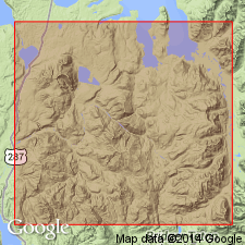
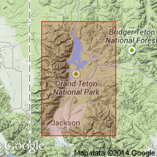
Crops out in an area of about 150 sq mi in Yellowstone province of northwest WY. A large area of conglomerate formerly mapped as Pinyon named Bobcat Member of Harebell Formation. No type section designated by Hague (1896). A principal reference section measured on east, north, and northwest spurs of Pinyon Peak, T47N, R113E, where it overlies Harebell. Pinyon is light-gray and -brown, is less well indurated, and has less volcanic debris than Harebell. Is 3,774+/-ft thick at principal reference section where formation is predominantly conglomerate (tan, coarse, quartzite, volcanic rocks, Paleozoic sedimentary rocks) but also has sandstone (brown, gray, tan, coarse-grained, massive to cross-bedded), and some siltstone and claystone. Includes a coal member on Dry Cottonwood Creek that has Paleocene fossils. Overlies Harebell unconformably at principal reference section. Is of Late Cretaceous age (dinosaur tooth) and Paleocene age (pollen). Deposited by streams from the Targhee uplift in a humid and warm clime.
Source: GNU records (USGS DDS-6; Denver GNULEX).
- Usage in publication:
-
- Pinyon Conglomerate*
- Modifications:
-
- Geochronologic dating
- AAPG geologic province:
-
- Yellowstone province
Summary:
A K-Ar age of about 68.6 Ma obtained from a 100 ft biotite-rich tuff in basal part of Pinyon in report area, Teton Co, WY in the Yellowstone province.
Source: GNU records (USGS DDS-6; Denver GNULEX).
- Usage in publication:
-
- Pinyon Conglomerate*
- Modifications:
-
- Geochronologic dating
- AAPG geologic province:
-
- Yellowstone province
Summary:
Age of 67.0 +/-0.7 Ma (K-Ar) obtained from white tuff 100 ft thick that occurs 300 ft above basal 800 ft thick unit (of nonconglomeratic gray sandstone, dark gray claystone, and tuff) on east side Gravel Peak about 3 mi east of map area and 4.5 mi southeast of Pinyon Peak, Yellowstone province. This is the evidence for the Late Cretaceous age of the lower part of the Pinyon. Upper part of Pinyon dated as Paleocene on pollen occurrence 2 mi east of map area.
Source: GNU records (USGS DDS-6; Denver GNULEX).
For more information, please contact Nancy Stamm, Geologic Names Committee Secretary.
Asterisk (*) indicates published by U.S. Geological Survey authors.
"No current usage" (†) implies that a name has been abandoned or has fallen into disuse. Former usage and, if known, replacement name given in parentheses ( ).
Slash (/) indicates name conflicts with nomenclatural guidelines (CSN, 1933; ACSN, 1961, 1970; NACSN, 1983, 2005, 2021). May be explained within brackets ([ ]).