The National Geologic Map Database is migrating to a new infrastructure. We apologize for any service disruptions during this process.
|
|---|


- Usage in publication:
-
- Kaibab limestone*
- Modifications:
-
- Named
- Dominant lithology:
-
- Limestone
- Shale
- Sandstone
- AAPG geologic province:
-
- Plateau sedimentary province
- Basin-and-Range province
Summary:
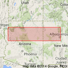
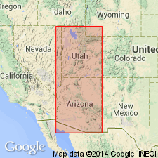
Named as the upper formation of the Aubrey group for the Kaibab Plateau, north side of the Grand Canyon, Coconino Co, AZ in the Plateau sedimentary province. No type locality designated. Geologic map. Mapped as far west as the Grand Wash Cliffs, Mohave Co, AZ in the Plateau sedimentary province, and as far south as the Verde River in Yavapai Co, AZ in the Basin-and-Range province. Previously called Aubrey limestone. Ranges from 100 to 820 ft thick. Description of a measured section at Cataract Creek from an earlier report shows it as consisting of soft, yellow limestone at base that becomes hard, blue chert limestone in middle and upper parts and is interbedded with green, red, and white shale and snowy gypsum 180 ft thick, 100 ft above base, and coarse drab sandstone containing quartz pebbles and vegetable impressions 20 ft thick that lies 50 ft below the top. Contains abundant Pennsylvanian fauna--corals, brachiopods, mollusks, etc. Overlies Coconino sandstone (new) of Aubrey group. Underlies Moencopie formation of Shinarump group. Stratigraphic chart.
Source: GNU records (USGS DDS-6; Denver GNULEX).
- Usage in publication:
-
- Kaibab limestone*
- Modifications:
-
- Revised
- AAPG geologic province:
-
- Great Basin province
Summary:
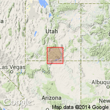
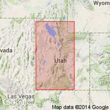
Harrisburg gypsiferous member newly named as the uppermost member of the Kaibab limestone. Two measured sections, both in Washington Co, UT in the Great Basin province, described. The first measured 6 mi south of Hurricane, UT is 930 ft thick consisting mostly of cream to gray limestones separated by a slope-unit of shale, sandstone, and gypsum. The uppermost 160 ft is the Harrisburg. The second section is a composite near St. George, UT where the Kaibab is 957 ft thick, and composed of a basal yellow gypsiferous sandstone and thin-bedded arenaceous limestone unit overlain in sequence by massive, cherty gray limestone, slope-forming gypsum, red shale, and a breccia of limestone and chert, massive, fine-grained, cherty, gray limestone, and at top the Harrisburg member, a gray limestone, gypsiferous shale and gypsum. Kaibab overlies Coconino sandstone and unconformably underlies the newly named Rock Canyon conglomerate member (new) of the Moenkopi. Kaibab may be as much as 1,100 ft thick. Of Permian age.
Source: GNU records (USGS DDS-6; Denver GNULEX).
- Usage in publication:
-
- Kaibab limestone*
- Modifications:
-
- Areal extent
- AAPG geologic province:
-
- Paradox basin
Summary:
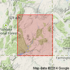
Is present in thin patches in the San Rafael Swell. Ranges from 0-85 ft thick. Is cut out at many places by the pre-Triassic unconformity. Fossil mollusks, brachiopods, and pelecypods found. Assigned to the Permian and to the Carboniferous. [Permian removed from Carboniferous in 1941.]
Source: GNU records (USGS DDS-6; Denver GNULEX).
- Usage in publication:
-
- Kaibab limestone*
- Modifications:
-
- Areal extent
- AAPG geologic province:
-
- Paradox basin
- Plateau sedimentary province
Summary:
Extended to southern Kane Co (T42S, R2W), UT in the Plateau sedimentary province and to Circle Cliffs (Ts35 to 33S, Rs8 to 6E), Garfield Co, UT in the Paradox basin. Assigned a Permian age. Fossil pelecypods, sponges, identified.
Source: GNU records (USGS DDS-6; Denver GNULEX).
- Usage in publication:
-
- Kaibab formation
- Modifications:
-
- Revised
- Redescribed
- AAPG geologic province:
-
- Plateau sedimentary province
- Great Basin province
- Paradox basin
Summary:
Name Kaibab stratigraphically restricted to upper part of Darton's Kaibab because original Kaibab is thought to have included two formations that have distinctive faunas and lithologies, and are separated by widespread unconformity. Name Kaibab limestone redescribed as Kaibab formation because the formation in eastern Grand Canyon is mostly sandstone and elsewhere it includes gypsum and red beds. Composed of an upper and lower red bed sequence separated by a massive limestone in its type "locality." Includes subdivisions A and B of Kaibab of earlier reports. Unconformably underlies Moenkopi formation. Unconformably overlies Toroweap formation (new name). Units formerly designated subdivisions C, D, and E of Kaibab are redesignated gamma, beta, and alpha (base to top) which characterize advancing sea (base), extended sea, and retreating sea (top). Cross sections. Areal extent map of facies. Detailed description of lithologies. Chemical analyses. Fossils (worms, sponges, crinoids, echinoids, bryozoans, brachiopods, pelecypods, scaphopods, gastropods, cephalopods, crustaceans, fish remains). Correlated with Leonard formation of TX, San Andres limestone of NM, Chiricahua of AZ, and Phosphoria of UT, ID, and WY. Considered Middle Permian. Recognized in measured sections in southeast NV and southwest UT, Great Basin province, northwest AZ and adjoining UT, Plateau sedimentary province, and south UT, Paradox basin.
Source: GNU records (USGS DDS-6; Denver GNULEX).
- Usage in publication:
-
- Kaibab Formation
- Modifications:
-
- Contact revised
- AAPG geologic province:
-
- Paradox basin
Summary:
Upper contact revised in that the newly named Black Dragon Member of the Moenkopi Formation overlies the Kaibab Formation in the San Rafael Swell and Circle Cliffs areas, Paradox basin, UT. Kaibab pinches out in the subsurface west of the Monument Upwarp. The Kaibab-Moenkopi contact is erosional. The contact where described in two measured sections is a cherty, locally fossiliferous limestone and dolomite (Kaibab) that is overlain by a 42+ ft thick chert pebble conglomerate interbedded with yellow-gray sandstone and mudstone (Black Dragon) or by a yellow-gray micaceous mudstone and siltstone (Black Dragon). Cross sections. Permian age.
Source: GNU records (USGS DDS-6; Denver GNULEX).
- Usage in publication:
-
- Kaibab Group
- Modifications:
-
- Areal extent
- Revised
- AAPG geologic province:
-
- Paradox basin
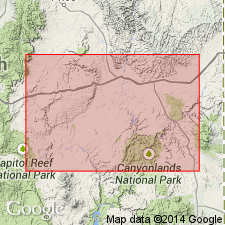
Summary:
Dolomite unconformably above the White Rim Sandstone in UT in the Capitol Reef area and unconformably above the Cedar Mesa Sandstone in the San Rafael area formerly assigned to the Kaibab Limestone is removed from the Kaibab and reassigned to the newly named Black Box Dolomite. Term Kaibab is restricted geographically to two areas of southwest UT discussed in this report--Marysvale and Beaver Dam. Kaibab considered at Marysvale --to be of group rank in this report and is divided into: 1) Toroweap Formation (basal unit) and Fossil Mountain Limestone (top); and 2) in the Beaver Dam Mountains --Seligman (base) and Brady Canyon Limestones, Woods Ranch Formation, Kaibab Limestone ["when a unit is divided into two or more of the same rank as the original, the original name should not be used for any of the divisions." NASC, 1983, art. 19g.], and Plympton Formation (top). Black Box shown as equivalent to the Fossil Mountain at Beaver Dam and to the Kaibab of the Beaver Dam Mountains. Permian age. [Intent or reason to modify rank of Kaibab not stated.]
Source: GNU records (USGS DDS-6; Denver GNULEX).
- Usage in publication:
-
- Kaibab Marble*
- Modifications:
-
- Redescribed
- Areal extent
- Dominant lithology:
-
- Marble
- AAPG geologic province:
-
- Salton basin
Summary:
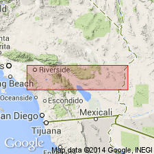
Names applied in Grand Canyon area extended geographically to sequence in Big Maria Mountains of southeast CA in the Salton basin with change of lithic designation. Permian Kaibab Limestone redescribed as Kaibab Marble. Overlies Coconino Quartzite (redescribed). The marble is varicolored: white, gray, buff, yellow, pink and brown. This part of CA was part of the stable craton of North America in Paleozoic and early Mesozoic time. Rocks were intruded by Middle Jurassic granodiorite and metamorphosed in Cretaceous time.
Source: GNU records (USGS DDS-6; Denver GNULEX).
- Usage in publication:
-
- Kaibab Formation*
- Modifications:
-
- Redescribed
- Dominant lithology:
-
- Dolomite
- Sandstone
- Limestone
- AAPG geologic province:
-
- Plateau sedimentary province
Summary:
Kaibab Formation (rather than Kaibab Limestone) accepted on this map in the Plateau sedimentary province where Kaibab is composed of dolomite, dolomitic sandstone, sandstone, and dolomitic limestone. Of Early Permian age.
Source: GNU records (USGS DDS-6; Denver GNULEX).

- Usage in publication:
-
- Kaibab Formation*
- Modifications:
-
- Redescribed
- Revised
- Reference
- Dominant lithology:
-
- Limestone
- Gypsum
- Chert
- AAPG geologic province:
-
- Basin-and-Range province
- Plateau sedimentary province
Summary:
Kaibab Limestone changed to Kaibab Formation. West of a generally north-south line in AZ from Page, Coconino Co in Plateau sedimentary province to Verde Valley and Prescott area, Yavapai Co in Basin-and-Range province, Kaibab is divisible into Fossil Mountain Member (first publication with intent to name) at base and Harrisburg Member (redescribed) at top. Fossil Mountain, called alpha member by McKee (1938), was named by Sorauf in an unpublished thesis. East of that line Kaibab consists of calcareous sandstone and sandstone, and is not divided into members. Reference section designated and measured in section that extends from southwest corner sec 12, T33N, R9W, Mohave Co, AZ. Is 416.7 ft thick at reference section where it overlies Woods Ranch Member (named) of Toroweap and unconformably underlies Moenkopi Formation. Fossil Mountain at reference section consists of fossiliferous limestone, white chert, and a yellow sandstone bed. Harrisburg at reference section consists of interbedded limestone, gypsum, dolomite, chert, and sandstone, and has fossil brachiopods and gastropods. Nomenclature chart. Of Early Permian, Leonardian age.
Source: GNU records (USGS DDS-6; Denver GNULEX).

- Usage in publication:
-
- Kaibab Formation*
- Modifications:
-
- Areal extent
- AAPG geologic province:
-
- Great Basin province
Summary:
Mapped in east-central Lincoln Co., NV in the Great Basin province. Divided into two mapped units the Fossil Mountain Member at base and the Harrisburg Member at the top. Fossil Mountain overlies Woods Ranch Member of Toroweap Formation. Harrisburg underlies the lower red member and Rock Canyon Conglomerate Member (undivided) of Moenkopi Formation unconformably. Of Early Permian, Leonardian age.
Source: GNU records (USGS DDS-6; Denver GNULEX).
For more information, please contact Nancy Stamm, Geologic Names Committee Secretary.
Asterisk (*) indicates published by U.S. Geological Survey authors.
"No current usage" (†) implies that a name has been abandoned or has fallen into disuse. Former usage and, if known, replacement name given in parentheses ( ).
Slash (/) indicates name conflicts with nomenclatural guidelines (CSN, 1933; ACSN, 1961, 1970; NACSN, 1983, 2005, 2021). May be explained within brackets ([ ]).