

- Usage in publication:
-
- Kneeling Nun rhyolite tuff
- Modifications:
-
- Named
- Dominant lithology:
-
- Rhyolite
- Tuff
- AAPG geologic province:
-
- Orogrande basin
- Basin-and-Range province
Summary:
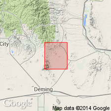
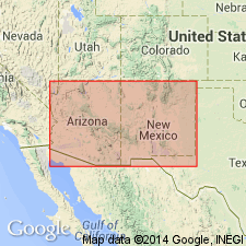
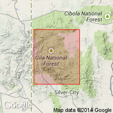
Named after a prominent rock monument overlooking town of Santa Rita, Grant Co, NM, Basin-and-Range province. The Kneeling Nun is an isolated column of welded rhyolite tuff which stands a short distance in front of a high escarpment of the same rock; it is a famous landmark. Originally described by Paige (1916) as a flow rhyolite--author calls it a welded tuff based on the fact that the gently dipping, widespread (tens of sq mi) rocks are fragmental, with a glassy groundmass; they lack vesicular or scoriaceous zones, suggesting strongly that they were not flow rocks rendered fluid by high gas content. May have been formed by a nuee ardente or possibly by eruption of fragmental material from a vent, without rising high in the air--a gaseous particulate flow eruption. Is pinkish gray to reddish brown, medium grained, highly porphyritic, with numerous 3 mm fragmental phenocrysts of quartz, less sanidine and plagioclase, and minor biotite in a fine-grained matrix; has the appearance of granite porphyry. Has marked columnar jointing and, in places, faint horizontal sheeting. Overlies conformably quartz latite tuffs of Sugarlump formation. In Barenda Valley, and directly west of Lake Valley fault block, and in a separated outcrop a mi west, is about 200 ft thick. To southwest, is only 6-10 ft thick. Shown on chart as late Tertiary in age. Older than Mimbres Peak formation; younger than Sugarlump tuffs. Geologic map; stratigraphic chart.
Source: GNU records (USGS DDS-6; Denver GNULEX).
- Usage in publication:
-
- Kneeling Nun Rhyolite Tuff*
- Modifications:
-
- Overview
- AAPG geologic province:
-
- Basin-and-Range province
Summary:
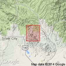
Consists of massive, partially welded, devitrified ash flow ranging from quartz latite to rhyolite. Is 200-600 ft thick. Conformable on Sugarlump Tuffs. Upper contact erosional. Assigned a Miocene? age. Floral assemblages of late Miocene or early Pliocene age collected from lake beds thought to be correlatives of Kneeling Nun. Flows of basaltic andesite overlying the Kneeling Nun are older than the Gila Conglomerate of Pliocene and Pleistocene age, and older than parts of Santa Fe Group of middle? Miocene to Pleistocene? age. Mapped in the southern part of quad, Grant Co, NM in the Basin-and-Range province.
Source: GNU records (USGS DDS-6; Denver GNULEX).
- Usage in publication:
-
- Kneeling Nun Tuff*
- Modifications:
-
- Redescribed
- Dominant lithology:
-
- Tuff
- AAPG geologic province:
-
- Basin-and-Range province
Summary:
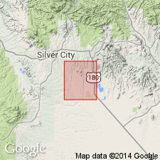
Stratigraphic rank term modified. Name changed from Kneeling Nun Rhyolite Tuff to Kneeling Nun Tuff because the rock is not everywhere a rhyolite. Described as a pinkish- or reddish-gray vitrophyre containing abundant crystal fragments of quartz, sanidine, plagioclase, and biotite, and a few lithic fragments in a pale-red to grayish-red glassy matrix. Mapped in northeasternmost part of quad in the Basin-and-Range province. Overlies Sugarlump Tuff. Assigned a Miocene? age but acknowledged to possibly range from late Oligocene to early Pliocene in age. Geologic map.
Source: GNU records (USGS DDS-6; Denver GNULEX).
- Usage in publication:
-
- Kneeling Nun Tuff*
- Modifications:
-
- Age modified
- AAPG geologic province:
-
- Basin-and-Range province
Summary:
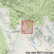
Extrusive volcanic activity in the Mogollon-Datil volcanic province, of which the Kneeling Nun was a part, resumed in the Oligocene. A K-Ar age of 33.4 m.y. obtained from the Kneeling Nun Tuff. Age of formation therefore changed from Miocene? to Oligocene. Mapped in the southeast part of quad (adjoins Santa Rita quad), Grant Co, NM in the Basin-and-Range province.
Source: GNU records (USGS DDS-6; Denver GNULEX).
- Usage in publication:
-
- Kneeling Nun Tuff
- Modifications:
-
- Paleomagnetics
- AAPG geologic province:
-
- Basin-and-Range province
Summary:
In the Dwyer quad, southeast of Silver City, Grant Co, NM, Basin-and-Range province, Kneeling Nun Tuff is everywhere reversely magnetized. Overlying Kneeling Nun is the very striking Mimbres Peak flow-banded rhyolite, which is normally magnetized. Underlying Kneeling Nun are the tuff beds of Sugarlump Formation, which interfinger with Rubio Peak andesite and latite [Rubio Peak Formation]. Upper part of the sequence is reversed and the lower part is normal. Magnetostratigraphic position of Kneeling Nun, Mimbres Peak, Sugarlump, and Rubio Peak units within a preliminary model of the middle Tertiary paleomagnetic reversal pattern is depicted on fig. 4. The same correlations can be made in the Lake Valley quad (Jicha, 1954) a few mi to the east.
Source: GNU records (USGS DDS-6; Denver GNULEX).
- Usage in publication:
-
- Kneeling Nun Tuff*
- Modifications:
-
- Geochronologic dating
- AAPG geologic province:
-
- Basin-and-Range province
Summary:
Has a 40Ar/39Ar age of 35.28 m.y. Has yielded an age of 34.2 +/-1.0 m.y. (sanidine) in Santa Rita quad and 34.6 +/-0.8 m.y. (biotite). [These ages are generally regarded as Oligocene.] Samples collected from Grant Co, NM in the Basin-and-Range province.
Source: GNU records (USGS DDS-6; Denver GNULEX).
- Usage in publication:
-
- Kneeling Nun Tuff*
- Modifications:
-
- Overview
- Geochronologic dating
- Paleomagnetics
- Revised
- AAPG geologic province:
-
- Basin-and-Range province
Summary:
Is revised to be specifically included as a formation in the Datil Group, in that it fits the definition of the Datil by Osburn and Chapin (1983) with respect to age and stratigraphic position. Is mapped in Horse Mountain West quadrangle, Catron Co, NM, in eastern part of Basin-and-Range province. Is distal outflow from the Emory caldera about 100 km to the south in the Black Range. Is 0 to about 5 m thick. Is light-gray, pinkish-brown, or nearly white, partially to densely welded ash-flow tuff; contains 15-20 percent phenocrysts (less than 1 to 2 mm) mainly sanidine and quartz, and minor plagioclase and biotite, and accessory opaque oxide, sphene, brown hornblende, apatite, and zircon in a vitroclastic matrix. Closely resembles several other quartz-bearing tuffs in the Mogollon-Datil volcanic field, particularly Hells Mesa Tuff (Osburn and Chapin, 1983) and Fall Canyon Tuff (Ratte, 1981), but is distinguished here by paleomagnetic properties and age. Natural remanent magnetism determined as follows: mean inclination, -44.3; mean declination, 165.6; polarity, reversed. Isotopic dating: 40Ar/39Ar age is 35.28 Ma, Oligocene.
Source: GNU records (USGS DDS-6; Denver GNULEX).
For more information, please contact Nancy Stamm, Geologic Names Committee Secretary.
Asterisk (*) indicates published by U.S. Geological Survey authors.
"No current usage" (†) implies that a name has been abandoned or has fallen into disuse. Former usage and, if known, replacement name given in parentheses ( ).
Slash (/) indicates name conflicts with nomenclatural guidelines (CSN, 1933; ACSN, 1961, 1970; NACSN, 1983, 2005, 2021). May be explained within brackets ([ ]).