


- Usage in publication:
-
- Cannon limestone*
- Modifications:
-
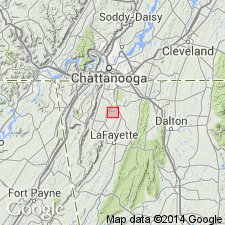
- Areal extent
- Dominant lithology:
-
- Limestone
- AAPG geologic province:
-
- Appalachian basin
Summary:
Pg. 417, 418, 429, pl. 27. Cannon limestone. Several hundred feet of limestone of Trenton age on eastern flank of Nashville dome, covering time interval of Bigby, Flanagan, and Perryville limestones and Catheys formation. Thins rapidly to west, and finally wedges out in vicinity of Nashville. Overlies Hermitage formation and is older than Eden group. [Age is Middle Ordovician (Trenton).]
Source: US geologic names lexicon (USGS Bull. 896, p. 335).
- Usage in publication:
-
- Cannon Limestone
- Modifications:
-
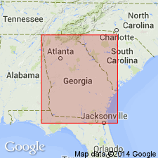
- Areal extent
- Revised
- AAPG geologic province:
-
- Appalachian basin
Summary:
Geographically extended the Cannon Limestone to northwestern GA and included it in the Nashville Group (middle formation of three). Consists of medium dark gray calcilutite and calcarenite in well defined beds generally 2 to 6 inches thick that contains chert lenses and nodules; It is fossiliferous and contains TETRADIUM, brachiopods, bryozoans, and gastropods. Thickness is 110 to 120 feet. Unit overlies the Hermitage Formation and underlies the Catheys Formation, both of the Nashville Group.
Source: GNU records (USGS DDS-6; Reston GNULEX).

- Usage in publication:
-
- Cannon Limestone*
- Modifications:
-
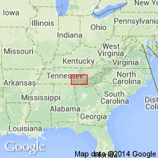
- Areal extent
- AAPG geologic province:
-
- Appalachian basin
Summary:
The Cannon Limestone of the Nashville Group, as defined by Milici and Smith (1969), is here used in the Chickamauga terrane in GA.
Source: GNU records (USGS DDS-6; Reston GNULEX).
- Usage in publication:
-
- Cannon Member
- Modifications:
-
- Revised
- AAPG geologic province:
-
- Appalachian basin
Summary:
Catheys (Catoosa Co.) and Cannon and Hermitage (Walker Co.) regarded as members of Nashville Formation of Chickamauga Group in this report, following the nomenclature of Carter and Chowns (1986: AL Geol. Soc. Guidebook, 23rd Ann. Field Trip) and Carter and Chowns (in press: Amer. Assoc. Pet. Geol., Studies in Geology).
Source: GNU records (USGS DDS-6; Reston GNULEX).
- Usage in publication:
-
- Cannon Limestone*
- Modifications:
-
- Overview
- AAPG geologic province:
-
- Cincinnati arch
Summary:
Nashville Group, consisting of Catheys Formation, Bigby and Cannon Limestones, and Hermitage Formation, is mapped undivided on plate 1. Age of Cannon is Middle Ordovician. Cannon correlates with Bigby.
Source: GNU records (USGS DDS-6; Reston GNULEX).

- Usage in publication:
-
- Cannon Limestone*
- Modifications:
-
- Age modified
- AAPG geologic province:
-
- Cincinnati arch
Summary:
Cannon Limestone is Champlainian (Kirkfieldian and Shermanian) in age. Shown undivided with Bigby Limestone.
Source: GNU records (USGS DDS-6; Reston GNULEX).
For more information, please contact Nancy Stamm, Geologic Names Committee Secretary.
Asterisk (*) indicates published by U.S. Geological Survey authors.
"No current usage" (†) implies that a name has been abandoned or has fallen into disuse. Former usage and, if known, replacement name given in parentheses ( ).
Slash (/) indicates name conflicts with nomenclatural guidelines (CSN, 1933; ACSN, 1961, 1970; NACSN, 1983, 2005, 2021). May be explained within brackets ([ ]).