

- Usage in publication:
-
- Fredericksburg group
- Modifications:
-
- Original reference
- Dominant lithology:
-
- Limestone
- Flint
- Chalk
Summary:
Pg. 269-299. Lower or Fredericksburg division (Comanche Peak) of Comanche series or Lower Cretaceous. Limestones, with some flints and chalk. Overlies Dinosaur sand [Trinity group] and underlies Washita division. Includes: AMMONITES ACUTOCARINATUS horizon; HIPPURITES limestone (="Caprina limestone"); Comanche Peak fauna (="Fredericksburg" of Roemer); GRYPHAEA PITCHERI (="Comanche Peak group"); and REQUIENIA TEXANA (="Caprotina limestone").
Source: US geologic names lexicon (USGS Bull. 896, p. 775-776).
- Usage in publication:
-
- Fredericksburg group
- Modifications:
-
- Revised
Summary:
Pg. 303. Placed provisional boundary line between Washita and Fredericksburg groups at top of "Caprina" [Edwards] limestone.
Source: US geologic names lexicon (USGS Bull. 896, p. 775-776).
- Usage in publication:
-
- Fredericksburg group
- Modifications:
-
- Revised
Summary:
Pg. 105-136, pl. 3. Divided Fredericksburg into (descending) Caprina chalky limestones, Comanche Peak chalk beds, and Basal or Alternating beds, the latter including 1st Caprotina horizon.
Source: US geologic names lexicon (USGS Bull. 896, p. 775-776).
- Usage in publication:
-
- Fredericksburg group
- Modifications:
-
- Revised
Summary:
Pg. 503-528. Fredericksburg or Comanche Peak division includes Caprina limestone [Edwards limestone]; Comanche Peak chalk; GRYPHAEA rock and Walnut clays or EXOGYRA TEXANA beds; and, tentatively Paluxy sands. Overlies Trinity division (which includes Glen Rose or Alternating beds, above, and Trinity or Basal sands) and underlies Kiamitia clays.
Source: US geologic names lexicon (USGS Bull. 896, p. 775-776).
- Usage in publication:
-
- Fredericksburg group
- Modifications:
-
- Revised
Summary:
Pg. 269-279, 327, etc. Included Kiamichi clay in Fredericksburg, at top, and Walnut clay at base, and excluded Paluxy sand. Taff in 1893 (Geol. Survey Texas 4th Ann. Rpt.) included Kiamichi in Fredericksburg and excluded Paluxy.
Source: US geologic names lexicon (USGS Bull. 896, p. 775-776).
- Usage in publication:
-
- Fredericksburg group
- Modifications:
-
- Revised
Summary:
Pg. 317-319. Divided Fredericksburg group into Caprina limestone, Comanche Peak chalk, and Walnut clays, and included Kiamichi clay in Washita group and Paluxy sand in Trinity group. Hill also followed this classification in 1901 (USGS 21st Ann. Rpt, pt. 7), as did Udden, Baker, and Bose in 1916 (Univ. Texas Bull., no. 44, p. 59-77); Adkins (1920, Univ. Texas Bull., no. 1856, p. 10); and Dumble (1920, Univ. Texas Bull., no. 1869).
Source: US geologic names lexicon (USGS Bull. 896, p. 775-776).
- Usage in publication:
-
- Fredericksburg group
- Modifications:
-
- Revised
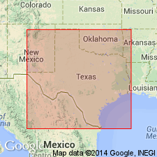
- Areal extent
- AAPG geologic province:
-
- Permian basin
Summary:
Pg. 47, geol. map. Fredericksburg group. Divided into (ascending) Campagrande, Cox, and Finlay formations (all new). Older than Washita group. Age is Early Cretaceous (Comanche). [See entries under Campagrande, Cox, and Finlay.]
Source: Publication.
- Usage in publication:
-
- Fredericksburg group
- Modifications:
-
- Revised
Summary:
Included Kiamichi in Fredericksburg and treated it as "final phase of the Goodland." G. Scott (1926, Amer. Jour. Sci., 5th ser., v. 12, p. 157-161) excluded Kiamichi from Washita group.
Source: US geologic names lexicon (USGS Bull. 896, p. 775-776).
- Usage in publication:
-
- Fredericksburg group
- Modifications:
-
- Revised
Summary:
Pg. 21. Excluded Kiamichi from Fredericksburg, as did Bullard (1928, Oklahoma Geol. Survey Bull., no. 47, p. 13-15).
Source: US geologic names lexicon (USGS Bull. 896, p. 775-776).
- Usage in publication:
-
- Fredericksburg group
- Modifications:
-
- Revised
Summary:
Included Kiamichi in Fredericksburg but excluded it from Goodland.
Source: US geologic names lexicon (USGS Bull. 896, p. 775-776).
- Usage in publication:
-
- Fredericksburg group
- Modifications:
-
- Revised
Summary:
Pg. 1292-1299. Kiamichi formation, heretofore considered to belong to Washita group, is now considered, because of its characteristic Fredericksburg fauna, as a transitional formation between the two groups.
Source: US geologic names lexicon (USGS Bull. 896, p. 775-776).
- Usage in publication:
-
- Fredericksburg group
- Modifications:
-
- Revised
Summary:
Pg. 76-77. Included Kiamichi in Washita group, as did Bullard and Redfield (1930, Oklahoma Geol. Survey Bull., no. 40-OO).
Source: US geologic names lexicon (USGS Bull. 896, p. 775-776).
- Usage in publication:
-
- Fredericksburg group
- Modifications:
-
- Revised
Summary:
Included Kiamichi in Washita group; but on June 1930 geologic map of Parker County, Texas, they included Kiamichi in Fredericksburg group.
Source: US geologic names lexicon (USGS Bull. 896, p. 775-776).
- Usage in publication:
-
- Fredericksburg group
- Modifications:
-
- Revised
Summary:
Included Kiamichi in Fredericksburg group. He stated (p. 323): There is some evidence of an unconformity at top of Kiamichi over parts of Oklahoma and Kansas. Also (p. 339): From Fort Worth to south of Waco the Edwards is overlain, apparently unconformably by Kiamichi clay. South of Waco the Kiamichi is absent. Also (p. 344): The Kiamichi is very close in age to upper Edwards, differing largely in presence of GRYPHAEA NAVIA and a few other zone fossils. [On p. 325-326 he discussed fossils.]
Source: US geologic names lexicon (USGS Bull. 896, p. 775-776).

- Usage in publication:
-
- Fredericksburg group
- Modifications:
-
- Revised
Summary:
Pg. 1537 [referring to proposals of S.A. Thompson (p. 1536, this volume); see also Thompson entries under Fredericksburg, Gatesville, Goodland]. Questions: (1) advisability of new name Gatesville formation; (2) whether the Goodland limestone is actually a synonym of Comanche Peak limestone and should be abandoned; Goodland seems to be a useful name for the northern thin limestone of the Fredericksburg group where the Edwards is either very thin or not recognizable as such. States that assignment of Kiamichi to Fredericksburg group is still considered a debatable question by some geologists.
Source: US geologic names lexicon (USGS Bull. 896, p. 775-776; 807; 837-838).
- Usage in publication:
-
- Fredericksburg group
- Modifications:
-
- Revised
Summary:
Pg. 1536. Included Kiamichi in Fredericksburg group; proposed the new name Gatesville formation to include Edwards and Comanche Peak limestones and Walnut clay, which he proposed be reduced to rank of members; and recommended abandonment of Goodland limestone. He stated the Edwards, Comanche Peak, and Walnut are in part contemporaneous with one another, and that they contain essentially same fauna. Also that there is is unconformity at top of Kiamichi. [This is a disputed point; see Mendenhall (p. 1537, this volume) entry under Fredericksburg.]
Source: US geologic names lexicon (USGS Bull. 896, p. 775-776).

- Usage in publication:
-
- Fredericksburg group
- Modifications:
-
- Adopted
Summary:
The USGS at present [ca. 1938] divides Fredericksburg group into Edwards limestone, Comanche Peak limestone, and Walnut clay.
Source: US geologic names lexicon (USGS Bull. 896, p. 776).
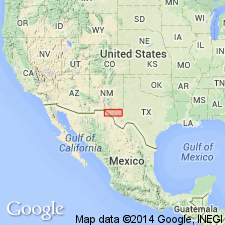
- Usage in publication:
-
- Fredericksburg group*
- Modifications:
-
- Areal extent
- AAPG geologic province:
-
- Permian basin
Summary:
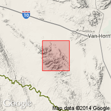
Pl. 1. As mapped in Eagle Mountains, Hudspeth County, Texas, comprises Finlay limestone and Kiamichi formation. Overlies Cox sandstone of Trinity group; underlies Georgetown limestone of Washita group.
Source: US geologic names lexicon (USGS Bull. 1200, p. 1423-1424).

- Usage in publication:
-
- Fredericksburg group
- Modifications:
-
- Revised
Summary:
Pg. 20-22. As used in this report [Cretaceous Foraminifera of Texas] group includes (ascending) Walnut clay, Goodland limestone, Edwards limestone, and Kiamichi formation. Overlies Paluxy formation of Trinity group; underlies Duck Creek formation of Washita group.
Source: US geologic names lexicon (USGS Bull. 1200, p. 1423-1424).
- Usage in publication:
-
- Fredericksburg group
- Modifications:
-
- Mapped 1:500k
Summary:
As mapped, includes Goodland limestone and Walnut clay. Kiamichi mapped with Washita group.
Source: US geologic names lexicon (USGS Bull. 1200, p. 1423-1424).
- Usage in publication:
-
- Fredericksburg group
- Modifications:
-
- Overview
Summary:
Pg. 3 (fig. 2), 28 (fig. 13), measured sections. In this report [Symposium on Edwards limestone], Fredericksburg group comprises (ascending) Paluxy sand, Walnut formation, Comanche Peak limestone, Edwards limestone, and Kiamichi formation. Overlies Glen Rose limestone of Trinity group; underlies Georgetown limestone of Washita group or Kiamichi shale where Kiamichi is considered part of Washita group. A southern complex of the Edwards, Comanche Peak, and Walnut formations is indicated to pass northward into a complex composed of the Goodland, Walnut, and Paluxy formations. Classification of included stratigraphic intervals as Fredericksburg division follows Hill's early nomenclature and concept of an integrated subseries representing a major and distinct cycle of sedimentation. Age is Early Cretaceous (Comanche). [Misprint: USGS Bull. 1200 (p. 1423) indicates P.E. Lozo is the sole author of this publication.]
Source: US geologic names lexicon (USGS Bull. 1200, p. 1423-1424).
- Usage in publication:
-
- Fredericksburg group
- Modifications:
-
- Revised
- AAPG geologic province:
-
- Ouachita folded belt
Summary:
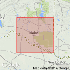
Pg. 16 (table 5), 31-34. In McCurtain County, only Goodland limestone is included in Fredericksburg group. No mappable stratigraphic boundary present between Kiamichi formation and Goodland limestone, and Kiamichi is mapped with Washita group. Unconformably overlies Paluxy sand of Trinity group.
Source: US geologic names lexicon (USGS Bull. 1200, p. 1423-1424).
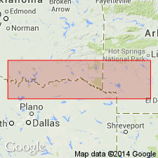
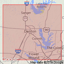
- Usage in publication:
-
- Fredericksburg group
- Modifications:
-
- Areal extent
- AAPG geologic province:
-
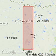
- Fort Worth syncline
Summary:
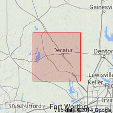
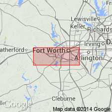
Pg. 9 (fig. 3), 11-21, pls. 1, 2. Fredericksburg group. In Fort Worth area, group comprises (ascending) Walnut marl and Goodland formation. Overlies Paluxy sandstone of Trinity group; underlies Kiamichi formation of Washita group.
Source: US geologic names lexicon (USGS Bull. 1200, p. 1423-1424).
- Usage in publication:
-
- Fredericksburg Group, undivided
- Modifications:
-
- Mapped 1:250k
- Dominant lithology:
-
- Limestone
- Dolomite
- Chert
- Marl
- AAPG geologic province:
-
- Permian basin
Summary:
Pamphlet [p. 3]. Fredericksburg Group, undivided. Limestone, dolomite, chert, and minor marl. Limestone, nodular, aphanitic, marly, gray, yellow, white, pink. Dolomite, fine-grained, gray. Chert, in thin layers and nodules. Marl, locally gypsiferous, gray, yellowish gray. Abundant EXOGYRA TEXANA, some beds made almost entirely of GRYPHAEA sp. Exposed thickness 50 feet. Correlative with Fort Terrett Formation [of Edwards Group]. Lies below Ogallala Formation (Pliocene) and above Antlers Sand (Lower Cretaceous). Age is Early Cretaceous.
[Mapped in narrow belt along southern boundary of map sheet, Winkler-Ector Co. line, TX.]
Source: Publication.
For more information, please contact Nancy Stamm, Geologic Names Committee Secretary.
Asterisk (*) indicates published by U.S. Geological Survey authors.
"No current usage" (†) implies that a name has been abandoned or has fallen into disuse. Former usage and, if known, replacement name given in parentheses ( ).
Slash (/) indicates name conflicts with nomenclatural guidelines (CSN, 1933; ACSN, 1961, 1970; NACSN, 1983, 2005, 2021). May be explained within brackets ([ ]).