

- Usage in publication:
-
- Ferris formation*
- Modifications:
-
- Original reference
- Dominant lithology:
-
- Shale
- Sandstone
- Coal
- AAPG geologic province:
-
- Green River basin
Summary:
Pg. 228, 230, etc. Ferris formation. Light-colored, dark-gray, and carbonaceous shale; buff to brown sandstone, in places extremely cross-bedded and showing great irregularity of deposition; and numerous coal beds. Pockets, lenses, and thin beds of conglomerate composed of pebbles of older rocks are distributed through a zone 1,000+/- feet thick at base. The formation contains fresh-water invertebrates, land plants, and vertebrate bones. The shells and plants, which occur chiefly above the conglomerate zone, are regarded as of Fort Union age. The vertebrates (consisting of bones of turtles, indeterminable fragments of ceratopsians, and a few specimens of Triceratops) were found only in the conglomerate zone. Formation tentatively classified as Tertiary(?). [Triceratops-bearing beds are now (ca. 1938) assigned to Upper Cretaceous by the USGS.] Thickness 6,500+/- feet. Unconformably underlies Hanna formation (Eocene) and overlies, without proof of unconformity, Medicine Bow formation (Upper Cretaceous). Is = lower part of "Upper Laramie" of Veatch.
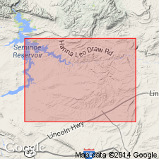
Best exposed from old Ferris Ranch on North Platte River [now submerged; in NW/4 sec. 33, T. 23 N., R. 84 W.], east to top of hill north of "Middle Ditch" at its junction with "Big Ditch" [in sec. 28, T. 23 N., R. 83 W., Walcott quadrangle (1914 ed.), scale 1:125,000], Carbon Co., central southern WY.
[Additional locality information from USGS historical topographic map collection TopoView, accessed March, 14, 2016.]
Source: US geologic names lexicon (USGS Bull. 896, p. 728-729).
- Usage in publication:
-
- Ferris formation*
- Modifications:
-
- Age modified
- AAPG geologic province:
-
- Denver basin
Summary:
p. 81-82. Ferris formation. Supposed unconformity between the Medicine Bow and Ferris is now regarded as nonexistent or as marked by a transitional zone indicating erosional irregularity. Basal 1,000 feet of Ferris is a coal-barren conglomeratic zone whose matrix and pebbles are similar to those of Medicine Bow. This zone yields remains of Triceratops and a Cretaceous flora not materially different from the lower Medicine Bow and Lance. Typical Paleocene flora has been found in lowest coal-bearing strata just above the latest dinosaur remains of the Ferris, indicating that the Cretaceous-Tertiary boundary is at or near that level. Concluded that Medicine Bow formation encompasses basal dinosaur-bearing part of the Ferris and that the remainder of the Ferris, about 5,500 feet, is Paleocene.
Source: US geologic names lexicon (USGS Bull. 1200, p. 1343).

- Usage in publication:
-
- Ferris Formation*
- Modifications:
-
- [Principal reference]
- Dominant lithology:
-
- Shale
- Sandstone
- Siltstone
- Coal
- AAPG geologic province:
-
- Green River basin
Summary:
Pg. 46-47. Ferris Formation. As originally proposed by Bowen. Lower part is conglomeratic sandstone, sandstone, siltstone, and shale, 1,100 feet thick; upper part is finer grained sandstone, shale, and coal, 5,400 feet thick. Total thickness about 6,500 feet at type locality. Conformably overlies Medicine Bow Formation; unconformably underlies Hanna Formation. Fossils. Age is Late Cretaceous [Maastrichtian] and early Tertiary (early Paleocene).
Type locality (Bowen, 1918): exposures between the old Ferris Ranch on the North Platte River [now submerged], in sec. 33, T. 23 N., R. 84 W., and a hilltop to the east, in sec. 28, T. 23 N., R. 83 W. [Walcott quadrangle (1914 ed.), scale 1:125,000], Carbon Co., central southern WY.
Source: Publication.
- Usage in publication:
-
- Ferris Formation*
- Modifications:
-
- Biostratigraphic dating
- AAPG geologic province:
-
- Green River basin
Summary:
Pg. 53 (table 1). Ferris Formation. Palynomorphs (identified by D.J. Nichols, USGS) from the coal-bearing strata above the basal conglomeratic sandstone (Upper Cretaceous) of the Ferris indicate an early Paleocene age (tentatively zones P1 and P2). Palynomorphs from near base of overlying Hanna Formation (Brooks Rider bed) indicate a middle Paleocene (zone P3) age.
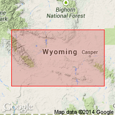
Study area in the Hanna basin, Carbon County, central southern Wyoming, where formation is up to 5,500 feet (1,676 m) thick.
For detailed descriptions of sampled intervals, see also G.B. Glass, 1975, Geol. Survey Wyoming Rpt. Inv., no. 11, 219 p., and G.B. Glass and J.T. Roberts, 1984, Geol. Survey Wyoming Rpt. Inv., no. 27, 104 p.
Source: Publication.
For more information, please contact Nancy Stamm, Geologic Names Committee Secretary.
Asterisk (*) indicates published by U.S. Geological Survey authors.
"No current usage" (†) implies that a name has been abandoned or has fallen into disuse. Former usage and, if known, replacement name given in parentheses ( ).
Slash (/) indicates name conflicts with nomenclatural guidelines (CSN, 1933; ACSN, 1961, 1970; NACSN, 1983, 2005, 2021). May be explained within brackets ([ ]).