


- Usage in publication:
-
- Cedar Hills sandstone
- Modifications:
-
- Original reference
- Dominant lithology:
-
- Sandstone
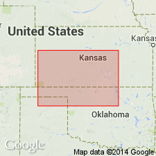
- AAPG geologic province:
-
- Sedgwick basin
Summary:
Pg. 3, 24. Cedar Hills sandstone [in Cimarron group]. Chiefly unevenly hard, in part massive, concretionary, fine-grained, bright-red sandstones, 50 to 75 feet thick, locally underlying Flower-pot shales and overlying Salt Plain measures in Barber County, central southern Kansas. Included in Salt Fork division. Age is Permian.
Named from Cedar Hills, near Hazelton, Barber Co., central southern KS.
Source: US geologic names lexicon (USGS Bull. 896, p. 382); GNC KS-NE Permian Corr. Chart, Oct. 1936; supplemental information from GNU records (USGS DDS-6; Denver GNULEX).
- Usage in publication:
-
- Cedar Hills sandstone*
- Modifications:
-
- Revised
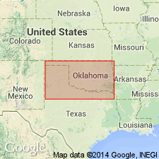
- AAPG geologic province:
-
- Anadarko basin
- Sedgwick basin
Summary:
Pg. 1782, 1789-1791. Assigned to Nippewalla group (new).
Source: US geologic names lexicon (USGS Bull. 1200, p. 688).

- Usage in publication:
-
- Cedar Hills sandstone
- Modifications:
-
- Overview
Summary:
Pg. 39. Cedar Hills sandstone of Nippewalla group. Consists of feldspathic sandstone, siltstone, and silty shale, chiefly red, containing beds of white sandstone in upper and lower parts; upper part contains "snow balls" of white gypsum; shaly siltstone separates the more resistant and more massive coarse siltstone and very fine sandstone. Thickness about 180 feet. Underlies Flower-pot shale; overlies Salt Plain formation. [Age is Early Permian (Leonardian).]
Source: US geologic names lexicon (USGS Bull. 1200, p. 688).
- Usage in publication:
-
- Cedar Hills sandstone member*
- Modifications:
-
- Revised
- Mapped 1:500k
Summary:
Mapped as sandstone member of Hennessey shale.
Source: US geologic names lexicon (USGS Bull. 1200, p. 688).
For more information, please contact Nancy Stamm, Geologic Names Committee Secretary.
Asterisk (*) indicates published by U.S. Geological Survey authors.
"No current usage" (†) implies that a name has been abandoned or has fallen into disuse. Former usage and, if known, replacement name given in parentheses ( ).
Slash (/) indicates name conflicts with nomenclatural guidelines (CSN, 1933; ACSN, 1961, 1970; NACSN, 1983, 2005, 2021). May be explained within brackets ([ ]).