The National Geologic Map Database is migrating to a new infrastructure. We apologize for any service disruptions during this process.
|
|---|


- Usage in publication:
-
- Buckland Formation
- Modifications:
-
- Named
- Dominant lithology:
-
- Basalt
- Sandstone
- Mudstone
- Shale
- AAPG geologic province:
-
- Culpeper basin
- Piedmont-Blue Ridge province
Summary:
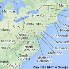
The Buckland Formation of the Culpeper Group, here named for exposures near Buckland, Prince William Co., VA, consists of basalt flows and interbedded sandstone, mudstone, and shale units. The basaltic flow units are designated I through V, with I being the oldest, and the sedimentary units are designated by the flows between which they occur, I-II through IV-V. The basalt is locally pegmatitic and columnar jointed. The Buckland crops out in an arcuate belt on the west side of the Culpeper basin, from the Rappahannock River north to near Leesburg. Overlies the Bull Run Formation; underlies the Waterfall Formation. Thickness is 1,670 m (5,480 feet). Age is Early Jurassic.
Source: GNU records (USGS DDS-6; Reston GNULEX).

- Usage in publication:
-
- Buckland Formation†
- Modifications:
-
- Abandoned
- AAPG geologic province:
-
- Culpeper basin
- Piedmont-Blue Ridge province
Summary:
The Buckland Formation of Lindholm (1979) is here abandoned. It is replaced by the Mount Zion Church Basalt, Midland Formation, Hickory Grove Basalt, Turkey Run Formation, and Sander Basalt of the Culpeper Group.
Source: GNU records (USGS DDS-6; Reston GNULEX).
For more information, please contact Nancy Stamm, Geologic Names Committee Secretary.
Asterisk (*) indicates published by U.S. Geological Survey authors.
"No current usage" (†) implies that a name has been abandoned or has fallen into disuse. Former usage and, if known, replacement name given in parentheses ( ).
Slash (/) indicates name conflicts with nomenclatural guidelines (CSN, 1933; ACSN, 1961, 1970; NACSN, 1983, 2005, 2021). May be explained within brackets ([ ]).