

- Usage in publication:
-
- Bear River group*
- Modifications:
-
- Original reference
- Dominant lithology:
-
- Coal
- AAPG geologic province:
-
- Green River basin
Summary:
Pg. 91, 92. I have named the group of coal strata that is exposed beneath the middle Tertiary beds by upheaval at Bear River City [Wyoming], Evanston [Wyoming], and Coalville [Utah], the Bear River group. In cut just west of Bear River City the beds contain the greatest profusion of molluscan life I have ever seen in Tertiary beds of West. There seems to be mingling of fresh and brackish water fossils. Flora and fauna are distinct from those of any other formation. Inclined to regard the beds of lower Tertiary age. [Relations to Wasatch and other formations not explained.]
Source: US geologic names lexicon (USGS Bull. 896, p. 133-134).
- Usage in publication:
-
- Bear River group*
- Modifications:
-
- [Principal reference]
- Dominant lithology:
-
- Clay
- Limestone
- Sandstone
- AAPG geologic province:
-
- Green River basin
Summary:
Bear River group is composed of clay, limestone, sandstone, marl, gypseous earth, bituminous and fossiliferous shale. Is exposed in RR cuts about 1 mi west of Bear River. Age is early Tertiary. [Gives detailed section.]
Source: US geologic names lexicon (USGS Bull. 896, p. 133-134).
- Usage in publication:
-
- brackish-water beds of Bear River
- Modifications:
-
- Age modified [tentatively]
- AAPG geologic province:
-
- Green River basin
Summary:
Pg. 462. Brackish-water beds of Bear River have always been regarded by me as lower Eocene, but I am not wholly without suspicion they may prove to be Cretaceous.
Source: US geologic names lexicon (USGS Bull. 896, p. 133-134).
- Usage in publication:
-
- Bear River group
- Modifications:
-
- Age modified
- AAPG geologic province:
-
- Green River basin
- Uinta basin
Summary:
Pg. 435-444, and Bull. no. 2, p. 1-2. Assigned Bear River group to Cretaceous.
Source: US geologic names lexicon (USGS Bull. 896, p. 133-134).
- Usage in publication:
-
- Bear River series
- Modifications:
-
- Revised
White, C.A., 1883, Fossils of Laramie group; Contributions to invertebrate paleontology No. 4: U.S. Geological and Geographical Survey of the Territories (Hayden), Annual Report, 12, p. 49-104.
Summary:
Pg. 52-53. I formerly included Bear River series in Laramie group, but lower part, which is of brackish water origin, contains a molluscan fauna, every known species of which is distinct from other formations and different from any found in any other parts of regional divisions of Laramie group. It is serious question whether we ought not to regard Bear River series as separate division of Laramie group, if not a separate group. Continuity of Bear River series with great body of Laramie group elsewhere is not known to exist.
Source: US geologic names lexicon (USGS Bull. 896, p. 133-134).
- Usage in publication:
-
- Bear River Laramie
- Modifications:
-
- Overview
Cope, E.D., 1888, Mesozoic realm: American Geologist, v. 2, p. 261-268.
Summary:
C.A. White footnote on p. 265-267. Fauna of Bear River Laramie is entirely different from that of Laramie proper, but I do not know which is older.
Source: US geologic names lexicon (USGS Bull. 896, p. 133-134).
- Usage in publication:
-
- Bear River Laramie
- Modifications:
-
- Age modified
Summary:
Pg. 153. The so-called Bear River Laramie I have long believed to be considerably older than Laramie formation proper.
Source: US geologic names lexicon (USGS Bull. 896, p. 133-134).
- Usage in publication:
-
- Bear River formation
- Modifications:
-
- Revised
White, C.A., 1892, On the Bear River formation, a series of strata hitherto known as the Bear River Laramie: American Journal of Science, 3rd series, v. 43, no. 254, p. 91-97.
Summary:
Pg. 97. Bear River formation is not = Laramie, but underlies equivalent of the Fort Benton.
Source: US geologic names lexicon (USGS Bull. 896, p. 133-134).
- Usage in publication:
-
- Bear River formation*
- Modifications:
-
- Biostratigraphic dating
- Age modified
- Areal extent
- Adopted
Summary:
Pg. 15-16, 45-46. Bear River formation. Brackish-water deposits, 650 to 2,500 feet thick. Has recently been shown to occupy much lower horizon than Laramie formation, or probably about that of the Dakota.
[See also C.A. White, 1895, The Bear River formation and its characteristic fauna, USGS Bull. 128, 108 p.]
Source: US geologic names lexicon (USGS Bull. 896, p. 133-134).
- Usage in publication:
-
- Bear River formation*
- Modifications:
-
- Areal extent
Stanton, T.W., 1903, A new fresh-water molluscan faunule from the Cretaceous of Montana: American Philosophical Society Proceedings, v. 42, no. 172, p. 188-199.
Summary:
Pg. 192. Bear River formation. Conglomerates, sandstones, and shales, 4,000 feet thck, containing a large and peculiar fresh-water fauna. Principal known area extends from neighborhood of Evanston northward near western boundary of Wyoming for more than 100 miles. Is known to lie between the Fort Benton [Benton] and the marine Jurassic. Indications are that the Bear River and the Dakota are of nearly same age. [See also T.W. Stanton, 1913 (Washington Acad. Sci. Jour., v. 3, p. 63).]
[GNC remark (ca. 1936, US geologic names lexicon, USGS Bull. 896, p. 134): Later field work showed thickness of Bear River formation to range from 500 to 5,000 feet, and it is now believed to include considerably more than the equivalent of Dakota sandstone.]
Source: US geologic names lexicon (USGS Bull. 896, p. 133-134).
- Usage in publication:
-
- Bear River formation
- Modifications:
-
- Areal extent
Summary:
Bear River formation. Mapped in Utah. Age is Early Cretaceous.
Source: US geologic names lexicon (USGS Bull. 1200, p. 252-253).
- Usage in publication:
-
- Bear River formation
- Modifications:
-
- Areal extent
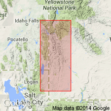
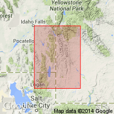
- AAPG geologic province:
-
- Central Western Overthrust
Summary:
Pg. 3, 4, 5. Bear River formation. In Bonneville County, Idaho, underlies Wayan formation and overlies Tygee sandstone of Gannett group. Thickness 152 feet. Age is Early Cretaceous.
Source: US geologic names lexicon (USGS Bull. 1200, p. 252-253).
- Usage in publication:
-
- Bear River Formation
- Modifications:
-
- Revised
- AAPG geologic province:
-
- Green River basin
- Snake River basin
- Wasatch uplift
Summary:
Pg. 1373-1374 (figs. 2, 3), 1383, 1387. Bear River Formation. Revised to include Tygee Member (revised) at its base. Overlies Smoot Formation (new), top formation of Gannett Group.
Source: Publication.
- Usage in publication:
-
- Bear River Formation*
- Modifications:
-
- Areal extent
- AAPG geologic province:
-
- Green River basin
- Central Western Overthrust
Summary:
Bear River Formation. In southwestern Wyoming only, geographically restricted to areas east of Absaroka fault. Overlies Gannett Group and underlies Aspen Shale. Equivalent to Smiths, Thomas Fork, and (lower member of) Cokeville Formations (all three here named) west of Absaroka fault. Usage remains unchanged elsewhere. Age is Early Cretaceous.
Source: Publication; Changes in stratigraphic nomenclature, 1974 (USGS Bull. 1405-A, p. A2-A3).
For more information, please contact Nancy Stamm, Geologic Names Committee Secretary.
Asterisk (*) indicates published by U.S. Geological Survey authors.
"No current usage" (†) implies that a name has been abandoned or has fallen into disuse. Former usage and, if known, replacement name given in parentheses ( ).
Slash (/) indicates name conflicts with nomenclatural guidelines (CSN, 1933; ACSN, 1961, 1970; NACSN, 1983, 2005, 2021). May be explained within brackets ([ ]).