The National Geologic Map Database is migrating to a new infrastructure. We apologize for any service disruptions during this process.
|
|---|


- Usage in publication:
-
- Roberts Mountains formation
- Modifications:
-
- Named
- Biostratigraphic dating
- Dominant lithology:
-
- Limestone
- AAPG geologic province:
-
- Great Basin province
Summary:
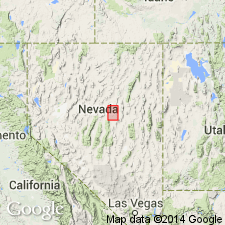
Roberts Mountains formation [probably] named for the Roberts Mountains, NV. Type section lies on west side of Roberts Creek Mountain [Roberts Creek Mountain 7.5' quad, Eureka Co]. Partial equivalent [lower part] at Lone Mountain; included by Hague (1883) in "Lone Mountain limestone". Consists of well-bedded, frequently slabby, dark slate gray limestone. Bedding becomes more massive in upper 800 ft; dolomitic 220 ft from top of unit. Much of lower and middle part of section consists of crystalline limestone beds (in part crinoidal). Moderately coarse-grained crinoidal beds from 6 in to about 2 ft in thickness are sometimes separated by thin-bedded, shaly limestone layers. Thickness at type section is 1900 ft; at Lone Mountain 741 ft. Overlies [conformably] the Hanson Creek formation (new) and conformably underlies the Lone Mountain formation (redefined). Lower boundary is drawn at base of a laterally persistent belt of bluish-black chert. Age is Silurian on the basis of fossils (brachiopods, corals, graptolites).
Source: GNU records (USGS DDS-6; Menlo GNULEX).
- Usage in publication:
-
- Roberts Mountains formation*
- Modifications:
-
- Adopted
- Redescribed
- AAPG geologic province:
-
- Great Basin province
Summary:
Roberts Mountains formation is adopted as defined by Merriam (1940). Type section is informally divided into lower (1100 ft) and upper (800 ft) units. Lower unit composed of medium gray to medium dark and dark slate gray, flaggy, platy, and shaly limestone; upper unit contains more massive and dolomitic beds. Age is Silurian (Niagara) on the basis of fossils (corals, brachiopods, graptolites).
Source: GNU records (USGS DDS-6; Menlo GNULEX).
- Usage in publication:
-
- Roberts Mountains Limestone*
- Modifications:
-
- Redescribed
- Biostratigraphic dating
- Mapped
- Dominant lithology:
-
- Limestone
- AAPG geologic province:
-
- Great Basin province
Summary:
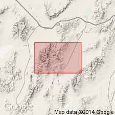
Pg. 9 (table 1), 17-19, pl. 1 (geol. map), pl. 3 (corr. chart), pl. 4 (fossil locs.). Roberts Mountains Limestone. Present in the Mount Lewis 15-min quadrangle, Lander County, Nevada, in the lower plate of Roberts thrust (carbonate eastern facies). Because here it is so predominantly limestone, it is locally designated Roberts Mountains Limestone. In fault contact with underlying Hanson Creek Formation and overlying Lone Mountain Dolomite. Estimated thickness 600 to 1,000 feet. Age is considered Silurian, based on fossils (corals, graptolites).
Source: Publication.
- Usage in publication:
-
- Roberts Mountains Formation*
- Modifications:
-
- Areal extent
- Overview
- AAPG geologic province:
-
- Idaho Mountains province
Summary:
A sequence of Upper Silurian (Pridolian) and Lower Devonian (Lochkovian) fossiliferous reef limestone, platy calcareous and dolomitic siltstone, and limestone phenoplast conglomerate assigned to Roberts Mountains Formation on the basis of age, lithologic character, and paleontologic setting. Is at least 656 ft thick. The lower unit is predominantly medium-gray, medium- to coarse-grained coralline patch-reef limestone with coral FAVOSITES and conodonts. The middle unit has lenticular reef limestone beds at base overlain by coarser encrinite, and has abundant reef talus. The upper unit is dominantly a fossiliferous phenoplast conglomerate or intraformational sedimentary limestone breccia. Fossils (corals, gastropods, forams, tentaculids, trilobites, brachiopods, calcareous algae, conodonts) in all three units. Geologic map, columnar section. Is a transitional facies thrust over the shelf sequence.
Source: GNU records (USGS DDS-6; Denver GNULEX).
- Usage in publication:
-
- Roberts Mountains Formation*
- Modifications:
-
- Age modified
- Overview
- AAPG geologic province:
-
- Idaho Mountains province
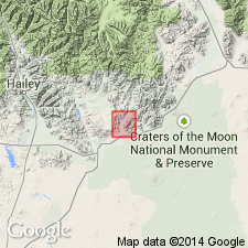
Summary:
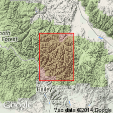
Mapped within Wildhorse window in northeast part of study area, Custer Co, ID, Idaho Mountains province. Divided into lower limestone and upper siltstone units. Limestone unit consists of light-gray, platy-bedded to massive, silty limestone and dolomitic limestone containing prominent 11 m thick bed of interlayered black dolomite and black chert at base; contains Monograptid graptolites of Wenlockian (Middle Silurian) age; lower part unfossiliferous but may be Early Silurian age; minimum measured thickness is 40 m; minimum thickness on cross section is 120 m. Siltstone unit consists of buff, tan- to orange-weathering, thin- to medium-bedded, slabby to block, slightly calcareous to dolomitic siltstone with graded bedding, small-scale cross-bedding, and convolute structure; dense and silicified in places; base not exposed though generally concordant with underlying limestone unit; contains unidentified brachiopod molds and crinoid debris, and Silurian corals; thickness about 600 m. Roberts Mountains underlies unnamed dolomite (Silurian and Devonian) with sharp concordant contact; overlies, probably disconformably, Hanson Creek Formation. Assigned Middle and (or) Late Silurian age.
Source: GNU records (USGS DDS-6; Denver GNULEX).
- Usage in publication:
-
- Roberts Mountains Formation*
- Modifications:
-
- Age modified
- AAPG geologic province:
-
- Great Basin province
Summary:
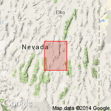
Age of the Roberts Mountains Formation in the Lynn window, Tuscarora Mountains [Rodeo Creek NE 7.5' quad, Eureka Co], NV is Early Silurian (late Llandoverian) to Early Devonian on the basis of fossils (graptolites) identified by W.B.N. Berry.
Source: GNU records (USGS DDS-6; Menlo GNULEX).
For more information, please contact Nancy Stamm, Geologic Names Committee Secretary.
Asterisk (*) indicates published by U.S. Geological Survey authors.
"No current usage" (†) implies that a name has been abandoned or has fallen into disuse. Former usage and, if known, replacement name given in parentheses ( ).
Slash (/) indicates name conflicts with nomenclatural guidelines (CSN, 1933; ACSN, 1961, 1970; NACSN, 1983, 2005, 2021). May be explained within brackets ([ ]).