

- Usage in publication:
-
- Pierson Cove Formation
- Modifications:
-
- Named
- Dominant lithology:
-
- Mudstone
- Limestone
- AAPG geologic province:
-
- Great Basin province
Summary:
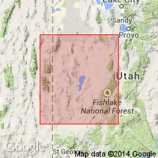
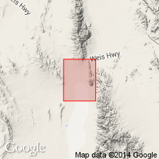
Named after valley shown on Wah Wah Summit topographic quad. Type section about 2 km south of Pierson Cove in Wah Wah Mountains, NW/4 sec 23, T26S, R16W, Beaver Co, UT, Great Basin province. Correlation chart shows unit also occurring in Fish Springs, northern and southern (not central) House and Cricket Ranges of western UT. Unit easily identified because it forms darkest (almost black) outcrops in Wah Wah Mountains. Consists predominately of dark-gray lime mudstone mottled with light-olive to brownish-gray dolomitic mudstone; next most common massive fine-crystalline medium-gray limestone, with occasional small rods or tubes filled with white calcite; least common is yellowish-gray laminated dolomitic boundstone forming white bands at base, in middle and near top of formation. Depositional environment may be shoal. At type is 440 m thick. Conformably overlies Eye of Needle Limestone (new) with transitional contact; conformably underlies Trippe Limestone (revised) with gradational contact. Correlates in part with Highland Peak Formation, Pioche, NV. In western UT correlates with upper part of Abercrombie Formation and Young Peak Dolomite, Deep Creek Range; lower part of Marjum Formation, central House Range; lower part of Fandangle Limestone, Dugway Range and Dagmar Dolomite, Herkimer Limestone, Bluebird Dolomite and lower part of Cole Canyon Dolomite, East Tintic Mountains. Assigned to trilobite BOLASPIDELLA Zone (Middle Cambrian).
Source: GNU records (USGS DDS-6; Denver GNULEX).
- Usage in publication:
-
- Pierson Cove Formation*
- Modifications:
-
- Adopted
- Areal extent
- AAPG geologic province:
-
- Great Basin province
Summary:
Pierson Cove Formation of Hintze and Robison (1975) is adopted and geographically extended into the southern Fish Springs Range and eastern Swasey Mountains. Thickness is 370 m. Conformably overlies the Wheeler Shale; conformably underlies the unnamed lower member of the Trippe Limestone. Age is Middle Cambrian.
Source: GNU records (USGS DDS-6; Menlo GNULEX).
For more information, please contact Nancy Stamm, Geologic Names Committee Secretary.
Asterisk (*) indicates published by U.S. Geological Survey authors.
"No current usage" (†) implies that a name has been abandoned or has fallen into disuse. Former usage and, if known, replacement name given in parentheses ( ).
Slash (/) indicates name conflicts with nomenclatural guidelines (CSN, 1933; ACSN, 1961, 1970; NACSN, 1983, 2005, 2021). May be explained within brackets ([ ]).