

- Usage in publication:
-
- Bonneterre limestone
- Modifications:
-
- Original reference
- Dominant lithology:
-
- Limestone
- AAPG geologic province:
-
- Ozark uplift
Summary:
Pg. 358-361. Bonne Terre [Bonneterre] or St. Joseph limestone. Non-cherty limestones, 300 feet thick; some fossiliferous strata; contains upper and lower lead zones. Overlies La Motte [Lamotte] sandstone and unconformably underlies Potosi slates and conglomerates, the basal bed of which consists of 6.5 feet of conglomerate.
Named for exposures at Bonneterre, St. Francois Co., southeastern MO.
Source: US geologic names lexicon (USGS Bull. 896, p. 235-236).
- Usage in publication:
-
- Bonneterre limestone*
- Modifications:
-
- Revised
Summary:
Pg. 21-26. Bonneterre limestone. As a rule consists of more or less heavily bedded, granular, and highly magnesium limestones, generally compactly crystalline and often minutely vesicular, with dolomite crystals lining the cavities; a few beds are fine-grained; color light- or dark-gray; usually weathers yellowish; locally contains beds of a pink or more decidedly red color; chert and drusy quartz seem to be entirely absent; some beds, especially in lower part, contain much chlorite, in places sufficient to give them a decidedly green color; toward base much silica occurs as grains of sand in the limestone. Thickness varies from 200 to 250 feet in vicinity of Mine La Motte and Frederickstown to nearly 500 feet in St. Francois County, to the north. It seems to wedge out on old hillsides. Appears to grade into underlying La Motte [Lamotte] sandstone. Where top of Bonneterre has suffered least from widespread erosion that took place prior to deposition of Elvins formation, it grades upward from the massive limestones into a thinly bedded zone, and this finally into a bed of blue shale; locally the thinly bedded and shaly zones appear to be absent. [See also entry under Elvins formation.]
Source: US geologic names lexicon (USGS Bull. 896, p. 235-236).
- Usage in publication:
-
- Bonneterre formation*
- Modifications:
-
- Revised
Summary:
Bonneterre formation. Consists of (descending): (1) argillaceous dolomite; (2) 250 to 300 feet of dark and light-gray dolomite with thin shale partings; (3) 50 to 100 feet of buff or gray dolomite, arenaceous buff or yellowish dolomite, thin green, gray, or brownish black shale beds, chloritic dolomite. Grades into underlying La Motte [Lamotte] sandstone. Is overlain by Davis formation (lower part of Elvins formation of Ulrich), 150 to 190 feet thick.
Source: US geologic names lexicon (USGS Bull. 896, p. 235-236).
- Usage in publication:
-
- Bonneterre formation
- Modifications:
-
- Overview
Summary:
Pg. 39. Nason placed upper limit of Bonneterre at edgewise conglomerate horizon, which is about 6 feet below "Central" marble boulder member of Davis formation. From sections given by Ulrich in 1905 it would appear that he similarly revised the Bonneterre, as defined by Nason, his Elvins formation being above the conglomerate, just below the "Central" marble boulder member of Buckley's Davis. Therefore Davis formation as recognized in latest reports contains probably 100 feet or more of shale and shaly dolomite that had been included in Bonneterre in earlier reports.
Source: US geologic names lexicon (USGS Bull. 896, p. 235-236).
- Usage in publication:
-
- Bonneterre dolomite*
- Modifications:
-
- Areal extent
- AAPG geologic province:
-
- Ozark uplift
Summary:
Pg. 234 (table 1). [Bonneterre dolomite] underlies Davis formation of Elvins group. [Age is Late Cambrian. Report includes correlation chart.]
Source: US geologic names lexicon (USGS Bull. 1200, p. 427); supplemental information (in brackets) from GNU records (USGS DDS-6; Denver GNULEX).
- Usage in publication:
-
- Bonneterre formation
- Modifications:
-
- Revised
- AAPG geologic province:
-
- Ozark uplift
Summary:
Pg. 248-267. Bonneterre formation. Includes Tom [Taum] Sauk limestone member (new) at base. [See also Taum Sauk.]
Source: US geologic names lexicon (USGS Bull. 1200, p. 427, 3913-3914).
- Usage in publication:
-
- Bonneterre formation
- Modifications:
-
- Overview
Summary:
Bonneterre formation. Varies in thickness throughout area, for it overlaps Lamotte sandstone and is to a certain degree still affected by irregularities in Precambrian surface. Average thickness 375 feet; maximum thickness 448 feet of Delassus on Bonneterre plain. Thickness decreases regularly southward with average of 200 feet in Madison County and minimum of 50 feet where unit lies directly on rhyolite porphyry. Two-fold lithic division recognized: basal 50 feet, which is intricate sequence interbedded and intergrading glauconitic sandstones, fine gray and yellow shales, fossiliferous crystalline limestone, and barren white or pink dolomites; and a 200- to 300-foot upper part, which is essentially a massive-bedded barren crystalline dolomite. Basal 50 feet carries late CEDARIA fauna of more than 61 species. [Age is Late Cambrian.]
Source: US geologic names lexicon (USGS Bull. 1200, p. 427).

- Usage in publication:
-
- Bonneterre formation
- Modifications:
-
- Areal extent
- AAPG geologic province:
-
- Upper Mississippi embayment
Summary:
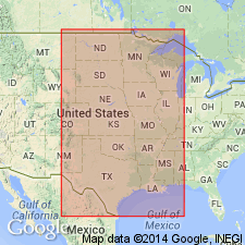
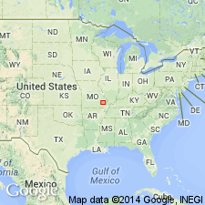
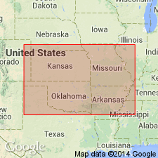
Bonneterre formation. Extended into subsurface of southeastern Missouri.
Source: GNU records (USGS DDS-6; Reston GNULEX).

- Usage in publication:
-
- Bonneterre formation
- Modifications:
-
- Overview
- AAPG geologic province:
-
- Ozark uplift
- Upper Mississippi embayment
Summary:
(Paleozoic Era; Cambrian System by W.C. Hayes and R.D. Knight, p. 15-18.) Bonneterre formation. Light-gray, medium- to fine-grained, medium-bedded dolomite; consists of relatively pure limestone in some areas. Thickness up to 1,580 feet in subsurface of Pemiscot County, Missouri; is about 375 to 400 feet in Lead Belt. Conformably overlies Lamotte formation; conformably underlies Davis formation of Elvins group. Age is Late Cambrian.
Source: Publication.
- Usage in publication:
-
- Bonneterre Dolomite
- Modifications:
-
- Overview
Summary:
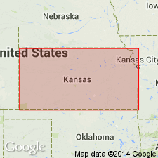
(Paleozoic Era; [Cambrian through Mississippian Systems] by E.D. Goebel, p. 12.) Bonneterre Dolomite. A conspicuously glauconitic, noncherty dolomite which is dark, gray to brown and finely crystalline in eastern Kansas and buff to white and coarsely crystalline in western Kansas. Includes sandy and silty dolomite, and, locally near the top, dolomitic shale beds. Distributed throughout Kansas except in places on the Central Kansas uplift and the Nemaha anticline. In western Kansas, most of the rocks reported to be Arbuckle are probably equivalent to the Bonneterre (Merriam, 1963). The Bonneterre is gradational downward into the Lamotte Sandstone. Thickness ranges from 0 at the margins of some uplifts to 150 feet in basin areas. [Age is Late Cambrian.]
Reference cited: Merriam, D.F., 1963, "The geologic history of Kansas," Kansas Geol. Survey Bull., no. 162.
Source: Publication.
- Usage in publication:
-
- Bonneterre Formation
- Modifications:
-
- Revised
- Areal extent
- AAPG geologic province:
-
- Ozark uplift
Summary:
Bonneterre Formation. Present [in outcrop and subsurface] from Crawford County, Missouri, southwestward into Carroll County, Arkansas. Lower part includes (ascending): "Bonneterre-Lamotte transition beds," sandstone with varying amounts of dolomite, distinguished from underlying Lamotte Sandstone by addition of shale; and an interval of intertonguing oolite facies and micrite and shale facies. Upper part revised to include (ascending): Sullivan Siltstone Member and Whetstone Creek Member (both new). Underlies, in places unconformably, Davis Formation [of Elvins Group]. High shale content in Davis distinguishes it from underlying Whetstone Creek. Thickness fairly uniform east of Wright County, Missouri. Carbonates thin to the southwest; in Carroll County, Arkansas, all but uppermost part changes to a nearshore, coarsely clastic, sandy facies which is assigned to the Reagan Sandstone. Age is Late Cambrian (early Dresbachian to early Franconian). Report includes core descriptions, cross section, stratigraphic chart.
Source: Missouri lexicon (Thompson, 2001, Missouri Geol. Survey Rpt. Inv., no. 73, p. 37-38); GNU records (USGS DDS-6; Denver GNULEX).

- Usage in publication:
-
- Bonneterre Formation
- Modifications:
-
- Overview
- AAPG geologic province:
-
- Illinois basin
Summary:
West of Illinois, Bonneterre Formation is equivalent to Eau Claire Formation. Galesville Formation in Illinois is probably equivalent to upper carbonate beds of Bonneterre Formation.
Source: GNU records (USGS DDS-6; Reston GNULEX).
- Usage in publication:
-
- Bonneterre Formation
- Modifications:
-
- Areal extent
- AAPG geologic province:
-
- Ozark uplift
Summary:
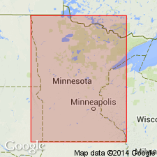
Pg. 6. Upper tongue of Bonneterre Formation recognized in southeastern Minnesota where it interfingers with Eau Claire Formation. Age is Late Cambrian (Dresbachian).
Source: GNC index card files (USGS-Reston).

- Usage in publication:
-
- Bonneterre Formation
- Modifications:
-
- Overview
Summary:
Pg. 18-19. The Bonneterre Formation. Is typically a light-gray, medium- to finely crystalline, medium-bedded dolomite, but also consists of pure limestone in some areas. In places it is very coarsely crystalline, it contains small cavities which are lined with dolomite rhombs. Locally, parts of the Bonneterre are glauconitic and shaly with the shale occurring in beds less than 2 inches thick. In some areas, the formation contains beds of relatively pure, thin-bedded, pink limestone which is referred to as "Taum Sauk marble." Wherever the Bonneterre has been deposited near or directly on the Precambrian surface, it contains pebbles and cobbles of igneous rock, much of which is felsite. Host rock at Doe Run's Hayden Creek mine is a granite conglomerate cemented by dolomite. Ore is present in dolomite and fills fractures in the granite boulders. Conformably overlies Lamotte Sandstone. The lower part of the Bonneterre consists of alternating beds of dolomite and arenaceous dolomite with the amount of sand increasing toward the base. This sandy zone (often called the "Bonneterre-Lamotte transition zone") is usually 10 to 20 feet thick, but may approach a thickness of 200 feet. The Bonneterre overlaps the underlying Lamotte on flanks of Precambrian highs. Westward, it [grades laterally into] nearshore facies of Reagan Sandstone. Includes Sullivan Siltstone and Whetstone Creek Members of Kurtz and others (1975, Missouri Geol. Survey, Rpt. of Inv., no. 55, p. 13). Most of the Bonneterre exposures lie to the north and east of the main area of Precambrian exposures; is concealed by younger beds to the west and south. In the Lead Belt and Viburnum Trend area, the formation is approx. 375 to 400 feet thick. Occurs in subsurface throughout most of state; attains maximum known thickness of 1,580 feet in subsurface of Peniscot County, Missouri. Major lead production has been from the lower half of the formation.
Source: Publication.

- Usage in publication:
-
- Bonneterre Formation*
- Modifications:
-
- Areal extent
- AAPG geologic province:
-
- Illinois basin
- Ozark uplift
Summary:
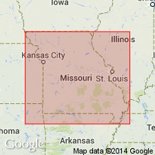
Bonneterre Formation occurs in subsurface of St. Louis area, Missouri and Illinois. Age is Late Cambrian (Croixan).
Source: GNU records (USGS DDS-6; Reston GNULEX).
- Usage in publication:
-
- Bonneterre Formation
- Modifications:
-
- Overview
Summary:
Pg. 37. Nason's failure to designate which edgewise conglomerate was the top of his Bonneterre left the top of the formation uncertain. Buckley (1909, p. 26-44) was the first to establish the top of the Bonneterre as now defined. Overlies [Lamotte] Sandstone; underlies Davis Formation. Is equivalent to portions of the "St. Joseph limestone" of Winslow, the "Fredericktown limestone" of Keyes, the "Third Magnesian limestone" of Swallow, and the "Decaturville" of Shepard. Age is Cambrian. Report includes nomenclature history.
Type section: Nason (1901, p. 396) was the first to use the name Bonneterre. He applied it to the beds between what is now called the LaMotte Sandstone and an edgewise conglomerate in what is now called the Davis Formation. It was named from exposures at Bonne Terre, St. Francois Co., MO.
Source: Publication.
- Usage in publication:
-
- Bonneterre Formation*
- Modifications:
-
- Age modified
- Biostratigraphic dating
- AAPG geologic province:
-
- Ozark uplift
Miller, J.F., Evans, K.R., Kurtz, V.E., and Repetski, J.E., 2013, Biostratigraphy and sequence stratigraphy of Cambrian and lowest Ordovician strata in Missouri; Chapter 2: Missouri Geological Survey Report of Investigations, no. 70, pt. 1 (revised), p. 13-24.
Summary:
Pg. 14 (fig. 2-1), 15 (fig. 2-2), 17-18. Bonneterre Formation. Dolomite, siltstone, and limestone. Thickness 0 to 500 feet (0 to 150 m). Present in southeastern Missouri. Divided into (ascending): (1) a lower unnamed part, = informal Lamotte-Bonneterre "transition beds" (sandy carbonate) and unnamed main carbonate member, correlates with lower and middle parts of Eau Claire Formation of northwestern Missouri, Iowa, and Minnesota, ranges from CEDARIA to CREPICEPHALUS trilobite zone (upper Middle Cambrian, lower Croixan, upper Lincolnian, upper Marjuman); (2) Sullivan Siltstone Member, 15 to 78 feet thick, ranges from uppermost CREPICEPHALUS to lower APHELASPIS trilobite zone (spans the Middle-Upper Cambrian boundary, Lincolnian-Millardan boundary, and Marjuman-Steptoean boundary); and (3) Whetstone Creek Member, 8 to 74 feet thick (2.5 to 23 m).
Source: Publication.
- Usage in publication:
-
- Bonneterre Formation*
- Modifications:
-
- Principal reference
- Revised
- AAPG geologic province:
-
- Ozark uplift
Thompson, T.L., Mulvany, P.S., Palmer, J.R., Davis, J.G., and Miller, J.F., 2013, Cambrian stratigraphic succession in Missouri; Chapter 3: Missouri Geological Survey Report of Investigations, no. 70, pt. 1 (revised), p. 25-266.
Summary:
Pg. 38 (fig. 3-4), 107-127. Bonneterre Formation. Dolomite. Thickness 70.5 feet at principal reference section. Upper part of formation divided into (descending) Whetstone Creek Member and Sullivan Siltstone Member. Excludes Taum Sauk limestone facies (transferred to Dug Hill Formation, new) and the basal Lamotte-Bonneterre "transition beds". Lies below Davis Formation of Elvins Group and above Lamotte Sandstone. Age is Middle to Late Cambrian (Lincolnian to Millardan; Marjuman to Steptoean).
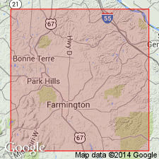
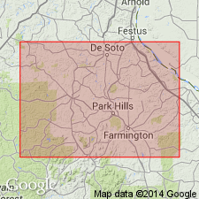
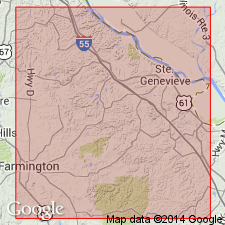
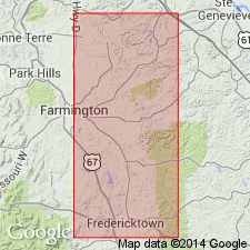
Principal reference section: excellent exposures in roadcut and adjacent natural river bluff immediately southeast of MO Route K Big River bridge, 2.3 mi east of junction of MO Route K and U.S. Route 67, 3.2 mi east of town of Bonne Terre, in SW/4 SE/4 sec. 8 (projected), T. 37 N., R. 5 E., [approx. Lat. 37 deg. 55 min. 36 sec. N., Long. 90 deg. 30 min. 05 sec. W.], Bonne Terre and French Village 7.5-min quadrangles, St. Francois Co., southeastern MO, credited to K.R. Evans.
Reference section (upper part of formation): in roadcut on north side of MO Route K, just east of Terre Bleue Creek, 0.6 mi east of principal reference section, in S/2 SW/4 sec. 9 (projected), T. 37 N., R. 5 E., [approx. Lat. 37 deg. 55 min. 42 sec. N., Long. 90 deg. 29 min. 16 sec. W.], French Village 7.5-min quadrangle, St. Francois Co., southeastern MO.
[Additional locality information from USGS historical topographic map collection TopoView; accessed on Tiller's Big 13th, January 22, 2015.]
Source: Publication.
For more information, please contact Nancy Stamm, Geologic Names Committee Secretary.
Asterisk (*) indicates published by U.S. Geological Survey authors.
"No current usage" (†) implies that a name has been abandoned or has fallen into disuse. Former usage and, if known, replacement name given in parentheses ( ).
Slash (/) indicates name conflicts with nomenclatural guidelines (CSN, 1933; ACSN, 1961, 1970; NACSN, 1983, 2005, 2021). May be explained within brackets ([ ]).