- Usage in publication:
-
- Boles Member
- Modifications:
-
- Original reference
- Dominant lithology:
-
- Dolomite
- Limestone
- AAPG geologic province:
-
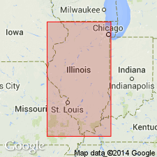
- Illinois basin
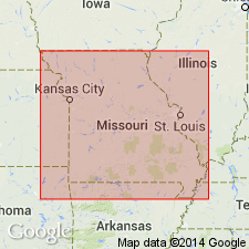
- Ozark uplift
Summary:
Pg. 60, 228. Boles Member of Joachim Dolomite of Ancell Group (new). Name proposed for member of Joachim Dolomite [also called Joachim Formation in text]. Principally thin to medium beds of silty dense dolomite alternating with similar layers of pure vuggy dolomites; in Cape Girardeau section, member is limestone. Contains at least seven discontinuous bands of nodular white to black chert. In Jefferson and St. Louis Counties, eastern Missouri, a chert band within this member has been designated as boundary between Rock Levee and Joachim Formations (Grohskopf, 1948), but in well in Jackson County, western Illinois, boundary was placed at chert band that appears to be near base of Augusta member (new). Thickness about 20 feet in most outcrops; 30 feet in Ancell type section. Overlies Augusta Member; underlies Defiance Member (new). Age is Middle Ordovician (Champlainian).
Type section: quarry in bluffs on north side of Missouri River 1 mi southwest of Matson, in northeast corner SE/4 NE/4 SW/4 sec. 4, T. 44 N., R. 2 E., Augusta 7.5-min quadrangle, St. Charles Co., eastern MO. Named from hamlet of Boles which is on Missouri Pacific RR on south side of Missouri River and 6 mi southwest of type section.
Source: US geologic names lexicon (USGS Bull. 1350, p. 81); supplemental information from GNU records (USGS DDS-6; Reston GNULEX).

- Usage in publication:
-
- Boles Member
- Modifications:
-
- Overview
- AAPG geologic province:
-
- Illinois basin
Summary:
Pg. 53 (fig. O-4), 61 (fig. O-15), 65. Boles Member of Joachim Dolomite of Ancell Group. Recognized in southern Illinois. Consists of thin to medium beds of dense silty dolomite and vuggy pure dolomite, separated by layers of dark-red-brown to gray-green shale as much as 5 inches thick. Many bedding surfaces are ripple marked, and mud cracks are common. Contains several bands of white to black chert nodules and is the only persistent chert zone in outcropping Joachim. However, chert is absent in places, and in subsurface of Illinois it occurs in other members of Joachim. Boles is distinguished from Augusta Member below and Defiance Member above by its thin bedding, abundance of shale, and chert bands. Thickness commonly about 20 feet; ranges 15 to 30 feet. Age is Middle Ordovician (Champlainian; Blackriverian).
Source: Publication.

- Usage in publication:
-
- Boles Member
- Modifications:
-
- Overview
- AAPG geologic province:
-
- Ozark uplift
Summary:
Pg. 36. Boles Member of Joachim Dolomite. The Defiance and Boles Members are very similar lithologically. However, the Boles does possess one or more beds of small chert nodules at some localities. It was at this chert horizon that the base of the "Rock Levee" formation was placed, before it was realized (Thompson, 1991) that the "Rock Levee" (i.e., "Pecatonica") Formation did not extend any farther north than its pinch-out in Perry County, Missouri. The "middle Joachim Dolomite" (Boles and Defiance Members combined) is readily distinguishable from the massively-bedded Matson Member above, and the slabby-bedded, sandy Augusta Member below. Age is [Late] Ordovician (Mohawkian).
See also T.L. Thompson, Missouri Div. Geol. Land Survey, Rpt. Inv., no. 70, pt. 3, 1991, and Missouri Div. Geol. Land Survey, v. 40 (revised), 2nd ser., 1995.
Source: Publication.
For more information, please contact Nancy Stamm, Geologic Names Committee Secretary.
Asterisk (*) indicates published by U.S. Geological Survey authors.
"No current usage" (†) implies that a name has been abandoned or has fallen into disuse. Former usage and, if known, replacement name given in parentheses ( ).
Slash (/) indicates name conflicts with nomenclatural guidelines (CSN, 1933; ACSN, 1961, 1970; NACSN, 1983, 2005, 2021). May be explained within brackets ([ ]).

