

- Usage in publication:
-
- Aztec sandstone*
- Modifications:
-
- Original reference
- Dominant lithology:
-
- Sandstone
- AAPG geologic province:
-
- Great Basin province
Summary:
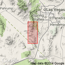
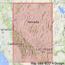
Pg. 9, 35, etc. Aztec sandstone. Massive ledge of reddish or buff sandstone, minutely cross-bedded. Is made up of many lenses, mostly 10 to 25 feet thick, each lens in turn made up of smaller laminae 0.5 to 2 inches thick. Thickness 2,100 feet at north border of quadrangle. Overlies Chinle Formation; unconformably underlies Quaternary deposits. Age is Jurassic(?), based on correlation with sandstones observed by Reeside and Bassler (1922) near St. George, Utah.
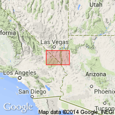
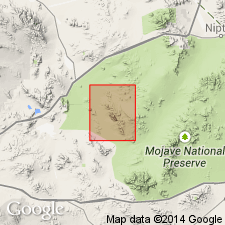
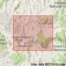
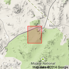
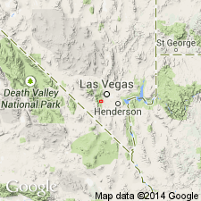
Named from Aztec Tank, a natural depression in the sandstone several hundred ft east of Contact Mine, in which water accumulates at times of heavy rain, Goodsprings quadrangle [Lat. 35 deg. 55 min. 43 sec. N., Long. 115 deg. 28 min. 12 sec. W., Cottonwood Pass 7.5-min quadrangle, Clark Co.], southeastern NV.
[Additional locality information from USGS GNIS database and ACME Mapper 2.0, accessed on Bastille Day 2009.]
Source: US geologic names lexicon (USGS Bull. 896, p. 98); supplemental information from GNU records (USGS DDS-6; Menlo GNULEX).
- Usage in publication:
-
- Aztec sandstone*
- Modifications:
-
- Areal extent
- AAPG geologic province:
-
- Great Basin province
Summary:
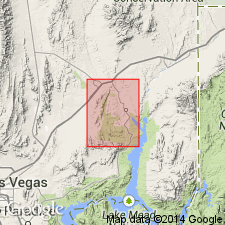
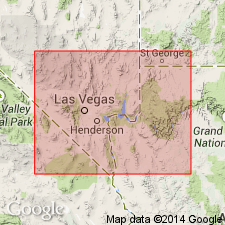
Pg. 929 (table 1), 931. Aztec sandstone. Geographically extended into northern Muddy Mountain area, Nevada. Thickness about 2,500 feet. Underlies, Upper Cretaceous Willow Tank formation (new), with angular unconformity, and overlies Chinle formation.
Source: US geologic names lexicon (USGS Bull. 1200, p. 185); GNU records (USGS DDS-6; Menlo GNULEX).
- Usage in publication:
-
- Aztec sandstone*
- Modifications:
-
- Areal extent
- AAPG geologic province:
-
- Great Basin province
Summary:
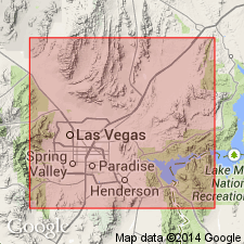
Pg. 34 (fig. 4), 35. Aztec sandstone. Geographically extended into Frenchman Mountain area, east of Las Vegas, southeastern Nevada. Here unconformably underlies Thumb formation (new) of Cretaceous(?) age. In Muddy Mountains, underlies Willow Tank formation and overlies Chinle formation. Age is Jurassic(?).
Source: US geologic names lexicon (USGS Bull. 1200, p. 185); GNU records (USGS DDS-6; Menlo GNULEX).
- Usage in publication:
-
- Aztec sandstone*
- Modifications:
-
- Areal extent
- AAPG geologic province:
-
- Great Basin province
Summary:
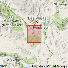
Pg. 48, pl. 1. Aztec sandstone. Mapped in Ivanpah quadrangle, California and Nevada. Geographically extended into the Mescal Range, 2 miles west of Kokoweef Peak in Mojave Desert. Here, thickness is 800 feet. Overlies Chinle Formation; underlies 50 feet of limestone and dolomite beds mapped with Aztec Sandstone. Age is Jurassic(?) [no basis given].
Source: US geologic names lexicon (USGS Bull. 1200, p. 185); GNU records (USGS DDS-6; Menlo GNULEX).
- Usage in publication:
-
- Aztec sandstone*
- Modifications:
-
- Areal extent
- AAPG geologic province:
-
- Great Basin province
Summary:
Aztec sandstone. Mapped in California part of Kingman sheet. Here extended to Devil's Playground area. Age is Jurassic(?). [no basis given]
Source: Modified from GNU records (USGS DDS-6; Menlo GNULEX).
- Usage in publication:
-
- Aztec Sandstone*
- Modifications:
-
- Mapped
- Dominant lithology:
-
- Quartzite
- Breccia
- AAPG geologic province:
-
- Great Basin province
Summary:
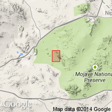
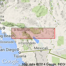
Aztec Sandstone. Mapped in northern part of Old Dad Mountain quadrangle, San Bernardino County, California. Geographically extended to Cowhole Mountain. Consists of dense quartzite. Contains boulder breccia lens 15 feet thick and 150 feet long near base. Thickness 1,975 to 2,100 feet. Age is Jurassic(?). "Small animal tracks, considered to be those of a Jurassic dinosaur, have been reported in the Mescal Range by J.R. Evans (oral commun., 1958)."
Source: GNU records (USGS DDS-6; Menlo GNULEX).
- Usage in publication:
-
- Aztec Sandstone*
- Modifications:
-
- Age modified
- AAPG geologic province:
-
- Great Basin province
Summary:
Aztec Sandstone. Authors indicate equivalence with Navajo Sandstone of Jurassic and Triassic(?) age.
Source: GNU records (USGS DDS-6; Menlo GNULEX).
- Usage in publication:
-
- Aztec Sandstone*
- Modifications:
-
- Areal extent
- AAPG geologic province:
-
- Great Basin province
Summary:
Aztec Sandstone. Mapped in Mescal Range quadrangle, San Bernardino County, California. Is 1,000 feet thick in Mescal Range. Age is Jurassic, based mainly on stratigraphic correlation with similar nonmarine sandstone in Nevada and Utah.
Source: GNU records (USGS DDS-6; Menlo GNULEX).
- Usage in publication:
-
- Aztec Sandstone*
- Modifications:
-
- Areal extent
- AAPG geologic province:
-
- Great Basin province
Summary:
Aztec Sandstone. Overlain by breccias of Paleozoic carbonic rocks in area north of Red Springs, northern Spring Mountains, Blue Diamond quadrangle, Nevada. (sketch map sec. 31, T. 20 S., R. 59 E.)
Source: GNU records (USGS DDS-6; Menlo GNULEX).
- Usage in publication:
-
- Aztec Sandstone*
- Modifications:
-
- Areal extent
- AAPG geologic province:
-
- Great Basin province
Summary:
Aztec Sandstone. Geographically extended to Old Dad Mountain, Mojave Desert, California. Contains lenses of pebble to boulder conglomerate derived from Bird Spring Formation. Is 90 feet thick and unconformably overlies Bird Spring Formation. Age is Early(?) Jurassic in text, but map shows Jurassic.
Source: GNU records (USGS DDS-6; Menlo GNULEX).
- Usage in publication:
-
- Aztec Sandstone*
- Modifications:
-
- Age modified
- Areal extent
- AAPG geologic province:
-
- Great Basin province
Summary:
Aztec Sandstone. Geographically extended into Currie Canyon and Currie Hills, Elko County, Nevada [this verified by R.R. Coats, 1/30/87, oral commun.]. Mapped in Elko and Clark Counties, Nevada. Age is Triassic(?) and Jurassic, based on correlation with Navajo Sandstone [this is a revision from Jurassic(?) age assignment].
Source: GNU records (USGS DDS-6; Menlo GNULEX).
- Usage in publication:
-
- Aztec Sandstone*
- Modifications:
-
- Areal extent
- AAPG geologic province:
-
- Great Basin province
Summary:
Aztec Sandstone. Measured sections in Cowhole Mountains. Contains interbedded volcanic units. In Cowhole Mountains, unconformably overlies Paleozoic carbonates and/or volcanics of Triassic(?) age. Conformably underlies Delfonte Volcanics in Cowhole Mountains (but unconformably in Mescal Range area).
Source: Modified from GNU records (USGS DDS-6; Menlo GNULEX).
- Usage in publication:
-
- Aztec Sandstone*
- Modifications:
-
- Age modified
- AAPG geologic province:
-
- Great Basin province
Summary:
Aztec Sandstone. [Conformably overlies the equivalent of the Moenave and Kayenta Formations in Clark County, Nevada]. Age is considered to be Early Jurassic, based on correlation with the Navajo Sandstone of the Colorado Plateau.
Source: GNU records (USGS DDS-6; Menlo GNULEX).
- Usage in publication:
-
- Aztec Quartzite*
- Modifications:
-
- Redescribed
- Dominant lithology:
-
- Quartzite
- AAPG geologic province:
-
- Great Basin province
Summary:
Aztec Quartzite. Name (applied in Grand Canyon area) extended geographically to sequence in Big Maria Mountains of southeastern California with change of lithic designation. Consists of fine-grained, ferruginous quartzite with few percent muscovite. Thickness here ranges from 2 to 150 m. Overlies Triassic(?) metasedimentary rocks; underlies Middle Jurassic(?) metaignimbrite. Intruded by Middle Jurassic granodiorite and metamorphosed in Cretaceous time. Age is Triassic(?) and Early Jurassic, based on correlation with Aztec Sandstone of the northeast Mojave Desert region.
Source: GNU records (USGS DDS-6; Menlo GNULEX).
- Usage in publication:
-
- Aztec Sandstone*
- Modifications:
-
- Age modified
- AAPG geologic province:
-
- Great Basin province
Summary:
Aztec Sandstone. Divided into "eastern facies" of eastern Mescal Range and "western facies" of western Mescal Range. Age is Late Triassic(?) and Early Jurassic(?), based on correlation with Navajo Sandstone.
Source: GNU records (USGS DDS-6; Menlo GNULEX).
- Usage in publication:
-
- Aztec Sandstone*
- Modifications:
-
- Overview
- AAPG geologic province:
-
- Great Basin province
Summary:
Detailed lithology, measured sections, origins ... for both Aztec and Navajo Sandstones included in report.
Source: GNU records (USGS DDS-6; Menlo GNULEX).
- Usage in publication:
-
- Aztec Sandstone*
- Modifications:
-
- Biostratigraphic dating
- Age modified
- AAPG geologic province:
-
- Great Basin province
Summary:
Aztec Sandstone. Trackways attributed to Coelurosaurs (small dinosaurs) identified in Aztec Sandstone in Mescal Range, northeastern San Bernardino County, California. Age range (for both Aztec and Navajo Sandstones) is suggested to be between early Pliensbachian and late middle Bajocian (citing Marzolf, 1982).
Source: GNU records (USGS DDS-6; Menlo GNULEX).
For more information, please contact Nancy Stamm, Geologic Names Committee Secretary.
Asterisk (*) indicates published by U.S. Geological Survey authors.
"No current usage" (†) implies that a name has been abandoned or has fallen into disuse. Former usage and, if known, replacement name given in parentheses ( ).
Slash (/) indicates name conflicts with nomenclatural guidelines (CSN, 1933; ACSN, 1961, 1970; NACSN, 1983, 2005, 2021). May be explained within brackets ([ ]).