

- Usage in publication:
-
- Wehutty Formation*
- Modifications:
-
- Named
- Dominant lithology:
-
- Schist
- Metasandstone
- Conglomerate
- AAPG geologic province:
-
- Piedmont-Blue Ridge province
- Appalachian basin
Summary:
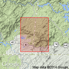
Named as a formation in Great Smoky Group. Named for settlement of Wehutty, southwestern NC, in north-central part of Isabella quad, TN-NC. Exposed along mostly poor roads leading northwest and southeast from Mt. Olive church, northeast of center of Isabella quad. Also seen along old State Rd through Postell, NC, and along Allen Branch and nearby lumber roads. Upper beds well exposed along wagon road of upper Persimmon Creek south of Wolfpen Gap, and along US Hwy 64 and minor tributary roads southeast of Franklin Gap, Isabella quad. Extends an unknown distance northeast and southwest of study area. Schist that was previously assigned to upper part of Copperhill Formation by Hurst (1955) in Mineral Bluff quad, GA, considered a transitional unit into overlying Hughes Gap Formation, is here reassigned to Wehutty. Because of the great lithologic differences originally described by Hurst (1955), the schist is here separated from Copperhill and contact placed where available information indicates a change from metasandstone of Copperhill and schist of Wehutty. Wehutty consists of alternating beds of fine-to medium-grained phyllitic schist and metasandstone (impure quartzite to metagraywacke); arenaceous layers have thin conglomerate layers. Upper contact with Hughes Gap is placed at top of a conglomeratic member within Wehutty that can be traced with confidence; marks change from dark schist (locally graphitic) and phyllite to light-colored sericitic and muscovitic schist. Age is Precambrian.
Source: GNU records (USGS DDS-6; Reston GNULEX).
- Usage in publication:
-
- Wehutty Formation
- Modifications:
-
- Overview
- AAPG geologic province:
-
- Piedmont-Blue Ridge province
Summary:
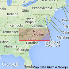
Wehutty Formation of Great Smoky Group of Ocoee Supergroup is mapped in Blue Ridge belt of western NC. Age is Late Proterozoic.
Source: GNU records (USGS DDS-6; Reston GNULEX).

- Usage in publication:
-
- Wehutty Formation*
- Modifications:
-
- Areal extent
- AAPG geologic province:
-
- Piedmont-Blue Ridge province
Summary:
Wehutty Formation of the Great Smoky Group is here mapped in the Murphy synclinorium in the Bill Arp thrust sheet in GA.
Source: GNU records (USGS DDS-6; Reston GNULEX).
For more information, please contact Nancy Stamm, Geologic Names Committee Secretary.
Asterisk (*) indicates published by U.S. Geological Survey authors.
"No current usage" (†) implies that a name has been abandoned or has fallen into disuse. Former usage and, if known, replacement name given in parentheses ( ).
Slash (/) indicates name conflicts with nomenclatural guidelines (CSN, 1933; ACSN, 1961, 1970; NACSN, 1983, 2005, 2021). May be explained within brackets ([ ]).