

- Usage in publication:
-
- Tomstown limestone*
- Modifications:
-
- Named
- Dominant lithology:
-
- Limestone
- AAPG geologic province:
-
- Appalachian basin
Summary:
Named Tomstown limestone for Tomstown, Franklin Co., PA. Consists of drab to white magnesian limestone with mottled dark- and light-gray pure limestone near base. Contains a cherty bed near the top of the formation. Unit is about 800 feet thick. It overlies the Antietam sandstone and underlies the Waynesboro formation. The Tomstown limestone is of Early Cambrian age.
Source: GNU records (USGS DDS-6; Reston GNULEX).
- Usage in publication:
-
- Tomstown dolomite*
- Modifications:
-
- Revised
- AAPG geologic province:
-
- Appalachian basin
Summary:
Name changed from Tomstown formation to Tomstown dolomite due to its main lithology being dolomite.
Source: GNU records (USGS DDS-6; Reston GNULEX).
- Usage in publication:
-
- Tomstown dolomite
- Modifications:
-
- Areal extent
- AAPG geologic province:
-
- Appalachian basin
Summary:
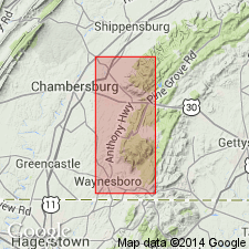
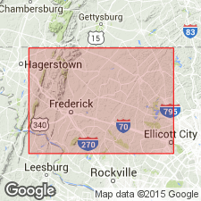
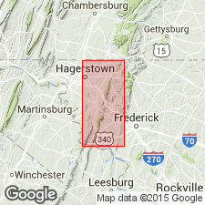
Geographically extended to MD. Narrow belt of Tomstown dolomite extends along east foot of Catoctin Mountain west and southwest of Frederick. Lies between ridge of Antietam quartzite and Triassic border fault. Thickness about 200 feet.
Source: GNU records (USGS DDS-6; Reston GNULEX).
- Usage in publication:
-
- Tomstown dolomite
- Modifications:
-
- Areal extent
- AAPG geologic province:
-
- Appalachian basin
Summary:
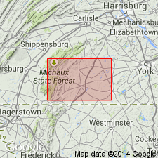
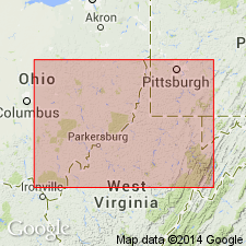
Geographically extended to WV. In WV, Tomstown dolomite crops out only in Jefferson Co. Outcrop is extended belt slightly more than 1 mi in width that enters county in vicinity of Antietam, Washington Co., MD, and strikes southwestward along meander belt of Shenandoah River into Clark Co. Estimated thickness between 1,200 and 1,500 feet. Overlies Antietam quartzite; underlies Waynesboro formation.
Source: GNU records (USGS DDS-6; Reston GNULEX).
- Usage in publication:
-
- Tomstown dolomite*
- Modifications:
-
- Areal extent
- AAPG geologic province:
-
- Appalachian basin
Summary:
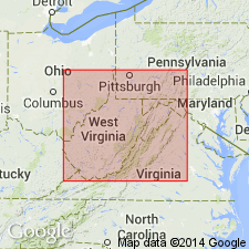
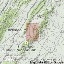
Geographically extended to VA. Described in Elkton area where it is 1000 feet thick. Overlies Antietam quartzite of Chilhowee Group; underlies Waynesboro formation. Closely resembles in character and stratigraphic position Shady dolomite, whose type locality is in northeastern TN. Name Tomstown is now used in VA as far south as Roanoke, beyond which name Shady is used.
Source: GNU records (USGS DDS-6; Reston GNULEX).
- Usage in publication:
-
- Tomstown Formation
- Modifications:
-
- Revised
- AAPG geologic province:
-
- Piedmont-Blue Ridge province
Summary:
Revised the Tomstown Formation by dividing unit into four new members in MD, PA and WV (ascending): Bolivar Heights, Fort Duncan, Benevola, and Dargan Members. Bolivar Heights Member consists predominantly of dark-gray, bioturbated and sheared limestone with white marble near base (200 to 250 feet thick). Fort Duncan Member consists of dark-gray, medium- to thick-bedded, bioturbated dolomite (175 to 200 feet thick). Benevola Member consists of light-gray, massive, coarse-grained dolomite (60 to 150 feet thick. Dargan Member consists of interbedded, dark-gray, bioturbated dolomite, medium to dark-gray, laminated dolomite, and dark-gray limestone (600 to 700 feet thick). The Tomstown overlies the Antietam Formation and underlies the Waynesboro Formation. Unit is of Early Cambrian age.
Source: GNU records (USGS DDS-6; Reston GNULEX).
- Usage in publication:
-
- Tomstown Dolomite*
- Modifications:
-
- Revised
- Areal extent
- Not used
- AAPG geologic province:
-
- Appalachian basin
Summary:
In cross section E-E', in the subsurface of central WV and western VA near Harrisburg and North Mountain, Shady Dolomite is used for limestone, gray shale, and equivalent dolomite(?). Shady preferred over Tomstown Dolomite because locality of the Shady in Johnson Co., TN than with the type locality of the Tomstown in Franklin Co., PA. Shady Limestone used where limestone predominates over dolomite.
Source: GNU records (USGS DDS-6; Reston GNULEX).
- Usage in publication:
-
- Tomstown Formation*
- Modifications:
-
- Areal extent
- AAPG geologic province:
-
- Appalachian basin
Summary:
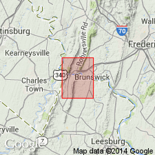
Geographically extended the Bolivar Heights, Fort Duncan, and Benevola Members of the Tomstown Formation into northern VA. The Dargan Member is not exposed in the Harpers Ferry quad.
Source: GNU records (USGS DDS-6; Reston GNULEX).
For more information, please contact Nancy Stamm, Geologic Names Committee Secretary.
Asterisk (*) indicates published by U.S. Geological Survey authors.
"No current usage" (†) implies that a name has been abandoned or has fallen into disuse. Former usage and, if known, replacement name given in parentheses ( ).
Slash (/) indicates name conflicts with nomenclatural guidelines (CSN, 1933; ACSN, 1961, 1970; NACSN, 1983, 2005, 2021). May be explained within brackets ([ ]).