

- Usage in publication:
-
- Swift Run tuff
- Modifications:
-
- Named
- Dominant lithology:
-
- Tuff
- AAPG geologic province:
-
- Piedmont-Blue Ridge province
Summary:
Swift Run tuff named and described as a series of tuffaceous and arkosic sediments that underlie Catoctin basalt and overlie injection complex on west limb of Catoctin Mountain-Blue Ridge anticlinorium.
Source: GNU records (USGS DDS-6; Reston GNULEX).
- Usage in publication:
-
- Swift Run tuff
- Modifications:
-
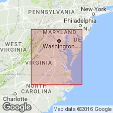
- Areal extent
- AAPG geologic province:
-
- Piedmont-Blue Ridge province
Summary:
Swift Run tuff geographically extended into MD where it underlies Catoctin metabasalt and lies directly on injection complex. Beds comprise blue and green blebby tuff, sericite schist, and a sericitic quartzite with glassy and blue quartz grains; also includes some marble just above the basal quartzose beds. Parts of unit here described as Swift Run had formerly been mapped as part of Loudoun formation by early workers.
Source: GNU records (USGS DDS-6; Reston GNULEX).
- Usage in publication:
-
- Swift Run tuff
- Modifications:
-
- Revised
- AAPG geologic province:
-
- Piedmont-Blue Ridge province
Summary:
In central VA, Oronoco formation (Bloomer and Bloomer 1947) is equivalent to Swift Run tuff which had previously been mapped as far south as this part of VA.
Source: GNU records (USGS DDS-6; Reston GNULEX).
- Usage in publication:
-
- Swift Run formation*
- Modifications:
-
- Revised
- AAPG geologic province:
-
- Piedmont-Blue Ridge province
Summary:
Revised as Swift Run formation because unit is varied in character and tuffaceous element is subordinate. Underlies Catoctin greenstone, probably conformably. Crops out in narrow belt around inliers of injection complex.
Source: GNU records (USGS DDS-6; Reston GNULEX).
- Usage in publication:
-
- Swift Run formation
- Modifications:
-
- Overview
- AAPG geologic province:
-
- Piedmont-Blue Ridge province
Summary:
In central VA, the Swift Run overlaps the basement complex from east to west and is equivalent to the uppermost part of the Lynchburg. Swift Run beds vary from a fraction of an inch to about 20 ft thick and consist of graywackes, subgraywackes, epidotized sandstone, andesite, tuffs, and greenstones. Where it overlies the Pedlar migmatite, the lower part of the formation is a conglomeratic graywacke with quartz, potash feldspar, and granite clasts ranging from 0.50 in. to 5.0 ft in diameter in an inequigranular matrix of quartz, feldspar, lithic fragments, and a paste-like aggregate of chlorite and sericite. Where the Swift Run is 100 or more ft thick, the graywacke grades upward into a uniformly fine-grained, thin-bedded subgraywacke composed of arenaceous grains of subrounded quartz in a matrix of sericite and chlorite. An epidotized sandstone member up to 20 ft thick is present near the overlap margin. An andesite member, about 85 ft thick, occurs in the middle part of the formation between Lynchburg Reservoir and U.S. Hwy 60. Reddish-brown, fine-grained tuffs in beds that range from a few inches to about 5 ft thick are interbedded with the coarsely clastic sedimentary rocks. Massive greenstones, like those of the Catoctin and Unicoi formations are fine-grained and extensively altered. Unit is highly metamorphosed only near steeply dipping contacts and thrust faults suggesting localized shear.
Source: GNU records (USGS DDS-6; Reston GNULEX).
- Usage in publication:
-
- Swift Run formation
- Modifications:
-
- Not used
- AAPG geologic province:
-
- Piedmont-Blue Ridge province
Summary:
Swift Run formation or Oronoco formation are acknowledged but not used in this report for rocks underlying Catoctin formation. Swift Run and Oronoco rocks are included in basal Catoctin.
Source: GNU records (USGS DDS-6; Reston GNULEX).
- Usage in publication:
-
- Swift Run tuff member
- Modifications:
-
- Revised
- AAPG geologic province:
-
- Piedmont-Blue Ridge province
Summary:
Referred to as Swift Run tuff member of Catoctin metavolcanics.
Source: GNU records (USGS DDS-6; Reston GNULEX).
- Usage in publication:
-
- Swift Run formation
- Modifications:
-
- Revised
- AAPG geologic province:
-
- Piedmont-Blue Ridge province
Summary:
Swift Run formation contacts revised by naming of Mechum River metasedimentary rocks which lie about halfway between Swift Run Formation in Blue Ridge to the west and Lynchburg Formation in the Piedmont to the east. All three of the formations were derived from and unconformably overlie basement complex rocks. Mechum River rocks are equivalent in part to Swift Run and Lynchburg, as suggested by the east-to-west overlap of Swift Run and Lynchburg rocks over basement with the Mechum River rocks in between. Catoctin Formation overlies Swift Run and Lynchburg Formations in central VA, Mechum River rocks probably also were overlain by Catoctin, but it was probably removed by erosion. In addition, basement rocks, Lynchburg, Swift Run, and Mechum River rocks are all intruded by basic dikes and possibly metagabbro sills, but none occur in formations above Catoctin Formation. Age is Precambrian. Report includes geologic map and cross section.
Source: GNU records (USGS DDS-6; Reston GNULEX).
- Usage in publication:
-
- Swift Run formation
- Modifications:
-
- Age modified
- Areal extent
- Overview
- AAPG geologic province:
-
- Appalachian basin
Summary:
Controversy in placement of Precambrian-Cambrian boundary in the Swift Run-Catoctin-Chilhowee sequence (King, 1950) or Lynchburg-Catoctin-Candler sequence (Brown, 1958), and the problems posed by lithologically similar Oronoco, Catoctin, and Unicoi formations (Bloomer and Werner, 1947, 1955) have led the author to assign an indefinite age of Cambrian or Precambrian to both Swift Run formation and Catoctin greenstone in this report in accordance with policy of Virginia Division of Mineral Resources. In Rockingham Co., Swift Run crops out on west side of Blue Ridge. Good exposure is seen along Skyline Drive, near Mile Post 70, in Powell Gap (R.M. Allen, personal commun.). Lithology of Swift Run matches description of King (1950, p. 10). Where Catoctin greenstone is interlayered with Swift Run, contact is placed at base of lowest massive greenstone. Swift Run is commonly thin, but thickness can vary over short distances. Range of 10 to 50 ft is common but can be 100 ft or more.
Source: GNU records (USGS DDS-6; Reston GNULEX).
- Usage in publication:
-
- Swift Run formation
- Modifications:
-
- Revised
- AAPG geologic province:
-
- Piedmont-Blue Ridge province
Summary:
Mechum River formation includes rocks of Swift Run formation and thinned down western edge of Charlottesville, Lynchburg, and Rockfish formations mapped as a unit. [Author is probably implying that Mechum River consists of rocks previously assigned to parts of other formations.]
Source: GNU records (USGS DDS-6; Reston GNULEX).
- Usage in publication:
-
- Swift Run formation
- Modifications:
-
- Overview
- AAPG geologic province:
-
- Piedmont-Blue Ridge province
Summary:
Used as Swift Run formation of Precambrian to Paleozoic age.
Source: GNU records (USGS DDS-6; Reston GNULEX).
- Usage in publication:
-
- Swift Run Formation
- Modifications:
-
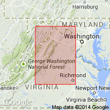
- Areal extent
- AAPG geologic province:
-
- Appalachian basin
Summary:
Swift Run Formation of Precambrian or Cambrian age shown in columnar section for northeastern WV, thereby extending Swift Run into WV.
Source: GNU records (USGS DDS-6; Reston GNULEX).
- Usage in publication:
-
- Swift Run Formation
- Modifications:
-
- Overview
- AAPG geologic province:
-
- Piedmont-Blue Ridge province
Summary:
Used as Swift Run Formation of late Precambrian age.
Source: GNU records (USGS DDS-6; Reston GNULEX).
- Usage in publication:
-
- Swift Run Formation
- Modifications:
-
- Revised
- Reference
- AAPG geologic province:
-
- Piedmont-Blue Ridge province
Summary:
Type locality outcrops now difficult to access because of reconstruction and straightening of US Hwy 33. However, from entrance of Skyline Dr eastward from the gap there are good exposures of sericitic phyllite believed to be metatuff. Exposures from near Whitehall, Albemarle Co., up Sugar Hollow are nearby and make good substitute for type locality. Vokes (1957) uses Swift Run as tuff member of Catoctin Greenstone in MD; however, green chlorite schist at or near base of Catoctin, as seen west of Middletown, MD, on US Hwy 40, may be found at almost any Catoctin locality and belongs to Catoctin rather than Swift Run. Some prefer to include lower Catoctin flows and interbedded arkose with Swift Run. Top of Swift Run and base of Catoctin may be difficult to establish in some localities. In Charlottesville, VA, sericite tuff under Catoctin, in turn underlain by tuffaceous arkose composed of fragmented Lynchburg over Lynchburg [Group] rocks establishes it as a definite formation. Since it was defined, Swift Run has been miscorrelated with Lynchburg gneiss. Obviously, Swift Run overlies Lynchburg, as seen at Charlottesville, and does not "overlap" Lynchburg as stated by Bloomer and Werner (1955). Bloomer (1950) correlates Swift Run over Blue Ridge anticlinorium to include Lynchburg Gneiss and Catoctin-Wissahickon rocks of Piedmont east of Blue Ridge province. Author does not believe that stratigraphic, structural, and metamorphic conditions confirm Bloomer's theory. Arkose, slate, biotite gneiss, and biotite-bearing arkose beds with overlying marble here classified as Lynchburg Group have been described in Loudoun Co., VA, as Swift Run by Parker (1968). These rocks are not pyroclastic or volcanic, nor are they similar to Swift Run at its type locality in Greene Co., or to many classic exposures in Albemarle Co.
Source: GNU records (USGS DDS-6; Reston GNULEX).

- Usage in publication:
-
- Swift Run Formation
- Modifications:
-
- Overview
- AAPG geologic province:
-
- Piedmont-Blue Ridge province
Summary:
In Rockfish River area, Swift Run is divisible into a lower unit, 80-360 m wide, of coarse-grained, feldspathic sandstone; a middle unit, 30-240 m wide, of greenstone, fine-grained sandstone, graphitic mudstone, and rare felsic volcanic rock; and an upper unit, 80-460 m wide, of coarse-grained, blue quartz sandstone and arkose interbedded with pale-green mudstone and a few thin greenstone beds. Total width of belt is 530-850 m. South of Culpeper, Swift Run is a thin belt of (0 to 400 m) of coarse-grained, feldspathic and blue quartz arenite and slate, truncated by Triassic border fault to the east. North of Culpeper, Swift Run interfingers with a broad, complexly faulted belt of coarse-grained sandstone, greenstone, siltstone, graphitic schist, and pale-green muscovite schist; exposure is poor and unit is mapped as Swift Run Formation(?). Contact between Swift Run(?) and Catoctin Formations is sharp. Overlies Lynchburg Group but is not included in it because of uncertain correlation with Swift Run at its type locality (Bartholomew, 1971, written commun., 1983). Age is Late Proterozoic.
Source: GNU records (USGS DDS-6; Reston GNULEX).
- Usage in publication:
-
- Swift Run Formation*
- Modifications:
-
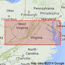
- Areal extent
- AAPG geologic province:
-
- Piedmont-Blue Ridge province
Summary:
Use of the name Swift Run Formation should be restricted to the western limb of the Blue Ridge anticlinorium. Rocks on the east limb of the Blue Ridge anticlinorium in northern VA are here tentatively mapped as Ball Mountain Formation of Wehr (1985).
Source: GNU records (USGS DDS-6; Reston GNULEX).
- Usage in publication:
-
- Swift Run Formation*
- Modifications:
-
- Revised
- AAPG geologic province:
-
- Piedmont-Blue Ridge province
Kasselas, G.D., 1993, Stratigraphic framework, structural evolution and tectonic implications of the eastern Blue Ridge sequence in the central Appalachians near Warrenton, Virginia: Virginia Polytechnic Institute and State University, Department of Geological Sciences M.S. thesis, __ p.
Summary:
Rocks south of Rappahannock River that Wehr (1985) mapped as Swift Run(?) Formation are here reassigned to Ball Mountain Formation because they lithologically do not match rocks of type Swift Run Formation. Rocks mapped by Wehr (1985) as Swift Run Formation in the Culpeper, VA, area probably pinch out to the north or are equivalent to upper part of Ball Mountain Formation in Warrenton, VA, area.
Source: GNU records (USGS DDS-6; Reston GNULEX).

- Usage in publication:
-
- Swift Run Formation
- Modifications:
-
- Areal extent
- AAPG geologic province:
-
- Piedmont-Blue Ridge province
Summary:
On the State map, the Swift Run is terminated along an east-west-trending normal fault just west of Leesburg, and is not mapped farther southwest on the southeast limb of the Blue Ridge anticlinorium.
Source: GNU records (USGS DDS-6; Reston GNULEX).
- Usage in publication:
-
- Swift Run Formation*
- Modifications:
-
- Revised
- AAPG geologic province:
-
- Piedmont-Blue Ridge province
Summary:
Reed (1955) demonstrated that basalts of Catoctin Formation were erupted on an irregular erosion surface and that as much as 45 m of sedimentary rock, indistinguishable from basalt, locally underlies the basalt. Sedimentary rocks include poorly sorted arkose, conglomerate containing basement clasts, and purple and green phyllite. Gathwright (1976), Gathwright and other (1977) have mapped these sedimentary rocks as Swift Run Formation, but note that they grade into and interfinger with Catoctin. King (1970) points out that the sedimentary rocks are probably of different ages because of overlap onto the irregular erosion surface. Problems arise when one attempts to correlate rocks called Swift Run with sedimentary, or sedimentary and volcanic, units on southeast limb of Blue Ridge anticlinorium because correlation commonly leads to unnecessary restrictions or ambiguities (Bloomer and Werner, 1955; Wehr, 1985). The preferable approach is that of Reed (1955) who included within Catoctin both basal sedimentary beds and sedimentary rocks interlayered with basalt. Report includes geologic maps, correlation chart, and isotopic data.
Source: GNU records (USGS DDS-6; Reston GNULEX).
- Usage in publication:
-
- Swift Run Formation*
- Modifications:
-
- Overview
- AAPG geologic province:
-
- Piedmont-Blue Ridge province
Summary:
The Swift Run Formation is divided into three mappable units in the mapped area. The lowest unit is a pinkish-gray, yellowish-gray, and medium-gray sericite-rich, coarse- to medium-grained, locally cross-bedded metasandstone that contains rounded quartz cobbles that is 46 meters thick. The middle unit is a light-gray, pale-olive, and dusky yellow quartz sericite schist with fine pebble conglomerate that is 122 to 213 meters thick. The upper consists of dolomitic marble, slate, laminated phyllite, and sandy phyllite, undifferentiated that is 61 meters thick. The Swift Run overlies Middle Proterozoic basement rocks and underlies the Catoctin Formation. Unit is of Late Proterozoic age.
Source: GNU records (USGS DDS-6; Reston GNULEX).
- Usage in publication:
-
- Swift Run Formation*
- Modifications:
-
- Overview
- Areal extent
- AAPG geologic province:
-
- Piedmont-Blue Ridge province
Summary:
Swift Run Formation consists of a thin sequence of clastic and tuffaceous metasediments that nonconformably overlies Middle Proterozoic gneisses of basement along most of the eastern margin of the basement core of the Blue Ridge anticlinorium in the map area. Thins gradually to the north; along Potomac River bluffs, appears to have been tectonically removed. To the north in MD, it is restricted to scattered lenses. Boundary between it and Fauquier Formation is placed in Lincoln quad to the south, at two east-trending syn-sedimentary(?) faults, one of which marks the southern termination of Swift Run and the other which marks the northern extent of Fauquier Formation, with Catoctin Formation overlying basement in between. Contains a local thin white, fine-grained calcite marble that may be stratigraphically equivalent to marble in lower part of Catoctin Formation. Age is Late Proterozoic. Report includes geologic map, cross sections, and correlation chart.
Source: GNU records (USGS DDS-6; Reston GNULEX).
For more information, please contact Nancy Stamm, Geologic Names Committee Secretary.
Asterisk (*) indicates published by U.S. Geological Survey authors.
"No current usage" (†) implies that a name has been abandoned or has fallen into disuse. Former usage and, if known, replacement name given in parentheses ( ).
Slash (/) indicates name conflicts with nomenclatural guidelines (CSN, 1933; ACSN, 1961, 1970; NACSN, 1983, 2005, 2021). May be explained within brackets ([ ]).