- Usage in publication:
-
- Sharp Mountain member*
- Modifications:
-
- Named
- Dominant lithology:
-
- Conglomerate
- Sandstone
- Siltstone
- Coal
- AAPG geologic province:
-
- Appalachian basin
Summary:
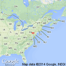
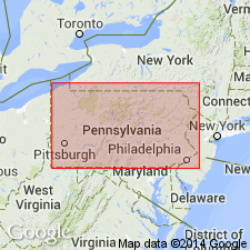
Named the Sharp Mountain member of the Pottsville formation for Sharp Mountain, near Pottsville, Schuylkill Co., eastern PA. Consists chiefly of cobble and coarse pebble conglomerate and fine to coarse sandstone and siltstone, shale, and coal; basal conglomerate beds are coarser and topographically more conspicuous than the other beds in member and are followed by several sequences of conglomeratic sandstone, sandstone, siltstone, shale, and coal intercalated with sequence of finer pebble conglomerate. Member comprises upper 280 feet of the Pottsville at the type section. Conformably overlies the Schuylkill member. In many localities in the southern anthracite field, basal beds are about 30 feet above the Lykens Valley no. 1 coal bed; at type section, basal beds are 40 to 70 feet above the Lykens Valley no. 1 coal bed; such variations in stratigraphic interval may be due to local intertonguing of the fine conglomerate and sandstone and shale facies of the Schuylkill member with coarser conglomerate and sandstone facies of the Sharp Mountain. Upper contact of Sharp Mountain member is at base of carbonaceous shale beneath the Buck Mountain coal bed which rests conformably on the conglomerate; contact is sharp and even. The Sharp Mountain is of Pennsylvanian age.
Source: GNU records (USGS DDS-6; Reston GNULEX).

- Usage in publication:
-
- Sharp Mountain formation
- Modifications:
-
- Revised
- AAPG geologic province:
-
- Appalachian basin
Summary:
The Sharp Mountain is revised to the Sharp Mountain formation of the Pottsville group in the Anthracite region of Pennsylvania.
Source: GNU records (USGS DDS-6; Reston GNULEX).
For more information, please contact Nancy Stamm, Geologic Names Committee Secretary.
Asterisk (*) indicates published by U.S. Geological Survey authors.
"No current usage" (†) implies that a name has been abandoned or has fallen into disuse. Former usage and, if known, replacement name given in parentheses ( ).
Slash (/) indicates name conflicts with nomenclatural guidelines (CSN, 1933; ACSN, 1961, 1970; NACSN, 1983, 2005, 2021). May be explained within brackets ([ ]).

