

- Usage in publication:
-
- Rich Butt sandstone*
- Modifications:
-
- Named
- Dominant lithology:
-
- Sandstone
- Conglomerate
- Siltstone
- AAPG geologic province:
-
- Appalachian basin
- Piedmont-Blue Ridge province
Summary:
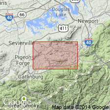
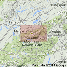
Named as a formation in the Ocoee series. Named for Rich Butt Mountain, a northwest spur of Mount Cammerer near the northeast end of Great Smoky Mountains. Type section is southeast of Mount Cammerer on Big Creek, above community of Mount Sterling. Occurs in eastern TN and western NC, north of and below Greenbrier fault. In type area, consists of light, feldspathic, medium- to fine-grained, medium- to thick-bedded sandstone containing sharply contrasting pelitic layers. Sandstone on Rich Butt Mountain is coarser grained, thicker bedded, and contains very coarse, feldspathic sandstone and arkosic conglomerate. Dark, argillaceous, thinly and evenly layered rocks appear locally and are often interbedded with fine, reddish-weathering ankeritic sandstone. Resembles Elkmont sandstone which overlies Greenbrier fault nearby. Conglomerate lenses are similar to coarser phases of Great Smoky group. Siltstones and sandstones resemble Snowbird group. Stratigraphic relationship to Great Smoky group not demonstrable, though Rich Butt conformably overlies and somewhat intertongues with Pigeon siltstone of Snowbird group; top of formation is cut off by Greenbrier fault. Thickness is 3,000 ft along Big Creek (beneath fault); 1,800 ft is preserved at Rich Butt Mountain. Report contains correlation chart and geologic map. Age is later Precambrian.
Source: GNU records (USGS DDS-6; Reston GNULEX).
- Usage in publication:
-
- Rich Butt sandstone*
- Modifications:
-
- Overview
- AAPG geologic province:
-
- Appalachian basin
Summary:
Rich Butt sandstone probably correlates with unnamed rocks of Webb Mountain and Big Ridge of this map area. Shown in this report only in cross section. Age is late Precambrian. Report includes geologic map, cross sections, correlation chart, and measured sections.
Source: GNU records (USGS DDS-6; Reston GNULEX).

- Usage in publication:
-
- Rich Butt Sandstone
- Modifications:
-
- Overview
- AAPG geologic province:
-
- Appalachian basin
Summary:
Rich Butt Sandstone of Ocoee Supergroup is mapped in Unaka Mountains. Age is Precambrian.
Source: GNU records (USGS DDS-6; Reston GNULEX).
- Usage in publication:
-
- Rich Butt Sandstone*
- Modifications:
-
- Areal extent
- Overview
- AAPG geologic province:
-
- Piedmont-Blue Ridge province
- Appalachian basin
Summary:
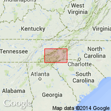
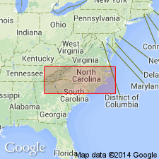
Included in Ocoee Series. Mapped undivided with Cades Sandstone and sandstone of Big Ridge in Blue Ridge belt, northwest of Greenbrier-Devils Fork fault. Occurs southwest of Pigeon River in Blount, Sevier, and Cocke Cos., eastern TN, and in Haywood Co., northwestern NC. Collectively described in southwest part of mapped area as mainly gray, coarse- to medium-bedded sandstone, highly feldspathic, in graded beds 1 to 4 ft thick, interbedded with dark-gray argillite and siltstone. Locally includes granite boulder conglomerate beds 5 to 15 ft thick. Upper part of unit in central areas is mainly coarse feldspathic sandstone in thick graded beds. In northeastern part of area, mainly medium- to fine-grained feldspathic sandstone, in part indistinctly current bedded, with sharply defined layers and laminae of dark argillite or slate. Age is late Precambrian.
Source: GNU records (USGS DDS-6; Reston GNULEX).
- Usage in publication:
-
- Rich Butt Sandstone
- Modifications:
-
- Revised
- AAPG geologic province:
-
- Piedmont-Blue Ridge province
Summary:
Rich Butt Sandstone included in part of Great Smoky Group of Ocoee Supergroup in Blue Ridge belt of western NC. Stratigraphic position uncertain. Age is Late Proterozoic.
Source: GNU records (USGS DDS-6; Reston GNULEX).
- Usage in publication:
-
- Rich Butt Sandstone*
- Modifications:
-
- Mapped
- AAPG geologic province:
-
- Appalachian basin (Eastern Overthrust area)
- Piedmont-Blue Ridge province
Summary:
Pg. 13-14, geol. map. Rich Butt Sandstone of Snowbird Group of Ocoee Supergroup. Here included in the Snowbird Group. Consists of light-gray, medium- to fine-grained feldspathic metasandstone and conglomeratic arkose interbedded with dark-colored, thinly laminated metasiltstone and slate. Thickness up to 4,000 feet (1,220 m). Intertongues with Pigeon Siltstone of Snowbird Group. Age is considered Late Proterozoic (Z).
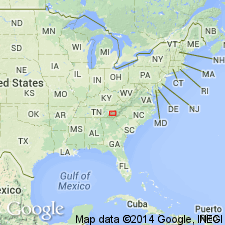
Notable exposures near Webb Mountain, Sevier Co., eastern TN; Big Ridge, Cocke Co., eastern TN; and Mount Sterling, Haywood Co., western NC.
Source: Publication.
For more information, please contact Nancy Stamm, Geologic Names Committee Secretary.
Asterisk (*) indicates published by U.S. Geological Survey authors.
"No current usage" (†) implies that a name has been abandoned or has fallen into disuse. Former usage and, if known, replacement name given in parentheses ( ).
Slash (/) indicates name conflicts with nomenclatural guidelines (CSN, 1933; ACSN, 1961, 1970; NACSN, 1983, 2005, 2021). May be explained within brackets ([ ]).